Ragiv:Occitania_blanck_map.PNG
From Wikipedia, the free encyclopedia
Gretot gudikum no pagebidon.
Occitania_blanck_map.PNG (573 × 397 pixel, ragivagret: 10 KB, pated MIME: image/png)
Ragiv at kömon de Wikimedia Commons e kanon pagebön fa proyegs votik. Bepenot su pad bepenota ragiva onik pajonon dono.
| Datasource (reference to visualized facts) is not provided for the data that is visualized in this self-made work. |

|
This linguistic map image could be re-created using vector graphics as an SVG file. This has several advantages; see Commons:Media for cleanup for more information. If an SVG form of this image is available, please upload it and afterwards replace this template with
{{vector version available|new image name}}.
It is recommended to name the SVG file “Occitania blanck map.svg”—then the template Vector version available (or Vva) does not need the new image name parameter. |
Plän brefik
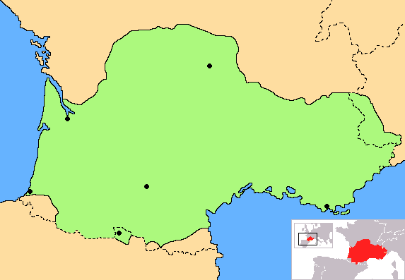
| BepenamOccitania blanck map.PNG | Correct map of Occitania, with geographic context and remarking of the country borders |
| Dät | |
| Fon | Vobot okik |
| Lautan | Norrin strange |
| Other versions | Derivative works of this file: Occitania aranes map.png |
I, the copyright holder of this work, hereby publish it under the following licenses:

|
Däl pagevon ad kopiedön, seagivön e/u votükön dokümi at ma Dälazöt ad Dokümam Libik: GNU, Fomam: 1.2 u nulikum fa el Free Software Foundation (Stitod: Nünömaprograms libik); nen diläds nevotükovik, nen vödems tegapada balid, e leigo nen vödems tegapada lätik. Kopied dälazöta pekeninon in diläd: Dälazöt ad Dokümam Libik: GNU panemöl.http://www.gnu.org/copyleft/fdl.htmlGFDLGNU Free Documentation Licensetruetrue |
| This file is licensed under the Creative Commons Attribution-Share Alike 3.0 Unported license. | ||
| ||
| This licensing tag was added to this file as part of the GFDL licensing update.http://creativecommons.org/licenses/by-sa/3.0/CC BY-SA 3.0Creative Commons Attribution-Share Alike 3.0truetrue |
You may select the license of your choice.
Captions
Add a one-line explanation of what this file represents
Map of Occitania
Актуальная карта Аксітаніі, з геаграфічным кантэкстам і дакладнымі абазначэннямі межаў краіны
some value
copyright status Linglänapük
copyrighted Linglänapük
copyright license Linglänapük
source of file Linglänapük
original creation by uploader Linglänapük
inception Linglänapük
14 yulul 2007
Jenotem ragiva
Välolös däti/timi ad logön ragivi soäsä äbinon ün tim at.
| Dät/Tim | Magodil | Mafots | Geban | Küpet | |
|---|---|---|---|---|---|
| anuik | 18:30, 2023 yunul 27id | | 573 × 397 (10 KB) | Jfblanc | Improved boundaries |
| 22:10, 2020 setul 4id |  | 573 × 397 (4 KB) | TSamuel | Minimized colors to 7 to recompress further | |
| 22:08, 2020 setul 4id |  | 573 × 397 (5 KB) | TSamuel | Losslessly recompressed | |
| 16:32, 2009 febul 17id |  | 573 × 397 (12 KB) | Tripallokavipasek | ||
| 15:21, 2007 yulul 14id |  | 573 × 397 (11 KB) | Norrin strange | {{Information |Description=Correct map of Occitania |Source=self-made |Date=14-07-07 |Author= Norrin strange }} {{GFDL-Self}} |
Yüms
Pads sököl payümons ko pad at:
Ragivigeb Valöpik
The following other wikis use this file:
- Geb su ace.wikipedia.org
- Geb su ady.wikipedia.org
- Geb su am.wikipedia.org
- Geb su an.wikipedia.org
- Geb su ar.wikipedia.org
- Geb su be.wikipedia.org
- Geb su br.wikipedia.org
- Geb su ca.wikipedia.org
- Geb su ce.wikipedia.org
- Geb su ckb.wikipedia.org
- Geb su cs.wikipedia.org
- Geb su cv.wikipedia.org
- Geb su cy.wikipedia.org
- Geb su da.wikipedia.org
- Geb su diq.wikipedia.org
- Geb su en.wiktionary.org
- Geb su eo.wikipedia.org
- Geb su eo.wikinews.org
- Geb su es.wikipedia.org
- Geb su et.wikipedia.org
- Geb su eu.wikipedia.org
- Geb su fa.wikipedia.org
- Geb su fi.wikipedia.org
- Geb su fr.wikipedia.org
- Geb su fr.wiktionary.org
- Geb su fur.wikipedia.org
- Geb su gd.wikipedia.org
- Geb su gl.wikipedia.org
- Geb su gv.wikipedia.org
- Geb su hr.wikipedia.org
- Geb su hr.wiktionary.org
- Geb su hsb.wikipedia.org
- Geb su hu.wikipedia.org
- Geb su hy.wikipedia.org
- Geb su id.wikipedia.org
- Geb su ilo.wikipedia.org
- Geb su io.wikipedia.org
View more global usage of this file.
Ragivanüns
Ragiv at keninükon nünis pluik, luveratiko se käm u numatüköm me kel päjafon. If ragiv at ya pevotükon e no plu leigon ko rigädastad okik, mögos, das pats anik is palisedöls no plu bepenons ragivi in stad anuik.
| Distidafäg horitätik | 28.34 dpc |
|---|---|
| Distidafäg penditik | 28.34 dpc |
Pekopiedon se „https://vo.wikipedia.org/wiki/Ragiv:Occitania_blanck_map.PNG“