File:Repuk_Makalu_Barun_Valley_Nepal.jpg
From Wikipedia, the free encyclopedia
Size of this preview: 622 × 600 pixels. Other resolutions: 249 × 240 pixels | 498 × 480 pixels | 797 × 768 pixels | 1,062 × 1,024 pixels | 1,980 × 1,909 pixels.
Original file (1,980 × 1,909 pixels, file size: 3.39 MB, MIME type: image/jpeg)
| This is a file from the Wikimedia Commons. Information from its description page there is shown below. Commons is a freely licensed media file repository. You can help. |
Summary
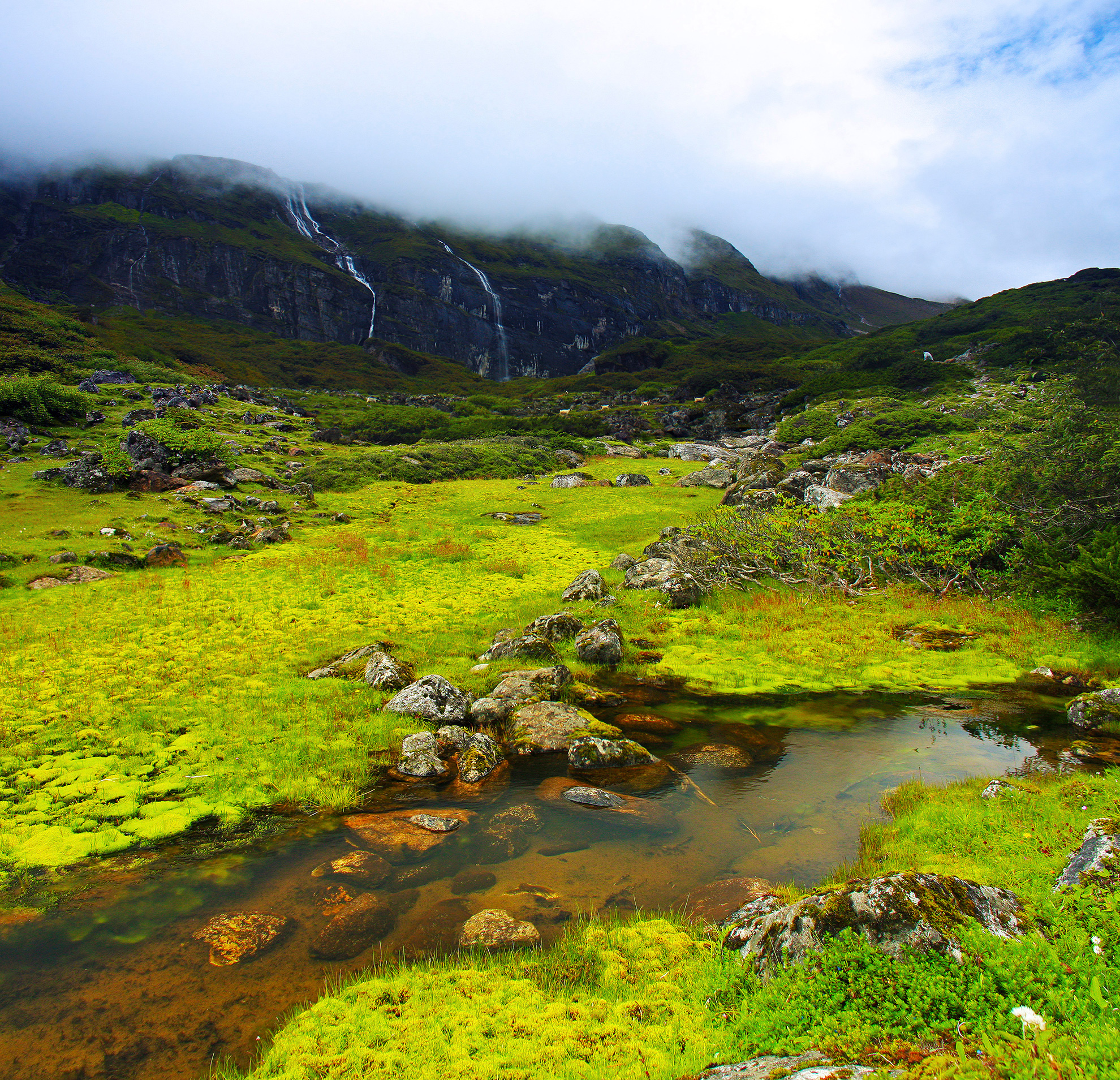
| DescriptionRepuk Makalu Barun Valley Nepal.jpg |
English: This is a place called Ripuk within the Barun Valley. Centuries ago, Barun used to be a glacier here, flowing to the north composing these lush green valleys for today. The cascading waterfalls against the stiff rocks was reflecting the sense of the flowing time and the eternity at the same time. |
| Date | |
| Source | Own work |
| Author | Dhilung |
| Other versions | https://www.flickr.com/photos/dhilung/3919034860/ |
| Camera location | 28° 23′ 41.49″ N, 84° 07′ 26.43″ E | View this and other nearby images on: OpenStreetMap |
|---|
Licensing
I, the copyright holder of this work, hereby publish it under the following license:
This file is licensed under the Creative Commons Attribution 3.0 Unported license.
- You are free:
- to share – to copy, distribute and transmit the work
- to remix – to adapt the work
- Under the following conditions:
- attribution – You must give appropriate credit, provide a link to the license, and indicate if changes were made. You may do so in any reasonable manner, but not in any way that suggests the licensor endorses you or your use.
Captions
Add a one-line explanation of what this file represents
Items portrayed in this file
depicts
16 August 2009
28°23'41.485"N, 84°7'26.429"E
0.0015625 second
18 millimetre
320
File history
Click on a date/time to view the file as it appeared at that time.
| Date/Time | Thumbnail | Dimensions | User | Comment | |
|---|---|---|---|---|---|
| current | 22:20, 16 January 2010 | | 1,980 × 1,909 (3.39 MB) | Dhilung | Without watermark removed. GPS info embedded. |
| 06:31, 19 September 2009 |  | 2,150 × 2,078 (2.15 MB) | Dhilung | {{Information |Description={{en|1=This is a place called Ripuk within the Barun Valley. Centuries ago, Barun used to be a glacier here, flowing to the north composing these lush green valleys for today. The cascading waterfalls against the stiff rocks was |
File usage
The following pages on the English Wikipedia use this file (pages on other projects are not listed):
Global file usage
The following other wikis use this file:
- Usage on bh.wikipedia.org
- Usage on bn.wikipedia.org
- Usage on de.wikipedia.org
- Usage on dty.wikipedia.org
- Usage on es.wikipedia.org
- Usage on fa.wikipedia.org
- Usage on fr.wikipedia.org
- Usage on hi.wikipedia.org
- Usage on it.wikipedia.org
- Usage on lt.wikipedia.org
- Usage on mai.wikipedia.org
- Usage on mk.wikipedia.org
- Usage on ml.wikipedia.org
- Usage on ne.wikipedia.org
- Usage on pa.wikipedia.org
- Usage on pnb.wikipedia.org
- Usage on ru.wikipedia.org
- Usage on sat.wikipedia.org
- Usage on sa.wikipedia.org
- Usage on sl.wikipedia.org
- Usage on ta.wikipedia.org
- Usage on th.wikipedia.org
- Usage on tt.wikipedia.org
- Usage on ur.wikipedia.org
- Usage on vi.wikipedia.org
- Usage on www.wikidata.org
Metadata
This file contains additional information, probably added from the digital camera or scanner used to create or digitize it.
If the file has been modified from its original state, some details may not fully reflect the modified file.
| Camera manufacturer | Canon |
|---|---|
| Camera model | Canon EOS 40D |
| Author | Dhilung Kirat |
| Copyright holder | matrixplay@gmail.com |
| Exposure time | 1/640 sec (0.0015625) |
| F-number | f/5 |
| ISO speed rating | 320 |
| Date and time of data generation | 10:05, 16 August 2009 |
| Lens focal length | 18 mm |
| Orientation | Normal |
| Horizontal resolution | 72 dpi |
| Vertical resolution | 72 dpi |
| Software used | Adobe Photoshop CS4 Windows |
| File change date and time | 10:05, 16 August 2009 |
| Y and C positioning | Co-sited |
| Exposure Program | Aperture priority |
| Exif version | 2.21 |
| Date and time of digitizing | 10:05, 16 August 2009 |
| Shutter speed | 9.375 |
| APEX aperture | 4.625 |
| Exposure bias | 0 |
| Metering mode | Pattern |
| Flash | Flash did not fire, compulsory flash suppression |
| DateTime subseconds | 00 |
| DateTimeOriginal subseconds | 00 |
| DateTimeDigitized subseconds | 00 |
| Color space | sRGB |
| Focal plane X resolution | 4,438.3561643836 |
| Focal plane Y resolution | 4,445.9691252144 |
| Focal plane resolution unit | inches |
| Custom image processing | Normal process |
| Exposure mode | Auto bracket |
| White balance | Manual white balance |
| Scene capture type | Standard |
| North or south latitude | North latitude |
| East or west longitude | East longitude |
| Satellites used for measurement | 0 |
| Geodetic survey data used | WGS-84 |
| GPS date | 16 August 2009 |