File:View_on_Gyakar_(edited).jpg
From Wikipedia, the free encyclopedia
Size of this preview: 800 × 556 pixels. Other resolutions: 320 × 222 pixels | 640 × 444 pixels | 1,024 × 711 pixels | 1,280 × 889 pixels | 2,560 × 1,778 pixels | 5,472 × 3,800 pixels.
Original file (5,472 × 3,800 pixels, file size: 12.98 MB, MIME type: image/jpeg)
| This is a file from the Wikimedia Commons. Information from its description page there is shown below. Commons is a freely licensed media file repository. You can help. |
Summary
| DescriptionView on Gyakar (edited).jpg |
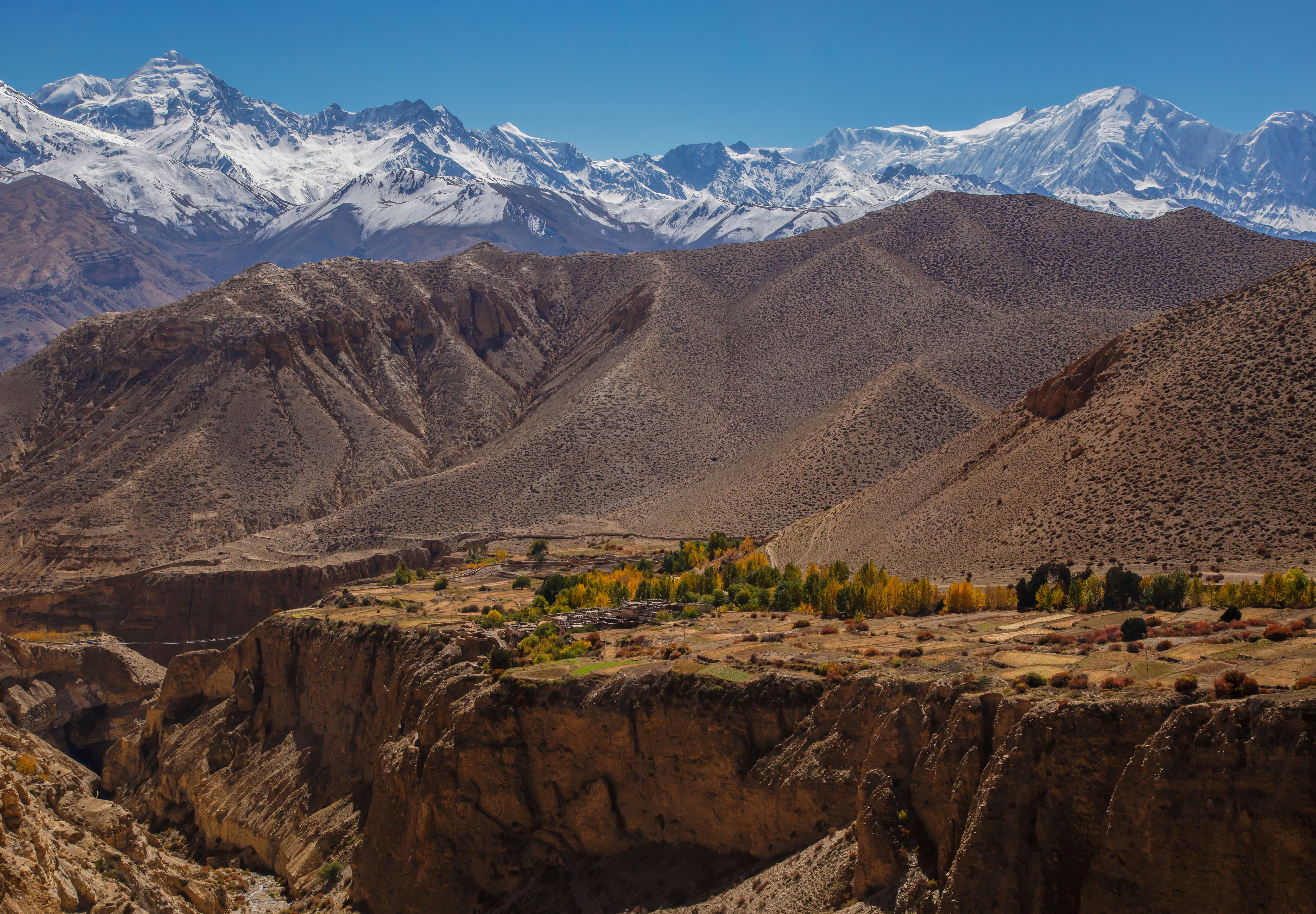
English: Majestic view on the village of Gyakar surrounded by a poplar grove and the summits of the Damodar Himal, the Purkung Himal and the Annapurnas. We were so lucky with the weather, having such a visibility all day long is not that common even in October after the monsoon.
Notice the suspended bridge over the deep canyon on the left. |
| Date | Taken on 23 October 2014, 11:24:53 |
| Source |
This file was derived from: View on Gyakar.jpg |
| Author |
|
| Other versions |
|

| Camera location | 28° 56′ 37.71″ N, 83° 48′ 19.74″ E | View this and other nearby images on: OpenStreetMap |
|---|
| This is a retouched picture, which means that it has been digitally altered from its original version. Modifications: Dust stop removed, noise reduced. Modifications made by UnpetitproleX.
|
| This is a retouched picture, which means that it has been digitally altered from its original version. Modifications: Added a little bit more sky. Modifications made by Aristeas.
|
Assessment
|
Licensing
I, the copyright holder of this work, hereby publish it under the following license:
This file is licensed under the Creative Commons Attribution 3.0 Unported license.
- You are free:
- to share – to copy, distribute and transmit the work
- to remix – to adapt the work
- Under the following conditions:
- attribution – You must give appropriate credit, provide a link to the license, and indicate if changes were made. You may do so in any reasonable manner, but not in any way that suggests the licensor endorses you or your use.
Captions
Add a one-line explanation of what this file represents
Items portrayed in this file
depicts
28°56'37.709999999"N, 83°48'19.734000001"E
0.002 second
16
47 millimetre
200
image/jpeg
File history
Click on a date/time to view the file as it appeared at that time.
| Date/Time | Thumbnail | Dimensions | User | Comment | |
|---|---|---|---|---|---|
| current | 16:52, 3 June 2022 | | 5,472 × 3,800 (12.98 MB) | Aristeas | =={{int:filedesc}}== {{Information |description={{en|1=Majestic view on the village of Gyakar surrounded by a poplar grove and the summits of the Damodar Himal, the Purkung Himal and the Annapurnas. We were so lucky with the weather, having such a visibility all day long is not that common even in October after the monsoon. Notice the suspended bridge over the deep canyon on the left.}} |date={{Taken on|2014-10-23 11:24:53|location=Nepal}} |source={{Derived from|File:View on Gyakar.jpg}} |aut... |
File usage
The following pages on the English Wikipedia use this file (pages on other projects are not listed):
Global file usage
The following other wikis use this file:
- Usage on fr.wikipedia.org
- Usage on ne.wikipedia.org
Metadata
This file contains additional information, probably added from the digital camera or scanner used to create or digitize it.
If the file has been modified from its original state, some details may not fully reflect the modified file.
| Image title |
|
|---|---|
| Camera manufacturer | Canon |
| Camera model | Canon EOS 6D |
| Author | Jean-Marie Hullot |
| Copyright holder |
|
| Exposure time | 1/500 sec (0.002) |
| F-number | f/16 |
| ISO speed rating | 200 |
| Date and time of data generation | 11:24, 23 October 2014 |
| Lens focal length | 47 mm |
| Latitude | 28° 56′ 37.71″ N |
| Longitude | 83° 48′ 19.73″ E |
| Altitude | 3,508.2 meters above sea level |
| Headline | Up to Dajori La pass (3735m) |
| Online copyright statement | https://creativecommons.org/licenses/by/3.0/ |
| Usage terms |
|
| City shown | Jharkot |
| Width | 5,472 px |
| Height | 3,648 px |
| Bits per component |
|
| Pixel composition | RGB |
| Orientation | Normal |
| Number of components | 3 |
| Horizontal resolution | 300 dpi |
| Vertical resolution | 300 dpi |
| Software used | Adobe Photoshop 23.3 (Macintosh) |
| File change date and time | 18:44, 3 June 2022 |
| Exposure Program | Aperture priority |
| Exif version | 2.31 |
| Date and time of digitizing | 11:24, 23 October 2014 |
| Shutter speed | 8.965784 |
| APEX aperture | 8 |
| Exposure bias | 0 |
| Maximum land aperture | 4 APEX (f/4) |
| Metering mode | Pattern |
| Flash | Flash did not fire, compulsory flash suppression |
| DateTimeOriginal subseconds | 00 |
| DateTimeDigitized subseconds | 00 |
| Color space | sRGB |
| Focal plane X resolution | 1,520 |
| Focal plane Y resolution | 1,520 |
| Focal plane resolution unit | 3 |
| Exposure mode | Auto exposure |
| White balance | Auto white balance |
| Scene capture type | Standard |
| Satellites used for measurement | 11 |
| Receiver status | Measurement in progress |
| Measurement mode | 3-dimensional measurement |
| Measurement precision | Good (4) |
| Geodetic survey data used | WGS-84 |
| GPS date | 23 October 2014 |
| GPS tag version | 0.0.3.2 |
| Serial number of camera | 043024001480 |
| Lens used | EF24-105mm f/4L IS USM |
| Date metadata was last modified | 20:44, 3 June 2022 |
| Unique ID of original document | C76C6AA348A48C7ABCAF6E0359353B62 |
| Copyright status | Copyrighted |
| Keywords |
|
| Contact information | jmhullot@gmail.com
|
| Province or state shown | Western Region |
| Country shown | Nepal |
| IIM version | 4 |
Retrieved from "https://en.wikipedia.org/wiki/File:View_on_Gyakar_(edited).jpg"
.jpg)