File:Mapa_do_Município_Neutro.tif
From Wikipedia, the free encyclopedia

Size of this PNG preview of this TIF file: 800 × 548 pixels. Other resolutions: 320 × 219 pixels | 640 × 439 pixels | 1,024 × 702 pixels | 1,280 × 877 pixels | 2,560 × 1,755 pixels | 6,817 × 4,673 pixels.
Original file (6,817 × 4,673 pixels, file size: 107.14 MB, MIME type: image/tiff)
| This is a file from the Wikimedia Commons. Information from its description page there is shown below. Commons is a freely licensed media file repository. You can help. |
Summary
| Title |
Mapa do Município Neutro |
||||||||||||||||||||||||||
| DescriptionMapa do Município Neutro.tif |
Português: Fundo: Ministério da Agricultura, Comércio e Obras Públicas.. |
||||||||||||||||||||||||||
| Date |
Unknown date Unknown date |
||||||||||||||||||||||||||
| Source | Arquivo Nacional | ||||||||||||||||||||||||||
| Georeferencing | Georeference the map in Wikimaps Warper If inappropriate please set warp_status = skip to hide. | ||||||||||||||||||||||||||
| Archival data | |||||||||||||||||||||||||||
| Collection |
institution QS:P195,Q2860546 |
||||||||||||||||||||||||||
| Accession number |
BR_RJANRIO_4M_0_MAP_004 |
||||||||||||||||||||||||||

Licensing
| Public domainPublic domainfalsefalse |
This media is a faithful reproduction of public domain multimedia and it was the result of a GLAM partnership between the Arquivo Nacional and the Wikimedia Users Group in Brazil. The Arquivo Nacional (in English: The Brazilian National Archives) is an institution of the Brazilian Ministry of Justice and Public Security responsible for the management and preservation of documents pertaining to the federal public administration and located in the city of Rio de Janeiro.
Please attribute as: Public domain / Arquivo Nacional Collection Por favor, atribua como: Domínio público / Acervo Arquivo Nacional |
| Public domainPublic domainfalsefalse |
This work is in the public domain in Brazil for one of the following reasons:
Deutsch ∙ English ∙ español ∙ français ∙ italiano ∙ 日本語 ∙ Nederlands ∙ português ∙ sicilianu ∙ slovenščina ∙ +/− |
 |
Captions
Add a one-line explanation of what this file represents
Items portrayed in this file
depicts
image/tiff
File history
Click on a date/time to view the file as it appeared at that time.
| Date/Time | Thumbnail | Dimensions | User | Comment | |
|---|---|---|---|---|---|
| current | 00:12, 23 May 2018 | 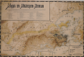 | 6,817 × 4,673 (107.14 MB) | Joalpe | pattypan 18.02 |
File usage
The following pages on the English Wikipedia use this file (pages on other projects are not listed):
Global file usage
The following other wikis use this file:
- Usage on ca.wikipedia.org
- Usage on pt.wikipedia.org
- Usage on www.wikidata.org
Metadata
This file contains additional information, probably added from the digital camera or scanner used to create or digitize it.
If the file has been modified from its original state, some details may not fully reflect the modified file.
| Width | 6,817 px |
|---|---|
| Height | 4,673 px |
| Compression scheme | LZW |
| Pixel composition | RGB |
| Orientation | Normal |
| Number of components | 4 |
| Number of rows per strip | 1 |
| Horizontal resolution | 170.612 dpi |
| Vertical resolution | 170.612 dpi |
| Data arrangement | chunky format |
Retrieved from "https://en.wikipedia.org/wiki/File:Mapa_do_Município_Neutro.tif"