File:Hamburg.Karte.1813_neddermeyer_300dpi.jpg
From Wikipedia, the free encyclopedia
Original file (5,808 × 4,614 pixels, file size: 7.63 MB, MIME type: image/jpeg)
| This is a file from the Wikimedia Commons. Information from its description page there is shown below. Commons is a freely licensed media file repository. You can help. |
Summary
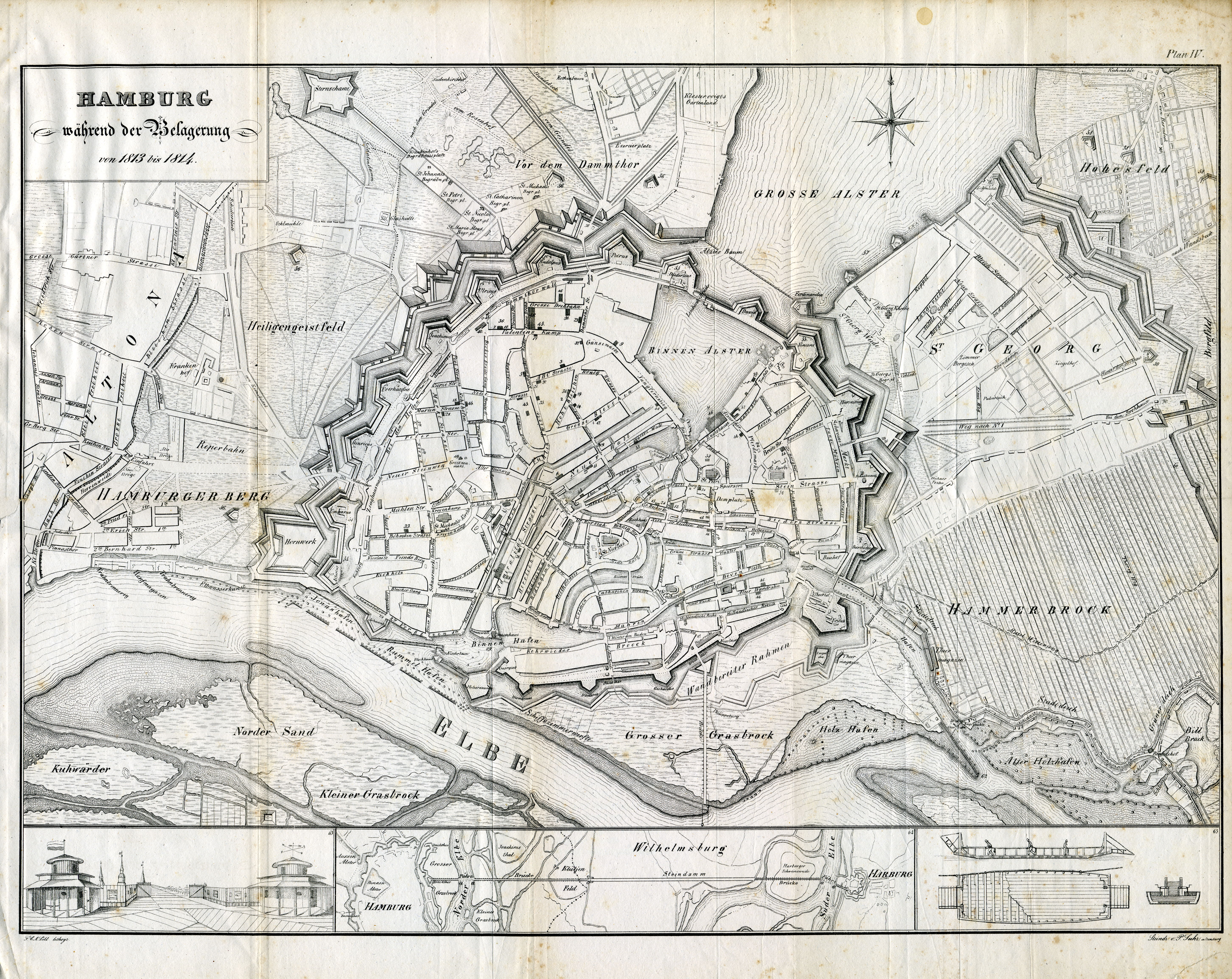
| DescriptionHamburg.Karte.1813 neddermeyer 300dpi.jpg |
Karte von Hamburg während der französischen Besatzung 1813/1814
|
| Date | |
| Source | http://www.christian-terstegge.de/hamburg/karten_hamburg/ |
| Author | F. H. Neddermeyer: Topographie der Freien und Hanse Stadt Hamburg, Plan IV: "Hamburg während der Belagerung in den Jahren 1813 und 1814", Verlag Hoffmann & Campe, Hamburg 1832. |
Licensing
| Public domainPublic domainfalsefalse |
|
This work is in the public domain in its country of origin and other countries and areas where the copyright term is the author's life plus 70 years or fewer.
| |
| This file has been identified as being free of known restrictions under copyright law, including all related and neighboring rights. | |
https://creativecommons.org/publicdomain/mark/1.0/PDMCreative Commons Public Domain Mark 1.0falsefalse
Captions
Items portrayed in this file
depicts
1830
File history
Click on a date/time to view the file as it appeared at that time.
| Date/Time | Thumbnail | Dimensions | User | Comment | |
|---|---|---|---|---|---|
| current | 15:52, 2 January 2011 | | 5,808 × 4,614 (7.63 MB) | Wmeinhart | {{Information |Description=Karte von Hamburg während der französischen Besatzung 1813/1814 |Source=http://www.christian-terstegge.de/hamburg/karten_hamburg/ |Date=1814 |Author=Neddermeyer |Permission= |other_versions= }} [[Category:Historical maps of H |
File usage
Global file usage
The following other wikis use this file:
- Usage on de.wikipedia.org
- Usage on fr.wikipedia.org
- Louis Nicolas Davout
- Wikipédia:Sélection
- Wikipédia:Sélection/France au XIXe siècle
- Wikipédia:Sélection/Premier Empire
- Portail:Hambourg
- Wikipédia:Sélection/Hambourg
- Siège de Hambourg
- Portail:Années 1810
- Wikipédia:Sélection/Années 1810
- Wikipédia:Lumière sur/Mars 2014
- Wikipédia:Lumière sur/Siège de Hambourg
- Projet:Guerres napoléoniennes/Batailles
- Projet:Guerres napoléoniennes/Batailles/2
- Utilisateur:Damned/Brouillon
- Wikipédia:Sélection/France/Bons articles/E à L
- Usage on it.wikipedia.org
- Usage on ru.wikipedia.org
- Usage on sv.wikipedia.org
- Usage on tr.wikipedia.org
- Usage on zh.wikipedia.org
Metadata
This file contains additional information, probably added from the digital camera or scanner used to create or digitize it.
If the file has been modified from its original state, some details may not fully reflect the modified file.
| Software used | IF |
|---|---|
| File change date and time | Adobe Photoshop CS4 |
| Color space | sRGB |
| Orientation | Normal |
| Horizontal resolution | 0.70056172486983 dpi |
| Vertical resolution | 2.1566387891354 dpi |