File:Chinthamani_Taluk_COVID_Map.pdf
From Wikipedia, the free encyclopedia

Size of this JPG preview of this PDF file: 424 × 599 pixels. Other resolutions: 170 × 240 pixels | 339 × 480 pixels | 543 × 768 pixels | 724 × 1,024 pixels | 1,754 × 2,479 pixels.
Original file (1,754 × 2,479 pixels, file size: 500 KB, MIME type: application/pdf)
| This is a file from the Wikimedia Commons. Information from its description page there is shown below. Commons is a freely licensed media file repository. You can help. |
Summary
| DescriptionChinthamani Taluk COVID Map.pdf |
English: COVID cases by village in Chinthamani Taluk |
| Date | |
| Source | https://covid19.karnataka.gov.in/storage/pdf-files/Taluk_Village_Criteria_Chikballapur.pdf |
| Author | Government of Karnataka |
| Camera location | 13° 24′ 06.29″ N, 78° 03′ 15.26″ E | View this and other nearby images on: OpenStreetMap |
|---|
Licensing

|
This file is a copyrighted work of the Government of India, licensed under the Government Open Data License - India (GODL).
Information on Related Items:
https://data.gov.in/sites/default/files/Gazette_Notification_OGDL.pdf GODL-India Government Open Data License – India true true |
 |
|
Deutsch ∙ English ∙ español ∙ français ∙ हिन्दी ∙ 日本語 ∙ മലയാളം ∙ मराठी ∙ русский ∙ 中文(简体) ∙ 中文(繁體) ∙ 中文(臺灣) ∙ +/− |

|
This image, which was originally posted in the source indicated above, has not yet been reviewed by an administrator or reviewer to confirm that the above license is valid. See Category:Unreviewed photos of GODL-India for further instructions.
|
Captions
COVID cases by village in Chinthamani Taluk
Items portrayed in this file
depicts
application/pdf
78a49a8fc997cc3b50e0bb6606100744ed7ec07b
512,118 byte
2,479 pixel
1,754 pixel
13°24'6.286"N, 78°3'15.260"E
20 May 2020
File history
Click on a date/time to view the file as it appeared at that time.
| Date/Time | Thumbnail | Dimensions | User | Comment | |
|---|---|---|---|---|---|
| current | 17:40, 28 January 2023 | 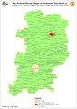 | 1,754 × 2,479 (500 KB) | Vijethnbharadwaj | Uploaded a work by Government of Karnataka from https://covid19.karnataka.gov.in/storage/pdf-files/Taluk_Village_Criteria_Chikballapur.pdf with UploadWizard |
File usage
The following pages on the English Wikipedia use this file (pages on other projects are not listed):
Metadata
This file contains additional information, probably added from the digital camera or scanner used to create or digitize it.
If the file has been modified from its original state, some details may not fully reflect the modified file.
| Software used | Esri ArcMap 10.4.0.5524 |
|---|---|
| Encrypted | no |
| Page size | 842.258 x 1190.24 pts |
| Version of PDF format | 1.6 |
Retrieved from "https://en.wikipedia.org/wiki/File:Chinthamani_Taluk_COVID_Map.pdf"