File:British_Empire_in_1898.png
From Wikipedia, the free encyclopedia
Size of this preview: 800 × 348 pixels. Other resolutions: 320 × 139 pixels | 640 × 278 pixels | 1,434 × 624 pixels.
Original file (1,434 × 624 pixels, file size: 39 KB, MIME type: image/png)
| This is a file from the Wikimedia Commons. Information from its description page there is shown below. Commons is a freely licensed media file repository. You can help. |

|
This map of the world image could be re-created using vector graphics as an SVG file. This has several advantages; see Commons:Media for cleanup for more information. If an SVG form of this image is available, please upload it and afterwards replace this template with
{{vector version available|new image name}}.
It is recommended to name the SVG file “British Empire in 1898.svg”—then the template Vector version available (or Vva) does not need the new image name parameter. |
| Datasource (reference to visualized facts) is not provided for the data that is visualized in this self-made work. |
Summary
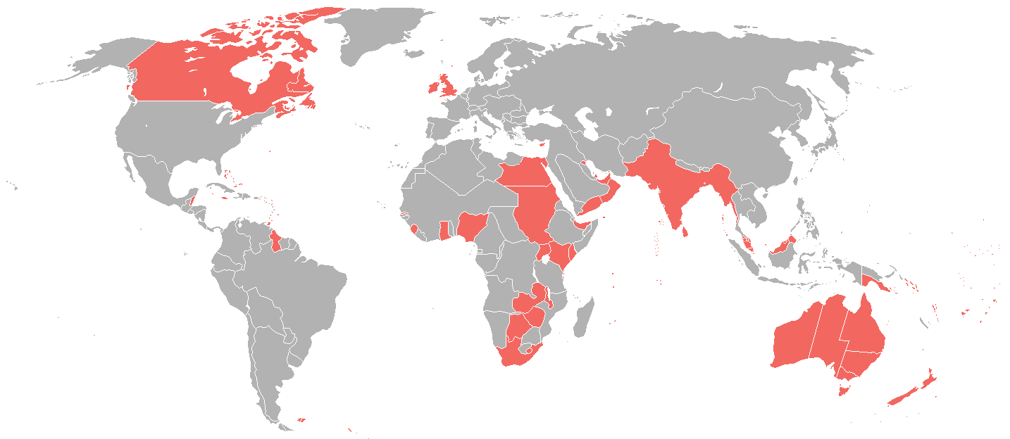
| DescriptionBritish Empire in 1898.png |
English: A map of the British Empire as it was in 1898, prior to the Second Boer War (1899-1902). |
| Date | |
| Source | File:World_1898_empires_colonies_territory.png |
| Author | User:Roke~commonswiki |
| Permission (Reusing this file) |
File:World_1898_empires_colonies_territory.png |
Licensing
This file is licensed under the Creative Commons Attribution-Share Alike 3.0 Unported license.
- You are free:
- to share – to copy, distribute and transmit the work
- to remix – to adapt the work
- Under the following conditions:
- attribution – You must give appropriate credit, provide a link to the license, and indicate if changes were made. You may do so in any reasonable manner, but not in any way that suggests the licensor endorses you or your use.
- share alike – If you remix, transform, or build upon the material, you must distribute your contributions under the same or compatible license as the original.
Captions
Add a one-line explanation of what this file represents
Items portrayed in this file
depicts
9 June 2006
image/png
7bd6ce66160549558d3e31acc44fa0be0d736b52
39,817 byte
624 pixel
1,434 pixel
File history
Click on a date/time to view the file as it appeared at that time.
| Date/Time | Thumbnail | Dimensions | User | Comment | |
|---|---|---|---|---|---|
| current | 08:08, 31 October 2021 | | 1,434 × 624 (39 KB) | Randomastwritter | jubaland |
| 23:12, 23 June 2016 |  | 1,434 × 624 (31 KB) | Maproom | Islands near Madagascar, which were colored blue as French territory, now grey. | |
| 22:20, 11 April 2016 |  | 1,434 × 624 (38 KB) | The- | More accurate map | |
| 12:29, 7 July 2015 |  | 1,357 × 628 (35 KB) | Snow Lion Fenian | {{subst:Upload marker added by en.wp UW}} {{Information |Description = {{en|A map of the British Empire as it was in 1898, prior to the Second Boer War (1899-1902).}} |Source = https://commons.wikimedia.org/wiki/File:World_1898_empires_colonies_territo... |
File usage
The following pages on the English Wikipedia use this file (pages on other projects are not listed):
Global file usage
The following other wikis use this file:
- Usage on ar.wikipedia.org
- Usage on ca.wikipedia.org
- Usage on cs.wikipedia.org
- Usage on de.wikipedia.org
- Usage on es.wikipedia.org
- Usage on et.wikipedia.org
- Usage on ko.wikipedia.org
- Usage on sk.wikipedia.org
- Usage on ta.wikipedia.org
Metadata
This file contains additional information, probably added from the digital camera or scanner used to create or digitize it.
If the file has been modified from its original state, some details may not fully reflect the modified file.
| Horizontal resolution | 37.78 dpc |
|---|---|
| Vertical resolution | 37.78 dpc |
| File change date and time | 22:55, 23 June 2016 |
Retrieved from "https://en.wikipedia.org/wiki/File:British_Empire_in_1898.png"