चित्र:Eurasian_steppe_belt.jpg
From Wikipedia, the free encyclopedia
ए नमूना के साइज: 800 × 597 पिक्सेल. अउरी रिजोल्यूशन: 320 × 239 पिक्सेल | 640 × 478 पिक्सेल | 1,024 × 765 पिक्सेल | 1,280 × 956 पिक्सेल | 2,048 × 1,529 पिक्सेल.
ओरिजनल फाइल (2,048 × 1,529 पिक्सेल, फाइल साइज: 1.62 MB, MIME टाइप: image/jpeg)
ई फाइल Wikimedia Commons से बा आ अउरी प्रोजेक्ट भी एकर इस्तेमाल कर सकत बाड़ें। एकर विवरण फाइल विवरण पन्ना नीचे देखावल गइल बा।
सारांश
References for this description (or part of this) or for the depiction in the file are not provided.
|
| बिबरणEurasian steppe belt.jpg |
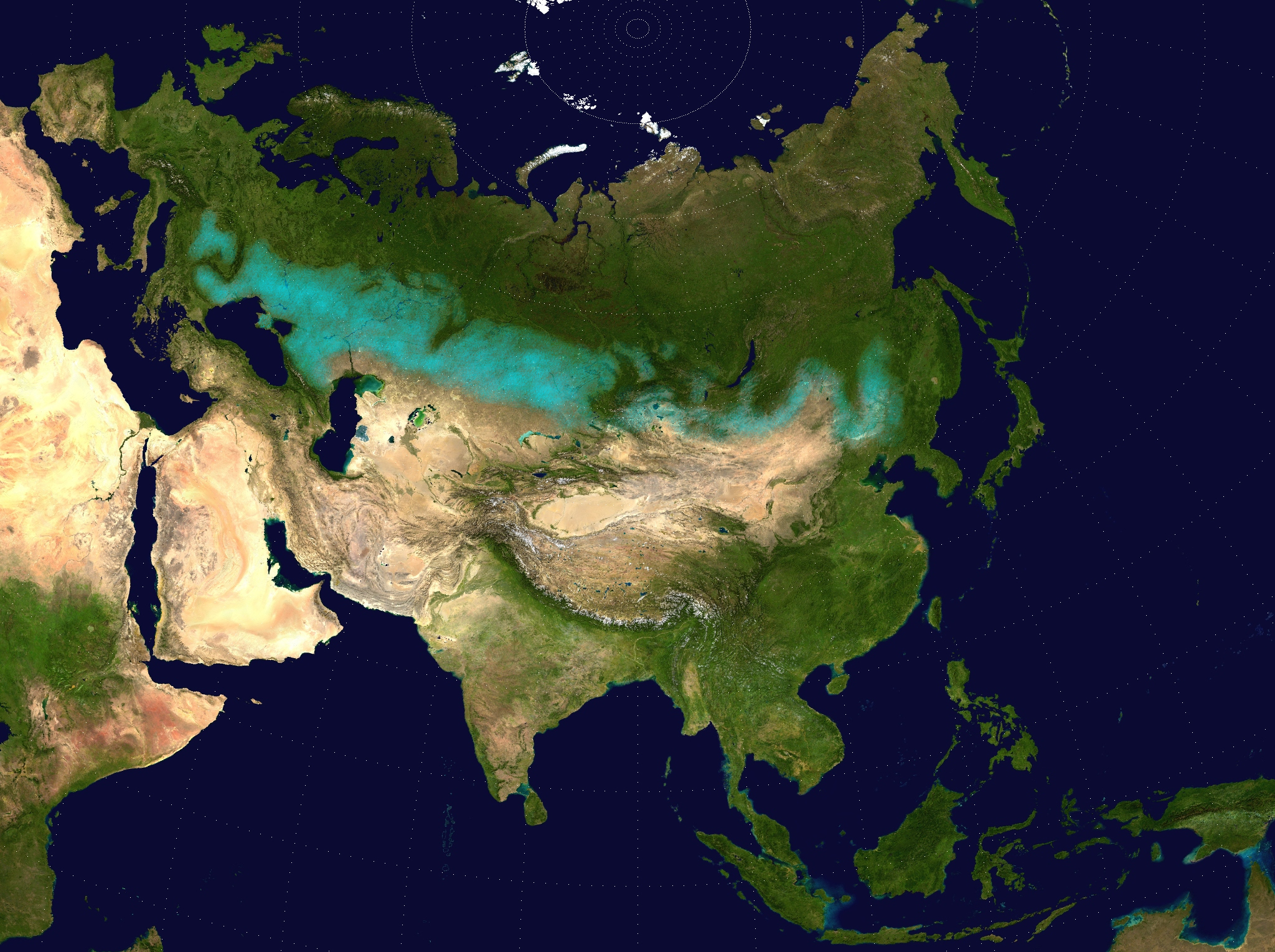
English: Approximate extent of the Eurasian Steppe grasslands ecoregion, and Eurasia cultural region.
|
| तारीख | (UTC) |
| स्रोत | |
| लेखक |
|
| परमीशन (एह फाइल के दुबारा इस्तेमाल) |
Source map released into public domain. |
| This is a retouched picture, which means that it has been digitally altered from its original version. Modifications: Eurasian Steppe highlighted in ; areas of Caspian Sea and Lake Balkhash converted to to avoid confusion; image cropped.. The original can be viewed here: Two-point-equidistant-asia.jpg:
|
लाइसेंसिंग
I, the copyright holder of this work, hereby publish it under the following license:
| Public domainPublic domainfalsefalse |
| I, the copyright holder of this work, release this work into the public domain. This applies worldwide. In some countries this may not be legally possible; if so: I grant anyone the right to use this work for any purpose, without any conditions, unless such conditions are required by law. |
Captions
Add a one-line explanation of what this file represents
Approximate extent of the Eurasian Steppe grasslands ecoregion, and Eurasia cultural region
Satellitenaufnahme von Asien.
Примерная зона распространения Евразийского степного экологического региона и Евразийского культурного региона. В Северо-Восточной и Центральной Азии, на западных границах Восточной Европы, в пределах России, Украины, Молдовы, Венгрии, Румынии и др.
Items portrayed in this file
depicts अंगरेजी
copyright status अंगरेजी
inception अंगरेजी
२६ मई 2009
फाइल के इतिहास
ओ समय ई फाइल कइसन लउके ई देखे खातिर कौनों तारीख/समय पर क्लिक करीं।
| तारीख/समय | चिप्पी रूप | डाइमेंशन | प्रयोगकर्ता | टिप्पणी | |
|---|---|---|---|---|---|
| वर्तमान | 17:24, 6 अप्रैल 2017 | | 2,048 × 1,529 (1.62 MB) | Clivius | The area was adjusted in accordance with the actual geographic location. |
| 00:48, 10 जून 2016 |  | 1,640 × 1,320 (296 KB) | Shattered Gnome | New coloration of source image; DarkPink highlight is now Cyan. Somewhat cropped. | |
| 14:37, 26 मई 2009 |  | 2,048 × 1,529 (1.64 MB) | Cp6 | {{Information |Description=Approximate pathway of the Eurasian steppe belt. Based on file Two-point-equidistant-asia, see below. |Source=*File:Two-point-equidistant-asia.jpg |Date=2009-05-26 15:24 (UTC) |Author=*[[:File:Two-point-equidistant-asia.j |
फाइल के उपयोग
फाइल के इस्तेमाल 2 पन्ना करत बाड़ें:
बैस्विक फाइल उपयोग
नीचे दिहल अउरी विकिसभ पर एह फाइल के इस्तेमाल हो रहल बा:
- ar.wikipedia.org पर इस्तेमाल
- azb.wikipedia.org पर इस्तेमाल
- az.wikipedia.org पर इस्तेमाल
- ba.wikipedia.org पर इस्तेमाल
- be-tarask.wikipedia.org पर इस्तेमाल
- be.wikipedia.org पर इस्तेमाल
- bg.wikipedia.org पर इस्तेमाल
- bn.wikipedia.org पर इस्तेमाल
- ca.wikipedia.org पर इस्तेमाल
- cs.wikipedia.org पर इस्तेमाल
- cy.wikipedia.org पर इस्तेमाल
- de.wikipedia.org पर इस्तेमाल
- de.wikibooks.org पर इस्तेमाल
- de.wikiversity.org पर इस्तेमाल
- el.wikipedia.org पर इस्तेमाल
- en.wikipedia.org पर इस्तेमाल
- eo.wikipedia.org पर इस्तेमाल
- es.wikipedia.org पर इस्तेमाल
- eu.wikipedia.org पर इस्तेमाल
- fa.wikipedia.org पर इस्तेमाल
- fa.wikibooks.org पर इस्तेमाल
- fi.wikipedia.org पर इस्तेमाल
- frr.wikipedia.org पर इस्तेमाल
- fr.wikivoyage.org पर इस्तेमाल
- ga.wikipedia.org पर इस्तेमाल
- glk.wikipedia.org पर इस्तेमाल
- he.wikipedia.org पर इस्तेमाल
- hi.wikipedia.org पर इस्तेमाल
- hr.wikipedia.org पर इस्तेमाल
- hu.wikipedia.org पर इस्तेमाल
- hy.wikipedia.org पर इस्तेमाल
- io.wikipedia.org पर इस्तेमाल
- ja.wikipedia.org पर इस्तेमाल
एह फाइल के अउरी बैस्विक इस्तेमाल देखीं