Ragiv:Carte_France_geo.png
From Wikipedia, the free encyclopedia
Gretot gudikum no pagebidon.
Carte_France_geo.png (564 × 573 pixel, ragivagret: 129 KB, pated MIME: image/png)
Ragiv at kömon de Wikimedia Commons e kanon pagebön fa proyegs votik. Bepenot su pad bepenota ragiva onik pajonon dono.

|
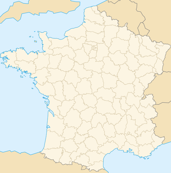
File:France location map-Departements-2015.svg is a vector version of this file. It should be used in place of this PNG file when not inferior.
File:Carte France geo.png → File:France location map-Departements-2015.svg
For more information, see Help:SVG.
|
 |
Dälastad
Benoît Stella alias BenduKiwi, the copyright holder of this work, hereby publishes it under the following licenses:

|
Däl pagevon ad kopiedön, seagivön e/u votükön dokümi at ma Dälazöt ad Dokümam Libik: GNU, Fomam: 1.2 u nulikum fa el Free Software Foundation (Stitod: Nünömaprograms libik); nen diläds nevotükovik, nen vödems tegapada balid, e leigo nen vödems tegapada lätik. Kopied dälazöta pekeninon in diläd: Dälazöt ad Dokümam Libik: GNU panemöl.http://www.gnu.org/copyleft/fdl.htmlGFDLGNU Free Documentation Licensetruetrue |
| This file is licensed under the Creative Commons Attribution-Share Alike 3.0 Unported license. | ||
| Attribution: Benoît Stella alias BenduKiwi | ||
| ||
| This licensing tag was added to this file as part of the GFDL licensing update.http://creativecommons.org/licenses/by-sa/3.0/CC BY-SA 3.0Creative Commons Attribution-Share Alike 3.0truetrue |
This file is licensed under the Creative Commons Attribution-Share Alike 2.5 Generic, 2.0 Generic and 1.0 Generic license.
Attribution: Benoît Stella alias BenduKiwi
- Binol libik:
- to share – to copy, distribute and transmit the work
- to remix – to adapt the work
- Under the following conditions:
- attribution – You must give appropriate credit, provide a link to the license, and indicate if changes were made. You may do so in any reasonable manner, but not in any way that suggests the licensor endorses you or your use.
- share alike – If you remix, transform, or build upon the material, you must distribute your contributions under the same or compatible license as the original.
You may select the license of your choice.
Captions
Add a one-line explanation of what this file represents
Items portrayed in this file
depicts Linglänapük
copyright status Linglänapük
copyrighted Linglänapük
copyright license Linglänapük
media type Linglänapük
image/png
checksum Linglänapük
8cf5ab1521a34bc5bfd563aea5454da29c7179aa
data size Linglänapük
132,175 byte
height Linglänapük
573 pixel
width Linglänapük
564 pixel
Jenotem ragiva
Välolös däti/timi ad logön ragivi soäsä äbinon ün tim at.
| Dät/Tim | Magodil | Mafots | Geban | Küpet | |
|---|---|---|---|---|---|
| anuik | 12:09, 2016 dekul 12id | | 564 × 573 (129 KB) | Andrew Dalby | Reverted to version as of 18:49, 18 June 2008 (UTC) because later version shows obsolete regions |
| 19:08, 2008 yunul 18id |  | 564 × 573 (136 KB) | TomKr | manquait les régions... | |
| 18:49, 2008 yunul 18id |  | 564 × 573 (129 KB) | TomKr | Couleurs standardisées | |
| 08:54, 2008 yunul 18id |  | 564 × 573 (93 KB) | Wikisoft* | Reverted to version as of 07:19, 16 June 2008 | |
| 16:38, 2008 yunul 16id |  | 564 × 573 (61 KB) | Touriste | Reverted to version as of 21:55, 20 August 2007 | |
| 16:37, 2008 yunul 16id |  | 564 × 573 (61 KB) | Touriste | Reverted to version as of 21:55, 20 August 2007 | |
| 16:31, 2008 yunul 16id |  | 645 × 634 (156 KB) | Touriste | {{Information |Description= |Source= |Date= |Author= |Permission= |other_versions= }} | |
| 07:19, 2008 yunul 16id |  | 564 × 573 (93 KB) | Wikisoft* | Carte France Géolocalisation + Départements | |
| 21:55, 2007 gustul 20id |  | 564 × 573 (61 KB) | Phe | ||
| 15:28, 2006 yulul 12id |  | 564 × 573 (61 KB) | BenduKiwi | test côte bretonne |
Yüms
Pads plu 100 labons yümi lü ragiv at. Lised dono jonon padayümis balid 100 te lü ragiv at. Lised lölöfik gebidon.
- Agen
- Aix-en-Provence
- Alès
- Amiens
- Angers
- Annemasse
- Antibes
- Arras
- Aubervilliers
- Aulnay-sous-Bois
- Auxerre
- Avignon
- Bayonne (Fransän)
- Beauvais
- Belfort
- Besançon
- Blois
- Bordeaux
- Boulogne-Billancourt
- Boulogne-sur-Mer
- Bourges
- Brest (Fransän)
- Brive-la-Gaillarde
- Béthune
- Béziers
- Calais (Fransän)
- Carcassonne
- Chalon-sur-Saône
- Chambéry
- Charleville-Mézières
- Chartres
- Cherbourg-Octeville
- Châteauroux
- Clermont-Ferrand
- Colmar
- Compiègne
- Courbevoie
- Creil
- Créteil
- Dijon
- Douai
- Drancy
- Dunkerque
- Elbeuf
- Forbach (Fransän)
- Fréjus
- Grenoble
- Issy-les-Moulineaux
- La Rochelle
- Le Havre
- Le Mans
- Levallois-Perret
- Lille (Fransän)
- Limoges
- Lorient
- Lyon
- Marseille
- Maubeuge
- Montbéliard
- Montpellier
- Mulhouse
- Mâcon
- Nancy
- Nanterre
- Nantes
- Nevers
- Nice
- Niort
- Nîmes
- Orléans
- Paris
- Pau (Fransän)
- Perpignan
- Poitiers
- Quimper
- Reims
- Rennes
- Roanne
- Roubaix
- Rouen
- Rueil-Malmaison
- Saint-Brieuc
- Saint-Chamond
- Saint-Dié-des-Vosges
- Saint-Nazaire
- Saint-Quentin
- Saint-Étienne
- Strasbourg
- Tarbes
- Thionville
- Toulon
- Toulouse
- Tourcoing
- Tours
- Valenciennes
- Vannes
- Versailles
- Vichy
- Villeurbanne
- Vitry-sur-Seine
Logolös yümis pluik ad ragiv at.
Ragivigeb Valöpik
The following other wikis use this file:
- Geb su avk.wikipedia.org
- Geb su br.wikipedia.org
- Geb su de.wikipedia.org
- Geb su eo.wikipedia.org
- Ŝablono:Geofra
- Ŝablono:Geofra/dokumentado
- Voulpaix
- Englefontaine
- Ghissignies
- Hecq
- Jolimetz
- Locquignol
- Louvignies-Quesnoy
- Neuville-en-Avesnois
- Poix-du-Nord
- Potelle
- Raucourt-au-Bois
- Ruesnes
- Salesches
- Vendegies-au-Bois
- Frasnoy
- Gommegnies
- Jenlain
- Maresches
- Orsinval
- Preux-au-Sart
- Sepmeries
- Villers-Pol
- Wargnies-le-Grand
- Wargnies-le-Petit
- Eppe-Sauvage
- Féron
- Glageon
- Moustier-en-Fagne
- Choisies
- Clairfayts
- Cousolre
- Dimechaux
- Dimont
- Hestrud
- Lez-Fontaine
- Liessies
- Sars-Poteries
- Solrinnes
- Wallers-en-Fagne
- Wignehies
- Écuélin
- Monceau-Saint-Waast
View more global usage of this file.
Ragivanüns
Ragiv at keninükon nünis pluik, luveratiko se käm u numatüköm me kel päjafon. If ragiv at ya pevotükon e no plu leigon ko rigädastad okik, mögos, das pats anik is palisedöls no plu bepenons ragivi in stad anuik.
| Distidafäg horitätik | 35.43 dpc |
|---|---|
| Distidafäg penditik | 35.43 dpc |
| Nünömaprogram pegeböl |
|
Pekopiedon se „https://vo.wikipedia.org/wiki/Ragiv:Carte_France_geo.png“