ھۆججەت:Map_of_USA_highlighting_Georgia.png
From Wikipedia, the free encyclopedia
يۇقىرىراق پەرق ئېتىش نىسبىتى يوق.
Map_of_USA_highlighting_Georgia.png (280 × 183 پىكسېل، ھۆججەت چوڭلۇقى: 35 KB، MIME تىپى: image/png)
بۇ ھۆججەت ۋىكى ۋاستە ھەمبەھىر دىن كەلگەن، ئۇ باشقا قۇرۇلۇشتا ئىشلىتىلىشى مۇمكىن. ھۆججەت چۈشەندۈرۈش بېتى نىڭ چۈشەندۈرۈشى تۆۋەندە كۆرسىتىلىدۇ.

|
File:Map of USA GA.svg is a vector version of this file. It should be used in place of this PNG file when not inferior.
File:Map of USA highlighting Georgia.png → File:Map of USA GA.svg
For more information, see Help:SVG.
|
 |
ئۈزۈندە
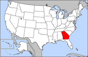
Public domain map courtesy of The General Libraries, The University of Texas at Austin, modified to highlight state boundaries.
Source: Modified version of United States (Outline Map) 1998 from Perry-Castañeda Library Map Collection: United States Maps
| This image is a copy or a derivative work of usa_blank.jpg, from the map collection of the Perry–Castañeda Library (PCL) of the University of Texas at Austin.
This tag does not indicate the copyright status of the attached work. A normal copyright tag is still required. See Commons:Licensing for more information. |
ئىجازەت

|
Permission is granted to copy, distribute and/or modify this document under the terms of the GNU Free Documentation License, Version 1.2 or any later version published by the Free Software Foundation; with no Invariant Sections, no Front-Cover Texts, and no Back-Cover Texts. A copy of the license is included in the section entitled GNU Free Documentation License.http://www.gnu.org/copyleft/fdl.htmlGFDLGNU Free Documentation Licensetruetrue |
| This file is licensed under the Creative Commons Attribution-Share Alike 3.0 Unported license. | ||
| ||
| This licensing tag was added to this file as part of the GFDL licensing update.http://creativecommons.org/licenses/by-sa/3.0/CC BY-SA 3.0Creative Commons Attribution-Share Alike 3.0truetrue |
From en.wikipedia
Captions
Add a one-line explanation of what this file represents
Items portrayed in this file
depicts ئىنگلىزچە
copyright status ئىنگلىزچە
copyrighted ئىنگلىزچە
ھۆججەت تارىخى
چېسلا/ۋاقىت چېكىلسە ئەينى ۋاقىتتا كۆرۈلگەن ھۆججەتنى كۆرسىتىدۇ.
| چېسلا/ۋاقىت | كىچىك سۈرەت | ئۆلچەم | ئىشلەتكۈچى | ئىزاھات | |
|---|---|---|---|---|---|
| نۆۋەتتىكى | 16:32, 4 ئاپرېل 2005 | | 280 × 183 (35 KB) | David.gaya | From English wikipedia: Public domain map courtesy of [http://www.lib.utexas.edu/ The General Libraries, The University of Texas at Austin], modified to highlight state boundaries. {{GFDL}} Category:State locator maps of the United States [[Category: |
ھۆججەت ئىشلىتىلىشى
تۆۋەندىكى بەت بۇ ھۆججەتنى ئىشلىتىدۇ:
ئورتاق ھۆججەت ئىشلىتىلىشى
تۆۋەندىكى باشقا ۋىكىلار بۇ ھۆججەتنى ئىشلىتىدۇ:
- ar.wikipedia.org دىكى ئىشلىتىشى
- az.wiktionary.org دىكى ئىشلىتىشى
- bat-smg.wikipedia.org دىكى ئىشلىتىشى
- chr.wikipedia.org دىكى ئىشلىتىشى
- en.wikipedia.org دىكى ئىشلىتىشى
- en.wiktionary.org دىكى ئىشلىتىشى
- eo.wikipedia.org دىكى ئىشلىتىشى
- es.wikipedia.org دىكى ئىشلىتىشى
- fi.wikivoyage.org دىكى ئىشلىتىشى
- frp.wikipedia.org دىكى ئىشلىتىشى
- fr.wikinews.org دىكى ئىشلىتىشى
- hr.wiktionary.org دىكى ئىشلىتىشى
- it.wiktionary.org دىكى ئىشلىتىشى
- kw.wikipedia.org دىكى ئىشلىتىشى
- li.wikipedia.org دىكى ئىشلىتىشى
- no.wikipedia.org دىكى ئىشلىتىشى
- pam.wikipedia.org دىكى ئىشلىتىشى
- pap.wikipedia.org دىكى ئىشلىتىشى
- pnb.wikipedia.org دىكى ئىشلىتىشى
- rm.wikipedia.org دىكى ئىشلىتىشى
- ro.wikipedia.org دىكى ئىشلىتىشى
- ru.wiktionary.org دىكى ئىشلىتىشى
- sd.wiktionary.org دىكى ئىشلىتىشى
- szl.wikipedia.org دىكى ئىشلىتىشى
- ur.wikipedia.org دىكى ئىشلىتىشى
- uz.wikipedia.org دىكى ئىشلىتىشى
- zh-min-nan.wikipedia.org دىكى ئىشلىتىشى
- zh.wiktionary.org دىكى ئىشلىتىشى