Ficheiro:Rashidun654wVassal.png
De Wikipedia, a enciclopédia encyclopedia
Dimensões desta antevisão: 800 × 487 píxeis. Outras resoluções: 320 × 195 píxeis | 640 × 390 píxeis | 1 024 × 624 píxeis | 1 481 × 902 píxeis.
Imagem numa resolução maior (1 481 × 902 píxeis, tamanho: 49 kB, tipo MIME: image/png)
|
|
Esta imagem provém do Wikimedia Commons, um acervo de conteúdo livre da Wikimedia Foundation que pode ser utilizado por outros projetos.
|
Descrição do ficheiro
| DescriçãoRashidun654wVassal.png |
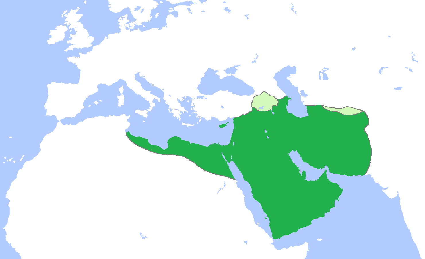
English: Map of the Rashidun Caliphate (dark green) with vassal states (light green), c. 654.
(Partially based on several other Wikimedia Commons maps of the Rashidun Caliphate). |
| Data | |
| Origem | Obra do próprio |
| Autor | Gabagool |
Licenciamento
Eu, titular dos direitos de autor desta obra, publico-a com a seguinte licença:
A utilização deste ficheiro é regulada nos termos da licença Creative Commons - Atribuição 3.0 Não Adaptada.
- Pode:
- partilhar – copiar, distribuir e transmitir a obra
- recombinar – criar obras derivadas
- De acordo com as seguintes condições:
- atribuição – Tem de fazer a devida atribuição da autoria, fornecer uma hiperligação para a licença e indicar se foram feitas alterações. Pode fazê-lo de qualquer forma razoável, mas não de forma a sugerir que o licenciador o apoia ou subscreve o seu uso da obra.
Legendas
Mapa da Califado Ortodoxo (verde-escuro) e estados vassalos (verde-claro), c. 654.
Elementos retratados neste ficheiro
retrata
Um valor sem um elemento no repositório Wikidata
21 abril 2009
Histórico do ficheiro
Clique uma data e hora para ver o ficheiro tal como ele se encontrava nessa altura.
| Data e hora | Miniatura | Dimensões | Utilizador | Comentário | |
|---|---|---|---|---|---|
| atual | 09h41min de 17 de junho de 2012 | | 1 481 × 902 (49 kB) | Cplakidas | further corrections: Western Georgia remained under Byz. control, Armenia and Iberia were vassals, but the Exarchate of Carthage was not |
| 01h48min de 12 de outubro de 2010 |  | 1 481 × 902 (47 kB) | Cplakidas | corrections: the Exarchate of Carthage extended only around mod. northern Tunisia at the time, Rhodes, Crete and Sicily were raided but not occupied, and Cilicia, the region of the northern Euphrates and western Armenia were not yet conquered. | |
| 16h07min de 21 de abril de 2009 |  | 1 481 × 902 (49 kB) | Gabagool | {{Information |Description={{en|1=Map of the Rashidun Caliphate (dark green) with vassal states (light green), c. 654. (Partially based on several other Wikimedia Commons maps of the Rashidun Caliphate).}} |Source=Own work by uploader |Author=[[User:Gaba |
Utilização local do ficheiro
As seguintes 3 páginas usam este ficheiro:
Utilização global do ficheiro
As seguintes wikis usam este ficheiro:
- ar.wikipedia.org
- arz.wikipedia.org
- az.wikipedia.org
- ba.wikipedia.org
- bn.wikipedia.org
- ca.wikipedia.org
- da.wikipedia.org
- el.wikipedia.org
- en.wikipedia.org
- User:Arab Hafez
- User:Ph1ne4s
- User:BomBom/List of caliphs
- User:Sobreira/Religion
- User:LeftAire/Islamic Caliphates
- User:Latristelagrima
- User:Yulin Zhang
- User:Sabbir31x/Userboxes3
- User:Dhaouadi bizerte
- User:WarriorofShiism
- User:Sj122390
- User:-Jafar277-
- User:Idriskamal
- User:Nayefc
- User:Felineastatine
- User:Euripides ψ
- User:Knowledgepocket
- User:Khalid Nezami/sandbox
- User:Pianist4
- User:Srpbm
- User:Nahiyan567
- User:CarvigoLD
- User:Malkawi99
- User:VFF0347
- User:TomReagan90
- Wikipedia:Userboxes/History/Empires
- User:Solavirum/about
- User:Carthago814
- User:Katafada
- User:Asianadrian
- User:Mohamed Taqi
- User:Kursemaster
- User:Bolt Escargot
Ver mais utilizações globais deste ficheiro.