File:Map_of_USA_highlighting_Georgia.png
From Wikipedia, the free encyclopedia
No tin resolushon mas mihó.
Map_of_USA_highlighting_Georgia.png (280 × 183 pixel, tamaño di fail: 35 KB, MIME type: image/png)
E fail akí ta di Wikimedia Commons i por us'é den otro proyekto. E deskripshon riba su página di deskripshon di fail ta indiká mas abou.

|
File:Map of USA GA.svg is a vector version of this file. It should be used in place of this PNG file when not inferior.
File:Map of USA highlighting Georgia.png → File:Map of USA GA.svg
For more information, see Help:SVG.
|
 |
Resúmen
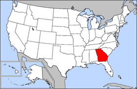
Public domain map courtesy of The General Libraries, The University of Texas at Austin, modified to highlight state boundaries.
Source: Modified version of United States (Outline Map) 1998 from Perry-Castañeda Library Map Collection: United States Maps
| This image is a copy or a derivative work of usa_blank.jpg, from the map collection of the Perry–Castañeda Library (PCL) of the University of Texas at Austin.
This tag does not indicate the copyright status of the attached work. A normal copyright tag is still required. See Commons:Licensing for more information. |
Lisensia

|
Ta pèrmití kopia, distribuí i/òf modifiká e dokumento akí segun e GNU Free Documentation License, Vershon 1.2 òf kualke vershon mas resien publiká pa Free Software Foundation; sin Sekshon Invariante, sin teksto Front-Cover, i sin teksto Back-Cover. Un ehemplar di e lisensia ta inkluí den e sekshon yamá Lisensia di Dokumentashon Liber GNU.http://www.gnu.org/copyleft/fdl.htmlGFDLGNU Free Documentation Licensetruetrue |
| E fail akí tin lisensia Creative Commons Attribution-Share Alike 3.0 Unported. | ||
| ||
| This licensing tag was added to this file as part of the GFDL licensing update.http://creativecommons.org/licenses/by-sa/3.0/CC BY-SA 3.0Creative Commons Attribution-Share Alike 3.0truetrue |
From en.wikipedia
Captions
Add a one-line explanation of what this file represents
Items portrayed in this file
ta portretá
Historia di fail
Klek riba un fecha/ora pa mira e fail, manera e tabata na e momentu ei.
| Fecha/Ora | Miniatura | Dimenshonnan | Usuario | Komentario | |
|---|---|---|---|---|---|
| aktual | 16:32, 4 aprel 2005 | | 280 × 183 (35 KB) | David.gaya | From English wikipedia: Public domain map courtesy of [http://www.lib.utexas.edu/ The General Libraries, The University of Texas at Austin], modified to highlight state boundaries. {{GFDL}} Category:State locator maps of the United States [[Category: |
Uso di fail
E próksimo page uses ta uza e fail akí:
Uso global di fail
E próksimo otro wikinan ta usa e fail akí
- Uso na ar.wikipedia.org
- Uso na az.wiktionary.org
- Uso na bat-smg.wikipedia.org
- Uso na chr.wikipedia.org
- Uso na en.wikipedia.org
- Uso na en.wiktionary.org
- Uso na eo.wikipedia.org
- Uso na es.wikipedia.org
- Uso na fi.wikivoyage.org
- Uso na frp.wikipedia.org
- Uso na fr.wikinews.org
- Uso na hr.wiktionary.org
- Uso na it.wiktionary.org
- Uso na kw.wikipedia.org
- Uso na li.wikipedia.org
- Uso na no.wikipedia.org
- Uso na pam.wikipedia.org
- Uso na pnb.wikipedia.org
- Uso na rm.wikipedia.org
- Uso na ro.wikipedia.org
- Uso na ru.wiktionary.org
- Uso na sd.wiktionary.org
- Uso na szl.wikipedia.org
- Uso na ug.wikipedia.org
- Uso na ur.wikipedia.org
- Uso na uz.wikipedia.org
- Uso na zh-min-nan.wikipedia.org
- Uso na zh.wiktionary.org