ဖိုင်:Israel_Sea_Level_BW_1.JPG
From Wikipedia, the free encyclopedia
ဤနမူနာ၏ အရွယ်အစား - ၈၀၀ × ၅၃၆ ပစ်ဇယ်။ အခြား ပုံရိပ်ပြတ်သားမှု: ၃၂၀ × ၂၁၄ ပစ်ဇယ် | ၆၄၀ × ၄၂၈ ပစ်ဇယ် | ၁၀၂၄ × ၆၈၅ ပစ်ဇယ် | ၁၂၈၀ × ၈၅၇ ပစ်ဇယ် | ၂၅၆၀ × ၁၇၁၄ ပစ်ဇယ် | ၃၈၇၂ × ၂၅၉၂ ပစ်ဇယ်။
မူရင်းဖိုင် (၃၈၇၂ × ၂၅၉၂ pixels, ဖိုင်အရွယ်အစား - ၂.၈၈ MB, MIME အမျိုးအစား image/jpeg)
| ဤဖိုင်သည် Wikimedia Commons မှဖြစ်ပြီး အခြားပရောဂျက်များတွင် သုံးကောင်းသုံးလိမ့်မည်။ ယင်း၏ ဖိုင်အကြောင်းစာမျက်နှာ တွင် ဖော်ပြထားချက်ကို အောက်တွင် ပြထားသည်။ Commons သည် မူပိုင်ခွင့်လွတ်လပ်သော မီဒီယာဖိုင်များ သိုလှောင်ထားရာ နေရာ ဖြစ်သည်။ သင်လည်း ပါဝင်ကူညီနိုင်ပါသည်။ |
အကျဉ်းချုပ်
| Camera location | ၃၁° ၄၈′ ၀၉.၇၇″ N, ၃၅° ၂၄′ ၁၀.၃၂″ E | View this and other nearby images on: OpenStreetMap |
|---|
| ဖော်ပြချက်Israel Sea Level BW 1.JPG |
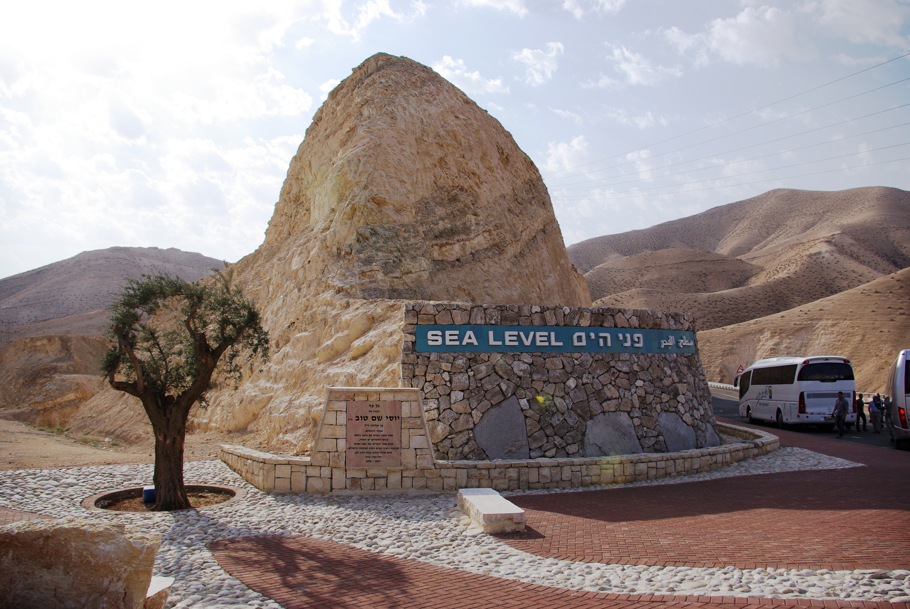
English: West Bank. Sea Level marker on the side of the road from Jerusalem to the Dead Sea
Deutsch: Westjordanland. Sea Level - Meereshöhe an der Straße von Jerusalem zum Toten Meer |
| ရက်စွဲ | |
| ရင်းမြစ် | ကိုယ်ပိုင်ဖန်တီးမှု |
| စာရေးသူ | Berthold Werner |
လိုင်စင်သတ်မှတ်ခြင်း
| Public domainPublic domainfalsefalse |
| I, the copyright holder of this work, release this work into the public domain. This applies worldwide. In some countries this may not be legally possible; if so: အကျွန်ုပ်သည် ဤဖန်တီးမှုလက်ရာကို ဥပဒေအရလိုအပ်ခြင်းမရှိသည့် မည်သည့်အခြေအနေမျိုးတွက်မဆို၊ မည်သို့သော ရည်ရွယ်ချက်အတွက်မဆို ၎င်းကို မည်သူမဆို အသုံးပြုပိုင်ခွင့်အား ပေးအပ်သည်။ |
ပုံစာများ
ဤဖိုင်၏ဆိုလိုရင်းကို စာတစ်ကြောင်းရှင်းလင်းချက်ဖြင့် ထည့်သွင်းရန်
Sea Level marker on the side of the road from Jerusalem to the Dead Sea
Items portrayed in this file
depicts အင်္ဂလိပ်
some value
၁၂ နိုဝင်ဘာ 2008
captured with အင်္ဂလိပ်
Pentax K10D အင်္ဂလိပ်
coordinates of the point of view အင်္ဂလိပ်
31°48'9.770"N, 35°24'10.321"E
ဖိုင်မှတ်တမ်း
ဖိုင်ကို ယင်းနေ့စွဲ အတိုင်း မြင်နိုင်ရန် နေ့စွဲ/အချိန် တစ်ခုခုပေါ်တွင် ကလစ်နှိပ်ပါ။
| နေ့စွဲ/အချိန် | နမူနာပုံငယ် | မှတ်တမ်း ဒိုင်မန်းရှင်းများ | အသုံးပြုသူ | မှတ်ချက် | |
|---|---|---|---|---|---|
| ကာလပေါ် | ၁၆:၄၀၊ ၁၉ ဖေဖော်ဝါရီ ၂၀၁၃ | | ၃၈၇၂ × ၂၅၉၂ (၂.၈၈ MB) | Soerfm | Contrast |
| ၁၈:၅၄၊ ၂၄ ဇန်နဝါရီ ၂၀၀၉ |  | ၃၈၇၂ × ၂၅၉၂ (၂.၇၂ MB) | Berthold Werner | {{Information |Description={{en|1=Israel. Sea Level at the street from Jerusalem to the Dead Sea}} {{de|1=Israel. Sea Level - Meereshöhe an der Straße von Jerusalem zum Toten Meer}} |Source=Eigenes Werk (own work) |Author=[[User:Berthold Werner|Berthold |
ဖိုင်သုံးစွဲမှု
အောက်ပါ စာမျက်နှာ သည် ဤဖိုင်ကို အသုံးပြုထားသည်:
ဂလိုဘယ် ဖိုင်သုံးစွဲမှု
အောက်ပါ အခြားဝီကီများတွင် ဤဖိုင်ကို အသုံးပြုထားသည်-
- af.wikipedia.org တွင် အသုံးပြုမှု
- ar.wikipedia.org တွင် အသုံးပြုမှု
- ast.wikipedia.org တွင် အသုံးပြုမှု
- bn.wikipedia.org တွင် အသုံးပြုမှု
- de.wikipedia.org တွင် အသုံးပြုမှု
- en.wikipedia.org တွင် အသုံးပြုမှု
- es.wikipedia.org တွင် အသုံးပြုမှု
- et.wikipedia.org တွင် အသုံးပြုမှု
- fa.wikipedia.org တွင် အသုံးပြုမှု
- fr.wikipedia.org တွင် အသုံးပြုမှု
- gu.wikipedia.org တွင် အသုံးပြုမှု
- ha.wikipedia.org တွင် အသုံးပြုမှု
- he.wikipedia.org တွင် အသုံးပြုမှု
- hi.wikipedia.org တွင် အသုံးပြုမှု
- ia.wikipedia.org တွင် အသုံးပြုမှု
- ilo.wikipedia.org တွင် အသုံးပြုမှု
- incubator.wikimedia.org တွင် အသုံးပြုမှု
- io.wikipedia.org တွင် အသုံးပြုမှု
- is.wikipedia.org တွင် အသုံးပြုမှု
- ku.wikipedia.org တွင် အသုံးပြုမှု
- mg.wikipedia.org တွင် အသုံးပြုမှု
- mk.wikipedia.org တွင် အသုံးပြုမှု
- mr.wikipedia.org တွင် အသုံးပြုမှု
- pms.wikipedia.org တွင် အသုံးပြုမှု
- ro.wikipedia.org တွင် အသုံးပြုမှု
- rue.wikipedia.org တွင် အသုံးပြုမှု
- ru.wikipedia.org တွင် အသုံးပြုမှု
- sk.wikipedia.org တွင် အသုံးပြုမှု
- sl.wikipedia.org တွင် အသုံးပြုမှု
- so.wikipedia.org တွင် အသုံးပြုမှု
- sr.wikipedia.org တွင် အသုံးပြုမှု
- tt.wikipedia.org တွင် အသုံးပြုမှု
- uk.wikipedia.org တွင် အသုံးပြုမှု
- ur.wikipedia.org တွင် အသုံးပြုမှု
- uz.wikipedia.org တွင် အသုံးပြုမှု
- vi.wikipedia.org တွင် အသုံးပြုမှု
- war.wikipedia.org တွင် အသုံးပြုမှု
- www.wikidata.org တွင် အသုံးပြုမှု
- zh-min-nan.wikipedia.org တွင် အသုံးပြုမှု
မီတာဒေတာ
ဤဖိုင်တွင် သတင်းအချက်အလက် အပိုများ ပါဝင်သည်။ ဒီဂျစ်တယ် ကင်မရာ သို့ စကင်နာများက ထည့်ပေါင်းပေးလိုက်ခြင်း ဖြစ်ကောင်းဖြစ်မည်။
အကယ်၍ ဖိုင်ကို မူရင်းအခြေအနေမှ ပြုပြင်လိုက်ပါက အသေးစိတ်အချို့သည် ပြုပြင်ထားသောဖိုင်တွင် အပြည့်အစုံ ပြန်ပါလာမည်မဟုတ်။
| ကင်မရာ ထုတ်လုပ်သူ | PENTAX Corporation |
|---|---|
| ကင်မရာ မော်ဒယ် | PENTAX K10D |
| ဖန်တီးသူ | Berthold Werner |
| မူပိုင်ခွင့်ပိုင်ရှင် |
|
| ရိုက်ကူးချိန် | ၁/၅၀၀ စက္ကန့် (၀.၀၀၂) |
| F နံပါတ် | f/၈ |
| ISO အမြန်နှုန်း အကဲဖြတ်တန်ဖိုး | ၁၀၀ |
| ဒေတာဖန်တီးခဲ့သော နေ့စွဲနှင့် အချိန် | ၀၆:၄၄၊ ၁၂ နိုဝင်ဘာ ၂၀၀၈ |
| မှန်ဘီလူးများဆုံချက်အလျား | ၁၈ mm |
| လတ္တီကျု | ၃၁° ၄၈′ ၉.၇၇″ N |
| လောင်ဂျီကျု | ၃၅° ၂၄′ ၁၀.၃၂″ E |
| အမြင့် | ပင်လယ်ရေမျက်နှာပြင်အမြင့် ၁၁.၄၃ မီတာ |
| မျက်နှာပြင် အသားကျမှု | ပုံမှန် |
| အသုံးပြုထားသော ဆော့ဝဲ | K10D Ver 1.30 |
| ဖိုင်အပြောင်းအလဲ ရက်စွဲနှင့် အချိန် | ၀၆:၄၄၊ ၁၂ နိုဝင်ဘာ ၂၀၀၈ |
| Y နှင့် C တည်နေရာပြခြင်း | Co-sited |
| ရိုက်ကူးရေးအစီအစဉ် | Aperture priority |
| Exif ဗားရှင်း | 2.21 |
| ဒီဂျစ်တယ်ပြောင်းသည့် နေ့ရက်နှင့် အချိန် | ၀၆:၄၄၊ ၁၂ နိုဝင်ဘာ ၂၀၀၈ |
| အစိတ်ပိုင်းတခုချင်းစီ၏ အဓိပ္ပာယ် |
|
| APEX exposure bias | −၁ |
| Metering mode | အဆင် |
| ဖလက်ရှ် | ဖလက်ချ်မီး မပွင့်ခဲ့ပါ, compulsory flash suppression |
| ရက်စွဲအချိန်မူလ စက္ကန့်ခွဲများ | 00 |
| DateTimeDigitized subseconds | 00 |
| Supported Flashpix version | 1 |
| အရောင်နေရာ | sRGB |
| အာရုံခံနည်းလမ်း | One-chip color area sensor |
| ဖိုင်ရင်းမြစ် | Digital still camera |
| ရှုခင်းအမျိုးအစား | တိုက်ရိုက် ဓါတ်ပုံရိုက်ထားသောရုပ်ပုံ |
| Custom image processing | Normal process |
| ရိုက်ကူးရေးပုံစံ | Auto bracket |
| အဖြူရောင် မျှတမှု | အလိုအလျောက် အဖြူရောင် မျှတမှု |
| Focal length in 35 mm film | ၂၇ mm |
| ရှုခင်းဖမ်းယူမှုအမျိုးအစား | စံနှုန်း |
| Contrast | သာမန် |
| Saturation | သာမန် |
| Sharpness | Hard |
| အရာဝတ္ထု အကွာအဝေး | အနီးကြည့် |