Attēls:Denmark_Street_in_2010,_by_Martin_Addison,_geograph.org.uk_1957933.jpg
From Wikipedia, the free encyclopedia
Šī priekšskata izmērs: 406 × 599 pikseļi. Citi izmēri: 163 × 240 pikseļi | 325 × 480 pikseļi | 521 × 768 pikseļi | 1 085 × 1 600 pikseļi.
Sākotnējais fails (1 085 × 1 600 pikseļi, faila izmērs: 562 KB, MIME tips: image/jpeg)
| Šis fails ir no Vikikrātuves. Tā apraksts no attēla lapas Vikikrātuvē ir parādīts zemāk. Vikikrātuve ir brīvi licencēta failu krātuve. Tu vari tai palīdzēt. |
Kopsavilkums
| AprakstsDenmark Street in 2010, by Martin Addison, geograph.org.uk 1957933.jpg |
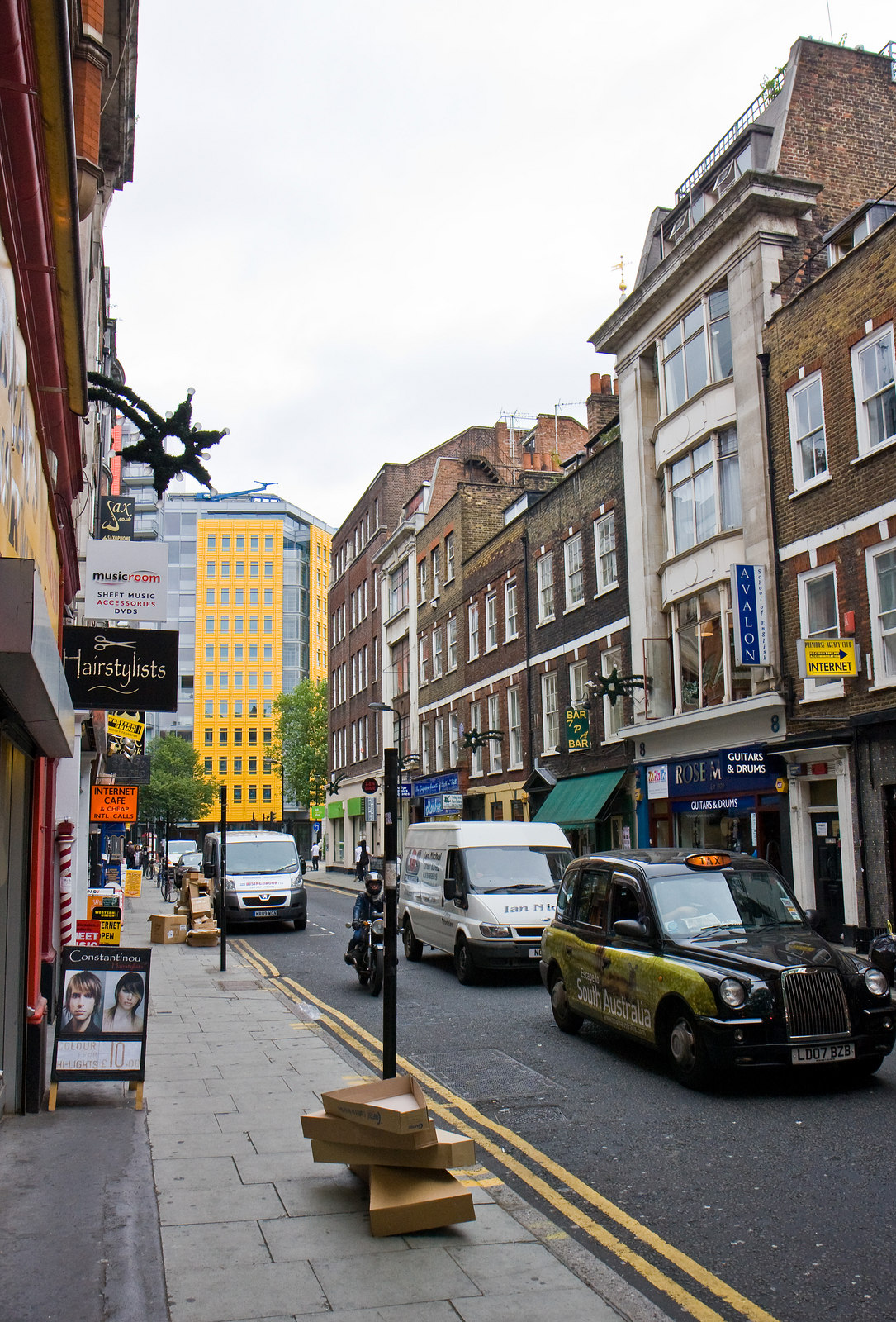
English: ;Denmark Street
This short road connecting St. Giles High Street with Charing Cross Road lies at the heart of London's music centre. Many of the shops sell instruments and sheet music. The cardboard boxes in the foreground provide evidence of a recent delivery of guitars. The bright yellow building at the end of the street is part of the Central St. Giles development. |
||
| Datums | |||
| Avots |
Šis fails tiek izplatīts saskaņā ar licences Creative Commons Atsauce-Līdzīgi Noteikumi 2.0 Vispārējiem noteikumiem. Atsauce: Martin Addison
|
||
| Autors | Geograph: Martin Addison | ||
| Citas versijas |
|
||
| Atsauce (required by the license) InfoField | Martin Addison / Denmark Street / | ||
InfoField | Martin Addison / Denmark Street |


| Camera location | 51° 30′ 56,16″ N, 0° 07′ 44″ W | View this and other nearby images on: OpenStreetMap |
|---|
Licence
Šis fails tiek izplatīts saskaņā ar licences Creative Commons Atsauce-Līdzīgi Noteikumi 2.0 Vispārējiem noteikumiem.
- Jūs varat brīvi:
- koplietot – kopēt, izplatīt un pārraidīt darbu
- remiksēt – pielāgot darbu
- Saskaņā ar šādiem nosacījumiem:
- atsaucoties – Tev ir jānorāda autors, saite uz licenci un to, vai veiktas kādas izmaiņas. To var darīt jebkādā saprātīgā veidā, bet ne tādā, kas norādītu, ka licencētājs atbalsta tevi vai veidu, kā tu izmanto šo darbu.
- nemainot licenci – Ja tu miksē, pārveido vai izmanto materiālu, tev savs devums jāpublicē ar to pašu vai saderīgu licenci kā oriģināls.
Captions
Pievieno vienas rindiņas aprakstu, ko šis fails attēlo
Šajā failā attēlotais
attēlo
7 jūlijs 2010
51°30'56.16"N, 0°7'44.00"W
Faila hronoloģija
Uzklikšķini uz datums/laiks kolonnā esošās saites, lai apskatītos, kā šis fails izskatījās tad.
| Datums/Laiks | Attēls | Izmēri | Dalībnieks | Komentārs | |
|---|---|---|---|---|---|
| tagadējais | 2017. gada 10. septembris, plkst. 14.53 | | 1 085 × 1 600 (562 KB) | Geograph Update Bot | Higher-resolution version from Geograph. |
| 2013. gada 26. jūlijs, plkst. 05.06 |  | 434 × 640 (106 KB) | Clusternote | User created page with UploadWizard |
Faila lietojums
Šo failu izmanto šajā 1 lapā:
Globālais faila lietojums
Šīs Vikipēdijas izmanto šo failu:
- Izmantojums ca.wikipedia.org
- Izmantojums en.wikipedia.org
- Izmantojums fa.wikipedia.org
- Izmantojums fi.wikipedia.org
- Izmantojums fr.wikipedia.org
- Izmantojums it.wikipedia.org
- Izmantojums no.wikipedia.org
- Izmantojums www.wikidata.org
- Izmantojums zh.wikipedia.org