Plaetje:Map_of_USA_highlighting_Georgia.png
From Wikipedia, the free encyclopedia
Gein hoeger resolutie besjikbaar.
Map_of_USA_highlighting_Georgia.png ((280 × 183 pixel, besjtandsgruutde: 35 kB, MIME type: image/png))
Dit besjtandj kump van Wikimedia Commons en kin ouch in anger projekte gebroek waere. De pagina mit de besjtandjsbesjrieving wurt hiejónger weergegaeve.

|
Bestand:Map of USA GA.svg is een vectorversie van dit bestand. Indien niet van slechtere kwaliteit dient deze gebruikt te worden in plaats van deze rasterafbeelding.
File:Map of USA highlighting Georgia.png → File:Map of USA GA.svg
Zie Help:SVG voor meer informatie.
|
 |
Besjrieving
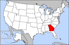
Public domain map courtesy of The General Libraries, The University of Texas at Austin, modified to highlight state boundaries.
Source: Modified version of United States (Outline Map) 1998 from Perry-Castañeda Library Map Collection: United States Maps
| This image is a copy or a derivative work of usa_blank.jpg, from the map collection of the Perry–Castañeda Library (PCL) of the University of Texas at Austin.
This tag does not indicate the copyright status of the attached work. A normal copyright tag is still required. See Commons:Licensing for more information. |
Licentie:

|
Toesteumming wert verleend veur t kopiëre, verspreide en/of wiezige van dit document onger de veurwaerd van de GNU-licentie veur vrieje documentatie, versie 1.2 of einige latere versie es gepubliceerd door de Free Software Foundation; zonger Invariant Sections, zonger Front-Cover Texts, en zonger Back-Cover Texts. n kopie van de licentie is opgenomme in de sectie GNU-licentie veur vrieje documentatie.http://www.gnu.org/copyleft/fdl.htmlGFDLGNU Free Documentation Licensetruetrue |
| Dit bestandj steit gelicenseerdj óngere Creative Commons Attribution-Share Alike 3.0 Unported lisensje. | ||
| ||
| Dees licentie-tag woort tougevoeg aon dit bestand in verband mèt de GFDL licentie-update.http://creativecommons.org/licenses/by-sa/3.0/CC BY-SA 3.0Creative Commons Attribution-Share Alike 3.0truetrue |
From en.wikipedia
Bijschriften
Beschrijf in één regel wat dit bestand voorstelt
Items getoond in dit bestand
beeldt af Nederlands
auteursrechtenstatus Nederlands
auteursrechtelijk beschermd Nederlands
Besjtandshistorie
Klik op 'ne datum/tied óm 't besjtand te zeen wie 't oetzaog op det tiedsjtip.
| Datum/Tied | Miniatuurplaetje | Aafmaetinge | Gebroeker | Kómmentaar | |
|---|---|---|---|---|---|
| hujig | 4 apr 2005 18:32 | | 280 × 183 (35 kB) | David.gaya | From English wikipedia: Public domain map courtesy of [http://www.lib.utexas.edu/ The General Libraries, The University of Texas at Austin], modified to highlight state boundaries. {{GFDL}} Category:State locator maps of the United States [[Category: |
Plaetjesverwiezinge
Dit plaetje weurt op de volgende pazjena's gebroek:
Globaal besjtandjsgebroek
De volgende anger wiki's gebroeke dit bestandj:
- Gebroek in ar.wikipedia.org
- Gebroek in az.wiktionary.org
- Gebroek in bat-smg.wikipedia.org
- Gebroek in chr.wikipedia.org
- Gebroek in en.wikipedia.org
- Gebroek in en.wiktionary.org
- Gebroek in eo.wikipedia.org
- Gebroek in es.wikipedia.org
- Gebroek in fi.wikivoyage.org
- Gebroek in frp.wikipedia.org
- Gebroek in fr.wikinews.org
- Gebroek in hr.wiktionary.org
- Gebroek in it.wiktionary.org
- Gebroek in kw.wikipedia.org
- Gebroek in no.wikipedia.org
- Gebroek in pam.wikipedia.org
- Gebroek in pap.wikipedia.org
- Gebroek in pnb.wikipedia.org
- Gebroek in rm.wikipedia.org
- Gebroek in ro.wikipedia.org
- Gebroek in ru.wiktionary.org
- Gebroek in sd.wiktionary.org
- Gebroek in szl.wikipedia.org
- Gebroek in ug.wikipedia.org
- Gebroek in ur.wikipedia.org
- Gebroek in uz.wikipedia.org
- Gebroek in zh-min-nan.wikipedia.org
- Gebroek in zh.wiktionary.org
Aafkomstig van Wikipedia, de Vriej Encyclopedie. "https://li.wikipedia.org/wiki/Plaetje:Map_of_USA_highlighting_Georgia.png"