Fasciculus:Map_of_the_Southern_United_States_modern_definition.png
From Wikipedia, the free encyclopedia
Nulla maior resolutio exstat.
Map_of_the_Southern_United_States_modern_definition.png (566 × 365 elementa imaginalia, magnitudo fasciculi: 6 chiliocteti, typus MIME: image/png)
Hic fasciculus apud Vicimedia Communia iacet; in aliis inceptis adhiberi potest. Contenta paginae descriptionis fasciculi subter monstrantur.

|
File:Dixie states map.svg is a vector version of this file. It should be used in place of this PNG file when not inferior.
File:Map of the Southern United States modern definition.png → File:Dixie states map.svg
For more information, see Help:SVG.
|
 |
Summarium
| DescriptioMap of the Southern United States modern definition.png |
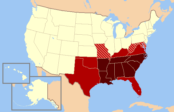
English: A map of the modern definition of the Southern United States, Oklahoma red.
|
| Datum | (UTC) |
| Fons |
|
| Auctor |
| This is a retouched picture, which means that it has been digitally altered from its original version. Modifications: Due to consensus of Oklahoma as usually included in the south, the color has been changed.. The original can be viewed here: US map-South Modern.png:
|
I, the copyright holder of this work, hereby publish it under the following license:

|
Licet hoc documentum exscribere vel distribuere vel demutare sub GNU Liberarum Litterarum Licentiae conditionibus in editione 1.2 aut in ulla editione recentiori a Fundatione Liberarum Programmationis Partium publicata; praeterquam Sectiones Immutabiles et Verba Involucra Adversa et Aversa. Licentiae exemplar praesto est in sectione intitulata GNU Free Documentation License.http://www.gnu.org/copyleft/fdl.htmlGFDLGNU Free Documentation Licensetruetrue |
| This file is licensed under the Creative Commons Attribution-Share Alike 3.0 Unported license. | ||
| ||
| This licensing tag was added to this file as part of the GFDL licensing update.http://creativecommons.org/licenses/by-sa/3.0/CC BY-SA 3.0Creative Commons Attribution-Share Alike 3.0truetrue |
Original upload log
This image is a derivative work of the following images:
- File:US map-South Modern.png licensed with GFDL
- 2007-07-15T15:01:30Z Lecter 572x371 (13768 Bytes) {{Information |Description= Based on GNU [[Image:US map-South.PNG]] |Source= [http://en.wikipedia.org/wiki/Image:US map-South Modern.png] |Date= |Author= [http://en.wikipedia.org/wiki/User:AstroAstrokey44 User:Astrokey44] |Permiss
Uploaded with derivativeFX
Captions
Add a one-line explanation of what this file represents
Items portrayed in this file
depicts Anglica
copyright status Anglica
copyrighted Anglica
1 Martii 2009
Historia fasciculi
Presso die vel tempore fasciculum videbis, sicut tunc temporis apparuit.
| Dies/Tempus | Minutio | Dimensiones | Usor | Sententia | |
|---|---|---|---|---|---|
| recentissima | 22:24, 13 Iunii 2010 | | 566 × 365 (6 chiliocteti) | Ras67 | cropped |
| 02:46, 1 Martii 2009 |  | 572 × 371 (13 chiliocteti) | Clark3934 | {{Information |Description=A map of the modern definition of the Southern United States. |Source=*File:US_map-South_Modern.png |Date=2009-03-01 02:44 (UTC) |Author=*File:US_map-South_Modern.png: [http://en.wikipedia.org/wiki/User:Astrokey44 Us |
Nexus ad fasciculum
Ad hunc fasciculum nectit:
Usus fasciculi per inceptus Vicimediorum
Quae incepta Vici fasciculo utuntur:
- Usus in be.wikipedia.org
- Usus in br.wikipedia.org
- Usus in ca.wikipedia.org
- Usus in de.wiktionary.org
- Usus in en.wikipedia.org
- Usus in en.wikivoyage.org
- Usus in fa.wikipedia.org
- Usus in fr.wikipedia.org
- Usus in hr.wikipedia.org
- Usus in id.wikipedia.org
- Usus in ja.wikipedia.org
- Usus in ka.wikipedia.org
- Usus in ms.wikipedia.org
- Usus in nn.wikipedia.org
- Usus in no.wikipedia.org
- Usus in pt.wikipedia.org
- Usus in sh.wikipedia.org
- Usus in sr.wikipedia.org
- Usus in vi.wikipedia.org