Archivo:British_Isles.svg
De Wikipedia, la enciclopedia encyclopedia

Tamaño de esta previsualización PNG del archivo SVG: 361 × 600 píxeles. Otras resoluciones: 144 × 240 píxeles · 289 × 480 píxeles · 462 × 768 píxeles · 616 × 1024 píxeles · 1232 × 2048 píxeles · 1300 × 2160 píxeles.
Ver la imagen en su resolución original ((Imagen SVG, nominalmente 1300 × 2160 pixels, tamaño de archivo: 154 kB))
|
|
Este es un archivo de Wikimedia Commons, un depósito de contenido libre hospedado por la Fundación Wikimedia. Más abajo se reproduce su página de descripción con la información sobre su origen y licencia. |
Resumen
| DescripciónBritish Isles.svg |
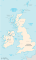
An SVG map of the British Isles, with the largest islands and archipelagos labelled. |
||
| Fuente | Trabajo propio | ||
| Autor | Smurrayinchester | ||
| SVG desarrollo InfoField | Este mapa, inválido según el W3C, fue creado con una desconocida SVG herramienta This map is translated using SVG switch elements: all translations are stored in the same file.
|
}
Licencia
Yo, el titular de los derechos de autor de esta obra, la publico en los términos de la siguiente licencia:

|
Se autoriza la copia, distribución y modificación de este documento bajo los términos de la licencia de documentación libre GNU, versión 1.2 o cualquier otra que posteriormente publique la Fundación para el Software Libre; sin secciones invariables, textos de portada, ni textos de contraportada. Se incluye una copia de la dicha licencia en la sección titulada Licencia de Documentación Libre GNU.http://www.gnu.org/copyleft/fdl.htmlGFDLGNU Free Documentation Licensetruetrue |
| Este archivo se encuentra bajo la licencia Creative Commons Genérica de Atribución/Compartir-Igual 3.0. | ||
| ||
| Esta etiqueta de licencia fue agregada a este archivo como parte de la actualización de la licencia GFDL.http://creativecommons.org/licenses/by-sa/3.0/CC BY-SA 3.0Creative Commons Attribution-Share Alike 3.0truetrue |
Derivative works
-
 македонски
 -
 Flag map (1801–1922)


derivative works
Obras derivadas de ésta: British Isles mk.svg
Leyendas
Añade una explicación corta acerca de lo que representa este archivo
Elementos representados en este archivo
representa a
Algún valor sin elemento de Wikidata
image/svg+xml
e064d2a4d0614c9fef65714d82c69e5f314e2a45
157 654 byte
2160 píxel
1300 píxel
Historial del archivo
Haz clic sobre una fecha y hora para ver el archivo tal como apareció en ese momento.
| Fecha y hora | Miniatura | Dimensiones | Usuario | Comentario | |
|---|---|---|---|---|---|
| actual | 15:33 10 feb 2019 | | 1300 × 2160 (154 kB) | MSG17 | Uploaded from SVG Translate. |
| 14:56 13 oct 2018 |  | 1300 × 2160 (141 kB) | Seb35 | small bug: translations have to be before the default text else the PNG rendering selects the default text | |
| 14:51 13 oct 2018 |  | 1300 × 2160 (141 kB) | Seb35 | added French translation | |
| 14:50 20 may 2014 |  | 1300 × 2160 (135 kB) | NikNaks | More cleaning. File could still be a lot smaller than it currently is | |
| 03:02 20 may 2014 |  | 1300 × 2160 (152 kB) | NikNaks | Malay translation | |
| 02:36 20 may 2014 |  | 1300 × 2160 (148 kB) | NikNaks | Cleaning unfortunately lost detail. Will have to return to later | |
| 02:22 20 may 2014 |  | 1297 × 2160 (37 kB) | NikNaks | Attempting to clean up the file before translation | |
| 12:37 20 ago 2006 |  | 1297 × 2160 (196 kB) | Smurrayinchester | An SVG map of the British Isles, with the largest islands and archipelagos labeled. {{legend|#fff0de|Always considered part of the British Isles|border=#ffffff}} {{legend|#ffb380|Sometimes considered part of the British Isles|border=#ffffff}} {{legend|#e |
Usos del archivo
Las siguientes páginas usan este archivo:
Uso global del archivo
Las wikis siguientes utilizan este archivo:
- Uso en ar.wikipedia.org
- Uso en az.wikipedia.org
- Uso en be.wikipedia.org
- Uso en bs.wikipedia.org
- Uso en ceb.wikipedia.org
- Uso en ckb.wikipedia.org
- Uso en da.wikipedia.org
- Uso en en.wikipedia.org
- Geography of the Isle of Man
- Burhou
- Talk:International Football Association Board
- Module:Location map/data/British Isles/doc
- List of offshore wind farms in the Irish Sea
- Siege of St Andrews Castle
- User:Malpass93/sandbox
- Module:Location map/data/British Isles
- 2014 Senior Open Championship
- 2017 Senior Open Championship
- 2018 Eisenhower Trophy
- User:Grover cleveland/History of the laws of the game/List of IFAB meetings
- User:Grover cleveland/English managers
- 2018 Espirito Santo Trophy
- 1965 European Amateur Team Championship
- 1975 European Amateur Team Championship
- 1981 European Amateur Team Championship
- 1989 European Amateur Team Championship
- 1997 European Amateur Team Championship
- 2005 European Amateur Team Championship
- 2007 European Amateur Team Championship
- 2009 European Amateur Team Championship
- 1971 European Ladies' Team Championship
- 1979 European Ladies' Team Championship
- 1987 European Ladies' Team Championship
- 1991 European Ladies' Team Championship
- 2013 European Ladies' Team Championship
- 2021 European Ladies' Team Championship
- 2022 European Amateur Team Championship
- 2022 European Ladies' Team Championship
- 2013 Senior Open Championship
- 2012 Senior Open Championship
- 2011 Senior Open Championship
- 2008 Senior Open Championship
- 2006 Senior Open Championship
- 2002 Senior British Open
- 2001 Senior British Open
- 2000 Senior British Open
- 2022 Senior Open Championship
- User:Erik Sergeant/sandbox 2
- 2023 Senior Open Championship
- Module:Location map/data/British Isles/sandbox
- Draft:2024 Monoposto Championship
Ver más uso global de este archivo.
Metadatos
Este archivo contiene información adicional, probablemente añadida por la cámara digital o el escáner usado para crearlo o digitalizarlo.
Si el archivo ha sido modificado desde su estado original, pueden haberse perdido algunos detalles.
| Anchura | 1300 |
|---|---|
| Altura | 2160 |
Obtenido de «https://es.wikipedia.org/wiki/Archivo:British_Isles.svg»