File:Yakima_Indian_Reservation_map.png
From Wikipedia, the free encyclopedia
Size of this preview: 800 × 559 pixels. Other resolutions: 320 × 224 pixels | 640 × 447 pixels | 1,024 × 715 pixels | 1,280 × 894 pixels | 1,486 × 1,038 pixels.
Original file (1,486 × 1,038 pixels, file size: 335 KB, MIME type: image/png)
| This is a file from the Wikimedia Commons. Information from its description page there is shown below. Commons is a freely licensed media file repository. You can help. |

|
This map image could be re-created using vector graphics as an SVG file. This has several advantages; see Commons:Media for cleanup for more information. If an SVG form of this image is available, please upload it and afterwards replace this template with
{{vector version available|new image name}}.
It is recommended to name the SVG file “Yakima Indian Reservation map.svg”—then the template Vector version available (or Vva) does not need the new image name parameter. |
Summary
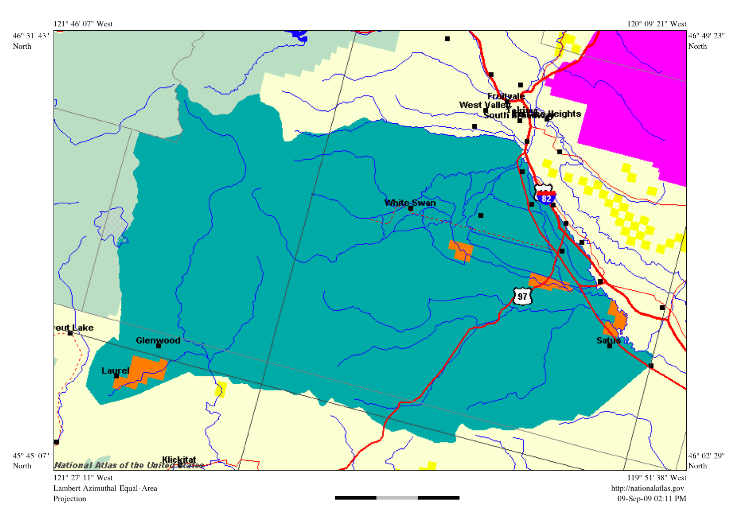
| DescriptionYakima Indian Reservation map.png |
English: Yakima Indian Reservation in Washington, USA |
| Date | |
| Source | National Atlas web site |
| Author | Pete Forsyth |
Licensing
| This file is made available under the Creative Commons CC0 1.0 Universal Public Domain Dedication. | |
| The person who associated a work with this deed has dedicated the work to the public domain by waiving all of their rights to the work worldwide under copyright law, including all related and neighboring rights, to the extent allowed by law. You can copy, modify, distribute and perform the work, even for commercial purposes, all without asking permission.
http://creativecommons.org/publicdomain/zero/1.0/deed.enCC0Creative Commons Zero, Public Domain Dedicationfalsefalse |
Captions
Add a one-line explanation of what this file represents
Items portrayed in this file
depicts
some value
9 September 2009
image/png
File history
Click on a date/time to view the file as it appeared at that time.
| Date/Time | Thumbnail | Dimensions | User | Comment | |
|---|---|---|---|---|---|
| current | 16:11, 17 May 2023 | | 1,486 × 1,038 (335 KB) | Smasongarrison | Cropped 6 % horizontally, 15 % vertically using CropTool with lossless mode. |
| 18:14, 9 September 2009 |  | 1,584 × 1,224 (393 KB) | Peteforsyth | {{Information |Description={{en|1=Yakima Indian Reservation in Washington, USA}} |Source=National Atlas web site |Author=Pete Forsyth |Date=September 9, 2009 |Permission= |other_versions= }} |
File usage
The following pages on the English Wikipedia use this file (pages on other projects are not listed):
Global file usage
The following other wikis use this file:
- Usage on ca.wikipedia.org
- Usage on es.wikipedia.org
- Usage on fr.wikipedia.org
- Usage on fy.wikipedia.org
- Usage on hu.wikipedia.org
- Usage on it.wikipedia.org
- Usage on ja.wikipedia.org
- Usage on ru.wikipedia.org
Metadata
This file contains additional information, probably added from the digital camera or scanner used to create or digitize it.
If the file has been modified from its original state, some details may not fully reflect the modified file.
| Horizontal resolution | 59.06 dpc |
|---|---|
| Vertical resolution | 59.06 dpc |
| File change date and time | 16:10, 17 May 2023 |
Retrieved from "https://en.wikipedia.org/wiki/File:Yakima_Indian_Reservation_map.png"