File:Via_domitia_map600x600_(1).png
From Wikipedia, the free encyclopedia
No higher resolution available.
Via_domitia_map600x600_(1).png (600 × 600 pixels, file size: 58 KB, MIME type: image/png)
| This is a file from the Wikimedia Commons. Information from its description page there is shown below. Commons is a freely licensed media file repository. You can help. |
Summary
| DescriptionVia domitia map600x600 (1).png |
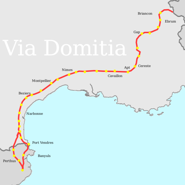
English: Thomas Miles, made on the gimp, consulting several maps, using wikipedia's blank France Map as template |
| Date | 17 May 2007 (original upload date) |
| Source | Transferred from en.wikipedia to Commons. |
| Author | T L Miles at English Wikipedia |
Licensing
| Public domainPublic domainfalsefalse |
| This work has been released into the public domain by its author, T L Miles at English Wikipedia. This applies worldwide. In some countries this may not be legally possible; if so: T L Miles grants anyone the right to use this work for any purpose, without any conditions, unless such conditions are required by law.Public domainPublic domainfalsefalse |
Original upload log
The original description page was here. All following user names refer to en.wikipedia.
- 2007-05-17 19:01 T L Miles 600×600×8 (58888 bytes) Thomas Miles, made on the gimp, consulting several maps, using wikipedia's blank France Map as template
Captions
Add a one-line explanation of what this file represents
Items portrayed in this file
depicts
17 May 2007
File history
Click on a date/time to view the file as it appeared at that time.
| Date/Time | Thumbnail | Dimensions | User | Comment | |
|---|---|---|---|---|---|
| current | 19:50, 7 April 2008 | | 600 × 600 (58 KB) | File Upload Bot (Magnus Manske) | {{BotMoveToCommons|en.wikipedia}} {{Information |Description={{en|Thomas Miles, made on the gimp, consulting several maps, using wikipedia's blank France Map as template}} |Source=Transferred from [http://en.wikipedia.org en.wikipedia] |Date=2007-05-17 ( |
File usage
The following pages on the English Wikipedia use this file (pages on other projects are not listed):
Global file usage
The following other wikis use this file:
- Usage on bg.wikipedia.org
- Usage on ca.wikipedia.org
- Usage on cs.wikipedia.org
- Usage on da.wikipedia.org
- Usage on de.wikipedia.org
- Usage on el.wikipedia.org
- Usage on es.wikipedia.org
- Usage on eu.wikipedia.org
- Usage on fi.wikipedia.org
- Usage on fr.wikipedia.org
- Voie Domitienne
- Durance
- Histoire du département de Vaucluse
- Histoire de l'Occitanie
- Histoire de Marseillan (Hérault)
- Forcalquier
- Apta Julia
- Wikipédia:Atelier graphique/Cartes/Archives/juillet 2011
- Histoire de Forcalquier
- Voie héracléenne
- Ebrodunensium
- Discussion:Liste des monuments historiques protégés en 1840/Wikidata
- Usage on it.wikipedia.org
- Usage on ja.wikipedia.org
- Usage on ja.wikibooks.org
- Usage on ko.wikipedia.org
- Usage on mk.wikipedia.org
- Usage on nl.wikipedia.org
- Usage on no.wikipedia.org
- Usage on ro.wikipedia.org
- Usage on ru.wikipedia.org
- Usage on sl.wikipedia.org
- Usage on uk.wikipedia.org
- Usage on www.wikidata.org
- Usage on zh.wikipedia.org
Retrieved from "https://en.wikipedia.org/wiki/File:Via_domitia_map600x600_(1).png"
.png)