File:USA_Territorial_Growth_1775.jpg
From Wikipedia, the free encyclopedia
Size of this preview: 800 × 550 pixels. Other resolutions: 320 × 220 pixels | 640 × 440 pixels | 914 × 628 pixels.
Original file (914 × 628 pixels, file size: 82 KB, MIME type: image/jpeg)
| This is a file from the Wikimedia Commons. Information from its description page there is shown below. Commons is a freely licensed media file repository. You can help. |
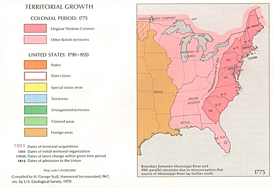
| DescriptionUSA Territorial Growth 1775.jpg | 1970 USGS map of US territorial growth as of 1775 | ||||
| Date | |||||
| Source | Esemono | ||||
| Author | USGS | ||||
| Permission (Reusing this file) |
|
| US growth maps |
| Animated: large · small |
| Years |
| 1775 · 1790 · 1800 · 1810 · 1820 · 1830 · 1840 · 1850 · 1860 · 1870 · 1880 · 1900 · 1920 |
Captions
Add a one-line explanation of what this file represents
Items portrayed in this file
depicts
January 2010
File history
Click on a date/time to view the file as it appeared at that time.
| Date/Time | Thumbnail | Dimensions | User | Comment | |
|---|---|---|---|---|---|
| current | 00:50, 19 January 2005 | | 914 × 628 (82 KB) | Exdaix | 1970 USGS map {{PD-USGov-USGS}} |
File usage
The following pages on the English Wikipedia use this file (pages on other projects are not listed):
Global file usage
The following other wikis use this file:
- Usage on it.wikipedia.org
- Usage on ja.wikipedia.org
- Usage on ro.wikipedia.org
- Usage on ru.wikipedia.org
Metadata
This file contains additional information, probably added from the digital camera or scanner used to create or digitize it.
If the file has been modified from its original state, some details may not fully reflect the modified file.
| _error | 0 |
|---|
Retrieved from "https://en.wikipedia.org/wiki/File:USA_Territorial_Growth_1775.jpg"