File:Tendaguru_location_map.jpg
From Wikipedia, the free encyclopedia
Size of this preview: 410 × 600 pixels. Other resolutions: 164 × 240 pixels | 569 × 832 pixels.
Original file (569 × 832 pixels, file size: 166 KB, MIME type: image/jpeg)
| This is a file from the Wikimedia Commons. Information from its description page there is shown below. Commons is a freely licensed media file repository. You can help. |
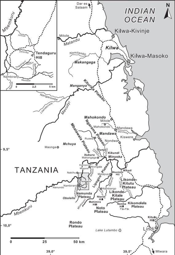
Summary
| DescriptionTendaguru location map.jpg |
English: Tendaguru location map |
| Date | |
| Source | Bussert, Robert (2009). "The Tendaguru Formation (Late Jurassic to Early Cretaceous, southern Tanzania): definition, palaeoenvironments, and sequence stratigraphy". Fossil Record 12 (2): 141–174. Retrieved on 2019-04-01.ISSN 1435-1943 |
| Author | Bussert et al., 2009 |
Licensing
This file is licensed under the Creative Commons Attribution-Share Alike 4.0 International license.
- You are free:
- to share – to copy, distribute and transmit the work
- to remix – to adapt the work
- Under the following conditions:
- attribution – You must give appropriate credit, provide a link to the license, and indicate if changes were made. You may do so in any reasonable manner, but not in any way that suggests the licensor endorses you or your use.
- share alike – If you remix, transform, or build upon the material, you must distribute your contributions under the same or compatible license as the original.
Captions
Tendaguru location map
Items portrayed in this file
depicts
3 August 2009
File history
Click on a date/time to view the file as it appeared at that time.
| Date/Time | Thumbnail | Dimensions | User | Comment | |
|---|---|---|---|---|---|
| current | 19:51, 2 April 2019 | | 569 × 832 (166 KB) | Tisquesusa | User created page with UploadWizard |
File usage
The following pages on the English Wikipedia use this file (pages on other projects are not listed):
Retrieved from "https://en.wikipedia.org/wiki/File:Tendaguru_location_map.jpg"