File:Tajikistan_OVER.jpg
From Wikipedia, the free encyclopedia
Size of this preview: 800 × 553 pixels. Other resolutions: 320 × 221 pixels | 640 × 443 pixels | 1,024 × 708 pixels | 1,280 × 885 pixels | 1,768 × 1,223 pixels.
Original file (1,768 × 1,223 pixels, file size: 490 KB, MIME type: image/jpeg)
| This is a file from the Wikimedia Commons. Information from its description page there is shown below. Commons is a freely licensed media file repository. You can help. |
Summary
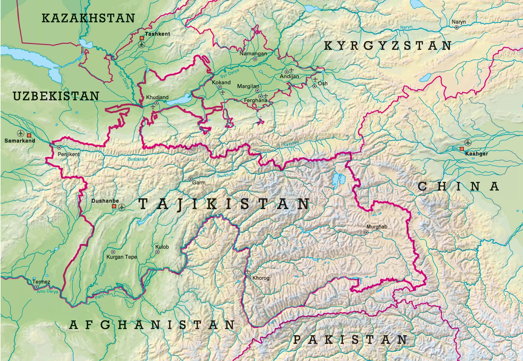
| DescriptionTajikistan OVER.jpg |
English: Overview Map of Tajikistan |
| Date | |
| Source | Topographic data from the NASA Shuttle Radar Topography Mission (SRTM3 v.2) (public domain) edited with 3DEM |
| Author | Hausibek |
| Permission (Reusing this file) |
Own work |
Licensing
I, the copyright holder of this work, hereby publish it under the following licenses:
This file is licensed under the Creative Commons Attribution-Share Alike 3.0 Unported license.
- You are free:
- to share – to copy, distribute and transmit the work
- to remix – to adapt the work
- Under the following conditions:
- attribution – You must give appropriate credit, provide a link to the license, and indicate if changes were made. You may do so in any reasonable manner, but not in any way that suggests the licensor endorses you or your use.
- share alike – If you remix, transform, or build upon the material, you must distribute your contributions under the same or compatible license as the original.

|
Permission is granted to copy, distribute and/or modify this document under the terms of the GNU Free Documentation License, Version 1.2 or any later version published by the Free Software Foundation; with no Invariant Sections, no Front-Cover Texts, and no Back-Cover Texts. A copy of the license is included in the section entitled GNU Free Documentation License.http://www.gnu.org/copyleft/fdl.htmlGFDLGNU Free Documentation Licensetruetrue |
You may select the license of your choice.

|
The categories of this image need checking. You can do so here.
|
Related galleries
Captions
Add a one-line explanation of what this file represents
Items portrayed in this file
depicts
2007
File history
Click on a date/time to view the file as it appeared at that time.
| Date/Time | Thumbnail | Dimensions | User | Comment | |
|---|---|---|---|---|---|
| current | 13:26, 4 September 2022 | | 1,768 × 1,223 (490 KB) | Moodylo333 | Cosmetic changes, since local maps available |
| 14:39, 2 October 2008 |  | 1,768 × 1,223 (493 KB) | Hausibek | {{Information |Description={{en|1=Overview Map of Tajikistan}} |Source=Own work by uploader |Author=Hausibek |Date=2007 |Permission= |other_versions= }} <!--{{ImageUpload|full}}--> |
File usage
The following pages on the English Wikipedia use this file (pages on other projects are not listed):
Global file usage
The following other wikis use this file:
- Usage on ar.wikipedia.org
- Usage on azb.wikipedia.org
- Usage on bn.wikipedia.org
- Usage on ca.wikipedia.org
- Usage on ckb.wikipedia.org
- Usage on es.wikipedia.org
- Usage on fa.wikipedia.org
- Usage on fr.wikipedia.org
- Usage on hr.wikipedia.org
- Usage on hu.wikipedia.org
- Usage on id.wikipedia.org
- Usage on incubator.wikimedia.org
- Usage on it.wikipedia.org
- Usage on ja.wikipedia.org
- Usage on pa.wikipedia.org
- Usage on pl.wikipedia.org
- Usage on sd.wikipedia.org
- Usage on sh.wikipedia.org
- Usage on sr.wikipedia.org
- Usage on sv.wikipedia.org
- Usage on tr.wiktionary.org
Metadata
This file contains additional information, probably added from the digital camera or scanner used to create or digitize it.
If the file has been modified from its original state, some details may not fully reflect the modified file.
| Orientation | Normal |
|---|---|
| Horizontal resolution | 144 dpi |
| Vertical resolution | 144 dpi |
| Software used | Adobe Photoshop CS3 Macintosh |
| File change date and time | 15:21, 4 September 2022 |
| Color space | sRGB |
| Image width | 1,768 px |
| Image height | 1,223 px |
| Date and time of digitizing | 15:45, 20 February 2007 |
| Date metadata was last modified | 17:21, 4 September 2022 |
Retrieved from "https://en.wikipedia.org/wiki/File:Tajikistan_OVER.jpg"