File:Standing_stones_-_geograph.org.uk_-_42227.jpg
From Wikipedia, the free encyclopedia
Size of this preview: 555 × 600 pixels. Other resolutions: 222 × 240 pixels | 592 × 640 pixels.
Original file (592 × 640 pixels, file size: 136 KB, MIME type: image/jpeg)
| This is a file from the Wikimedia Commons. Information from its description page there is shown below. Commons is a freely licensed media file repository. You can help. |
Summary
| DescriptionStanding stones - geograph.org.uk - 42227.jpg |
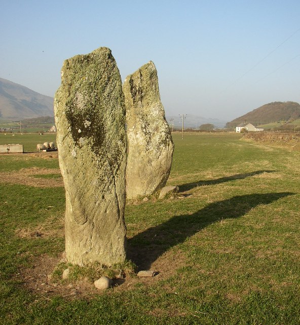
English: Standing stones. These prehistoric stones can be found by walking a field path SW from the level crossing on the main road. |
| Date | |
| Source | From geograph.org.uk |
| Author | Humphrey Bolton |
| Attribution (required by the license) InfoField | Humphrey Bolton / Standing stones / |
InfoField | Humphrey Bolton / Standing stones |
| Camera location | 54° 13′ 04″ N, 3° 19′ 37″ W | View this and other nearby images on: OpenStreetMap |
|---|
| Object location | 54° 13′ 04″ N, 3° 19′ 37″ W | View this and other nearby images on: OpenStreetMap |
|---|
Licensing

|
This image was taken from the Geograph project collection. See this photograph's page on the Geograph website for the photographer's contact details. The copyright on this image is owned by Humphrey Bolton and is licensed for reuse under the Creative Commons Attribution-ShareAlike 2.0 license.
|
This file is licensed under the Creative Commons Attribution-Share Alike 2.0 Generic license.
Attribution: Humphrey Bolton
- You are free:
- to share – to copy, distribute and transmit the work
- to remix – to adapt the work
- Under the following conditions:
- attribution – You must give appropriate credit, provide a link to the license, and indicate if changes were made. You may do so in any reasonable manner, but not in any way that suggests the licensor endorses you or your use.
- share alike – If you remix, transform, or build upon the material, you must distribute your contributions under the same or compatible license as the original.
Captions
Add a one-line explanation of what this file represents
Items portrayed in this file
depicts
some value
54°13'4.4"N, 3°19'37.2"W
2003
54°13'4.4"N, 3°19'37.2"W
0.00125 second
2.9
6 millimetre
File history
Click on a date/time to view the file as it appeared at that time.
| Date/Time | Thumbnail | Dimensions | User | Comment | |
|---|---|---|---|---|---|
| current | 18:53, 30 January 2010 | | 592 × 640 (136 KB) | GeographBot | == {{int:filedesc}} == {{Information |description={{en|1=Standing stones. These prehistoric stones can be found by walking a field path SW from the level crossing on the main road.}} |date=2003 |source=From [http://www.geograph.org.uk/photo/42227 geograph |
File usage
The following pages on the English Wikipedia use this file (pages on other projects are not listed):
Global file usage
The following other wikis use this file:
- Usage on fr.wikipedia.org
- Usage on www.wikidata.org
Metadata
This file contains additional information, probably added from the digital camera or scanner used to create or digitize it.
If the file has been modified from its original state, some details may not fully reflect the modified file.
| Image title | OLYMPUS DIGITAL CAMERA |
|---|---|
| Camera manufacturer | OLYMPUS OPTICAL CO.,LTD |
| Camera model | C300Z,D550Z |
| Exposure time | 1/800 sec (0.00125) |
| F-number | f/2.9 |
| ISO speed rating | 60 |
| Date and time of data generation | Unknown date |
| Lens focal length | 6 mm |
| Orientation | Normal |
| Horizontal resolution | 72 dpi |
| Vertical resolution | 72 dpi |
| Software used | v574p-76 |
| File change date and time | Unknown date |
| Y and C positioning | Co-sited |
| Exposure Program | Normal program |
| Exif version | 2.1 |
| Date and time of digitizing | Unknown date |
| Image compression mode | 1 |
| Exposure bias | 0 |
| Maximum land aperture | 3.1 APEX (f/2.93) |
| Metering mode | Pattern |
| Light source | Unknown |
| Flash | Flash did not fire |
| Color space | sRGB |