File:SpainTajoBasin.png
From Wikipedia, the free encyclopedia
Size of this preview: 800 × 571 pixels. Other resolutions: 320 × 228 pixels | 640 × 457 pixels | 1,024 × 731 pixels | 1,280 × 914 pixels | 1,752 × 1,251 pixels.
Original file (1,752 × 1,251 pixels, file size: 2.29 MB, MIME type: image/png)
| This is a file from the Wikimedia Commons. Information from its description page there is shown below. Commons is a freely licensed media file repository. You can help. |
Summary
| DescriptionSpainTajoBasin.png |
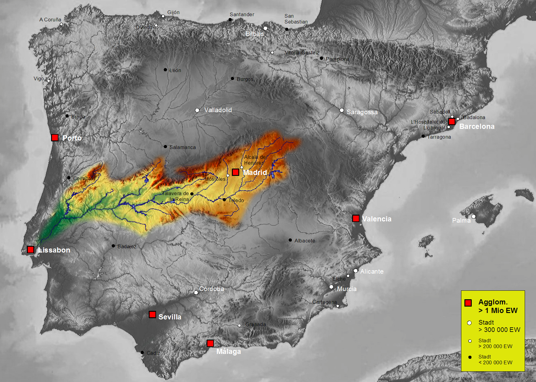
English: Map of Tajo river basin in Spain
Deutsch: Karte des hydrogeografischen Beckens des Tajo
Polski: Mapa dorzecza rzeki Tag w Hiszpanii i Portugalii |
| Date | |
| Source | Own work, based on an image of http://www.maps-for-free.com/ (Creative Commons Attribution Share Alike 3.0) |
| Author | Port(u*o)s |
| Permission (Reusing this file) |
Creative Commons Attribution Share Alike 3.0 |
Licensing
This file is licensed under the Creative Commons Attribution-Share Alike 3.0 Unported license.
- You are free:
- to share – to copy, distribute and transmit the work
- to remix – to adapt the work
- Under the following conditions:
- attribution – You must give appropriate credit, provide a link to the license, and indicate if changes were made. You may do so in any reasonable manner, but not in any way that suggests the licensor endorses you or your use.
- share alike – If you remix, transform, or build upon the material, you must distribute your contributions under the same or compatible license as the original.
Captions
Add a one-line explanation of what this file represents
Items portrayed in this file
depicts
27 October 2007
image/png
File history
Click on a date/time to view the file as it appeared at that time.
| Date/Time | Thumbnail | Dimensions | User | Comment | |
|---|---|---|---|---|---|
| current | 16:46, 7 October 2021 | | 1,752 × 1,251 (2.29 MB) | Lojwe | Santiago mal posicionada |
| 17:05, 21 February 2010 |  | 1,752 × 1,251 (2.02 MB) | ✓ | Rahmen entfernt | |
| 02:02, 30 October 2007 |  | 1,808 × 1,307 (2.49 MB) | Port(u*o)s | == Summary == {{Information |Description=Map of Tajo river basin in Spain, Karte des hydrogeografischen Beckens des Tajo |Source= Own work, based on an image of http://www.maps-for-free.com/ (Creative Commons Attribution Share Alike 3.0) |Date=October 27, |
File usage
The following pages on the English Wikipedia use this file (pages on other projects are not listed):
Global file usage
The following other wikis use this file:
- Usage on af.wikipedia.org
- Usage on ar.wikipedia.org
- Usage on arz.wikipedia.org
- Usage on ast.wikipedia.org
- Usage on az.wikipedia.org
- Usage on ba.wikipedia.org
- Usage on be.wikipedia.org
- Usage on br.wikipedia.org
- Usage on ca.wikipedia.org
- Usage on cs.wikipedia.org
- Usage on cv.wikipedia.org
- Usage on de.wikipedia.org
- Usage on dsb.wikipedia.org
- Usage on el.wikipedia.org
- Usage on eo.wikipedia.org
- Usage on es.wikipedia.org
- Tajo
- Anexo:Ríos de España
- Portal:Castilla-La Mancha/Bueno/1
- Usuario discusión:NACLE
- Portal:Provincia de Guadalajara
- Portal:Castilla-La Mancha/Bueno/Archivo
- Cuenca hidrográfica del Tajo
- Confederación Hidrográfica del Tajo
- Portal:Castilla-La Mancha/Bueno/2
- Portal:Castilla-La Mancha/Bueno/3
- Portal:Castilla-La Mancha/Bueno/4
- Portal:Castilla-La Mancha/Bueno/5
- Portal:Castilla-La Mancha/Bueno/6
- Portal:Castilla-La Mancha/Bueno/7
- Portal:Castilla-La Mancha/Bueno/8
- Portal:Castilla-La Mancha/Bueno/9
- Portal:Castilla-La Mancha/Bueno/10
- Portal:Castilla-La Mancha/Bueno/11
- Portal:Castilla-La Mancha/Bueno/12
- Portal:Castilla-La Mancha/Bueno/13
- Portal:Castilla-La Mancha/Bueno/14
- Portal:Castilla-La Mancha/Bueno/15
- Plantilla:Portada Bueno/2244
- Usuario:AvatarFR/Tage
- Plantilla:Portada Bueno/5819
- Usage on eu.wikipedia.org
- Usage on frr.wikipedia.org
- Usage on fr.wikipedia.org
- Usage on he.wikipedia.org
- Usage on hr.wikipedia.org
View more global usage of this file.
Retrieved from "https://en.wikipedia.org/wiki/File:SpainTajoBasin.png"