File:SouthAtlanticStates.png
From Wikipedia, the free encyclopedia
Original file (904 × 593 pixels, file size: 17 KB, MIME type: image/png)
| This is a file from the Wikimedia Commons. Information from its description page there is shown below. Commons is a freely licensed media file repository. You can help. |
Hi
Summary
| DescriptionSouthAtlanticStates.png |
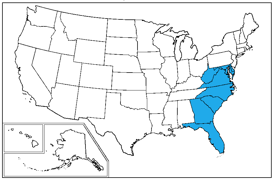
English: A map of the United States Census Bureau Region 3, Division 5, "South Atlantic", consisting of the states of Delaware, Maryland, Virginia, West Virginia, North Carolina, South Carolina, Georgia and the District of Columbia |
||||||
| Date | |||||||
| Source | Own creation | ||||||
| Author | Dubyavee | ||||||
| Permission (Reusing this file) |
|
||||||
- Florida is missing from the description**
Licensing
| Copyleft: This work of art is free; you can redistribute it and/or modify it according to terms of the Free Art License. You will find a specimen of this license on the Copyleft Attitude site as well as on other sites. http://artlibre.org/licence/lal/enFALFree Art Licensefalsetrue |
Captions
Items portrayed in this file
depicts
8 March 2010
File history
Click on a date/time to view the file as it appeared at that time.
| Date/Time | Thumbnail | Dimensions | User | Comment | |
|---|---|---|---|---|---|
| current | 00:53, 9 March 2010 | | 904 × 593 (17 KB) | Dubyavee | {{Information |Description={{en|1=A map of the United States Census Bureau Region 3, Division 5, "South Atlantic", consisting of the states of Delaware, Maryland, Virginia, West Virginia, North Carolina, South Carolina, Georgia and the District of Columbi |
File usage
Global file usage
The following other wikis use this file:
- Usage on ar.wikipedia.org
- Usage on de.wikipedia.org
- Usage on it.wikipedia.org
- Usage on la.wikipedia.org
- Usage on pnb.wikipedia.org
- Usage on pt.wikipedia.org
- Usage on sc.wikipedia.org
- Usage on ur.wikipedia.org
- Usage on www.wikidata.org