File:Schoenenbourg_carte.jpg
From Wikipedia, the free encyclopedia
Original file (1,120 × 689 pixels, file size: 178 KB, MIME type: image/jpeg)
| This is a file from the Wikimedia Commons. Information from its description page there is shown below. Commons is a freely licensed media file repository. You can help. |
| DescriptionSchoenenbourg carte.jpg |
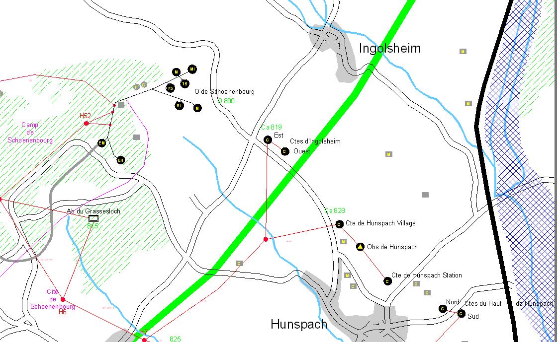
Français : Plan de situation de l'Ouvrage de Schoenenbourg |
||
| Date | |||
| Source | Cartomaginot.com - Cartographie de la ligne Maginot | ||
| Author | Lambert Pascal - Editor : 'Cartomaginot.com / wikimaginot.eu' | ||
| Permission (Reusing this file) |
|
- You are free:
- to share – to copy, distribute and transmit the work
- to remix – to adapt the work
- Under the following conditions:
- attribution – You must give appropriate credit, provide a link to the license, and indicate if changes were made. You may do so in any reasonable manner, but not in any way that suggests the licensor endorses you or your use.
- share alike – If you remix, transform, or build upon the material, you must distribute your contributions under the same or compatible license as the original.
Captions
Items portrayed in this file
depicts
7 January 2007
image/jpeg
9d0601718a8be2552357c4dcdc1e17d74b94230b
182,151 byte
689 pixel
1,120 pixel
File history
Click on a date/time to view the file as it appeared at that time.
| Date/Time | Thumbnail | Dimensions | User | Comment | |
|---|---|---|---|---|---|
| current | 13:45, 17 January 2007 | | 1,120 × 689 (178 KB) | Loiseaulybre | {{Information |Description={{fr|Plan de situation de l'Ouvrage de Schoenenbourg}} |Source=www.lignemaginot.com |Date=07 janvier 2007 |Author=Association des Amis de la Ligne Maginot d'Alsace |Permission={{cc-by-sa-2.0-fr}} |other_versions= }} |
File usage
Global file usage
The following other wikis use this file:
- Usage on fr.wikipedia.org