File:Roman_Milestone_on_A66_-_geograph.org.uk_-_17980.jpg
From Wikipedia, the free encyclopedia
Size of this preview: 450 × 600 pixels. Other resolutions: 180 × 240 pixels | 480 × 640 pixels.
Original file (480 × 640 pixels, file size: 182 KB, MIME type: image/jpeg)
| This is a file from the Wikimedia Commons. Information from its description page there is shown below. Commons is a freely licensed media file repository. You can help. |
Summary
| DescriptionRoman Milestone on A66 - geograph.org.uk - 17980.jpg |
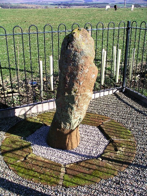
English: Roman Milestone on A66. This Roman Milestone is approximately one mile west of Kirkby Thore, where there was an important Roman Fort known as Bravoniacum, dating from about AD80 to the late 4th century. |
| Date | |
| Source | From geograph.org.uk |
| Author | Lynne Kirton |
| Attribution (required by the license) InfoField | Lynne Kirton / Roman Milestone on A66 / |
InfoField | Lynne Kirton / Roman Milestone on A66 |
| Object location | 54° 37′ 54″ N, 2° 35′ 28″ W | View this and other nearby images on: OpenStreetMap |
|---|
Licensing

|
This image was taken from the Geograph project collection. See this photograph's page on the Geograph website for the photographer's contact details. The copyright on this image is owned by Lynne Kirton and is licensed for reuse under the Creative Commons Attribution-ShareAlike 2.0 license.
|
This file is licensed under the Creative Commons Attribution-Share Alike 2.0 Generic license.
Attribution: Lynne Kirton
- You are free:
- to share – to copy, distribute and transmit the work
- to remix – to adapt the work
- Under the following conditions:
- attribution – You must give appropriate credit, provide a link to the license, and indicate if changes were made. You may do so in any reasonable manner, but not in any way that suggests the licensor endorses you or your use.
- share alike – If you remix, transform, or build upon the material, you must distribute your contributions under the same or compatible license as the original.
Captions
Add a one-line explanation of what this file represents
Items portrayed in this file
depicts
some value
20 February 2005
54°37'54.1"N, 2°35'27.6"W
File history
Click on a date/time to view the file as it appeared at that time.
| Date/Time | Thumbnail | Dimensions | User | Comment | |
|---|---|---|---|---|---|
| current | 04:52, 30 January 2010 | | 480 × 640 (182 KB) | GeographBot | == {{int:filedesc}} == {{Information |description={{en|1=Roman Milestone on A66. This Roman Milestone is approximately one mile west of Kirkby Thore, where there was an important Roman Fort known as Bravoniacum, dating from about AD80 to the late 4th cent |
File usage
The following pages on the English Wikipedia use this file (pages on other projects are not listed):
Metadata
This file contains additional information, probably added from the digital camera or scanner used to create or digitize it.
If the file has been modified from its original state, some details may not fully reflect the modified file.
| Camera manufacturer | PENTAX Corporation |
|---|---|
| Camera model | PENTAX Optio 550 |
| Exposure time | 1/319 sec (0.0031347962382445) |
| F-number | f/4.3 |
| Date and time of data generation | 11:54, 19 February 2005 |
| Lens focal length | 7.8 mm |
| Orientation | Normal |
| Horizontal resolution | 72 dpi |
| Vertical resolution | 72 dpi |
| Software used | ACD Systems Digital Imaging |
| File change date and time | 20:25, 12 June 2005 |
| Y and C positioning | Centered |
| Exif version | 2.2 |
| Date and time of digitizing | 11:54, 19 February 2005 |
| Image compression mode | 2 |
| Exposure bias | 0 |
| Maximum land aperture | 3 APEX (f/2.83) |
| Metering mode | Pattern |
| Flash | Flash did not fire, compulsory flash suppression |
| DateTime subseconds | 100 |
| Color space | sRGB |