File:Relief_map_of_USA_Massachusetts.png
From Wikipedia, the free encyclopedia
No higher resolution available.
Relief_map_of_USA_Massachusetts.png (700 × 478 pixels, file size: 487 KB, MIME type: image/png)
| This is a file from the Wikimedia Commons. Information from its description page there is shown below. Commons is a freely licensed media file repository. You can help. |
Summary
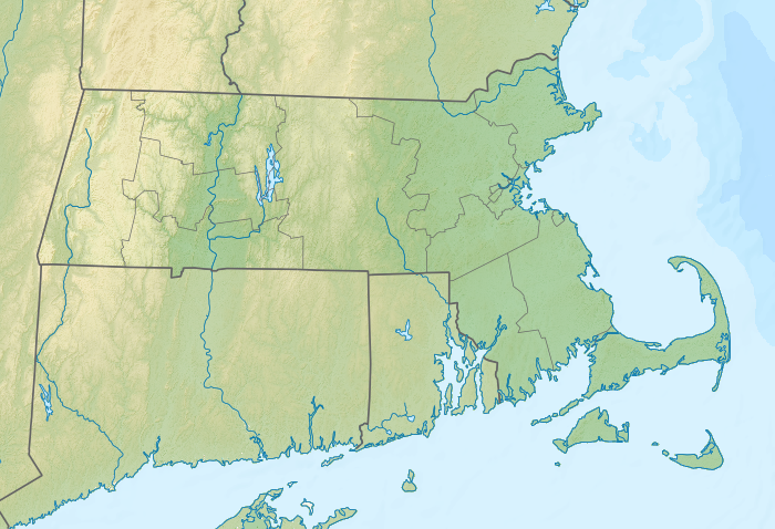
| DescriptionRelief map of USA Massachusetts.png |
Русский: Физическая карта штата Массачусетс (США).
Geographic limits of the map:
|
|||||||||
| Date | ||||||||||
| Source |
|
|||||||||
| Creator | ||||||||||
| Geotemporal data | ||||||||||
| Spatial reference system | Equirectangular projection, N/S stretching 130.0 %. | |||||||||
| Bounding box |
|
|||||||||
| Georeferencing | Georeference the map in Wikimaps Warper If inappropriate please set warp_status = skip to hide. | |||||||||
| Other versions |
|
|||||||||

Licensing
I, the copyright holder of this work, hereby publish it under the following license:
This file is licensed under the Creative Commons Attribution-Share Alike 3.0 Unported license.
- You are free:
- to share – to copy, distribute and transmit the work
- to remix – to adapt the work
- Under the following conditions:
- attribution – You must give appropriate credit, provide a link to the license, and indicate if changes were made. You may do so in any reasonable manner, but not in any way that suggests the licensor endorses you or your use.
- share alike – If you remix, transform, or build upon the material, you must distribute your contributions under the same or compatible license as the original.
Captions
Relief map of Massachusetts, USA
Items portrayed in this file
depicts
File history
Click on a date/time to view the file as it appeared at that time.
| Date/Time | Thumbnail | Dimensions | User | Comment | |
|---|---|---|---|---|---|
| current | 10:29, 21 November 2012 | | 700 × 478 (487 KB) | Nzeemin | User created page with UploadWizard |
File usage
More than 100 pages use this file. The following list shows the first 100 pages that use this file only. A full list is available.
- Alewife Brook Reservation
- Alumni Stadium
- Assawompset Pond
- Bakke Mountain
- Bash Bish Falls State Park
- Beartown State Forest
- Beaver Brook (Merrimack River tributary)
- Beaver Brook Reservation
- Belle Isle Marsh Reservation
- Blue Hills Reservation
- Boston Harbor Islands National Recreation Area
- Bradley Palmer State Park
- Brimfield State Forest
- Brockton, Massachusetts
- Buzzards Bay
- C. M. Gardner State Park
- Cambridge, Massachusetts
- Campanelli Stadium
- Cape Ann
- Castle Island (Massachusetts)
- Cedar Pond (Massachusetts)
- Chappaquiddick Island
- Chicopee Memorial State Park
- DCU Center
- Dell Technologies Championship
- Dighton Rock State Park
- Dorchester Shores Reservation
- Douglas State Forest
- Dug Pond
- Edgartown, Massachusetts
- Follins Pond
- Frederick Law Olmsted National Historic Site
- Fresh Pond (Cambridge, Massachusetts)
- Gillette Stadium
- Great Meadows National Wildlife Refuge
- Great Quittacas Pond
- Haggetts Pond
- Hardy Pond
- Holyoke Heritage State Park
- Indian Lake (Massachusetts)
- J. A. Skinner State Park
- Jamaica Pond
- Jiminy Peak (ski area)
- John Fitzgerald Kennedy National Historic Site
- Lake Attitash
- Lake Chaubunagungamaug
- Lake Monomonac
- Lake Nippenicket
- Lake Quinsigamond
- Lake Rico
- Lake Sabbatia
- Little Quittacas Pond
- Little River (Merrimack River tributary)
- Long Pond (Lakeville, Massachusetts)
- Lowell National Historical Park
- Mandela, Massachusetts
- Martha's Vineyard
- MassMutual Center
- Massasoit State Park
- Middlesex Fells Reservation
- Mirey Brook
- Mount Frissell
- Mount Greylock
- Mount Greylock State Reservation
- Mount Jefferson (Massachusetts)
- Mount Wachusett
- Mount Washington State Forest
- Mullins Center
- Myopia Hunt Club
- Nantucket
- Nashua River
- Nashua River Rail Trail
- New Bedford Whaling National Historical Park
- Nissitissit River
- Norton Reservoir
- Peabody Museum of Archaeology and Ethnology
- Pilgrim Memorial State Park
- Pittsfield, Massachusetts
- Plum Island (Massachusetts)
- Plymouth, Massachusetts
- Pocksha Pond
- Powwow River
- Provincetown, Massachusetts
- Purgatory Chasm State Reservation
- Quabbin Reservoir
- Revere Beach
- Smith Pool
- Southern New England Trunkline Trail
- Spicket River
- Spy Pond
- TD Garden
- Tarbell Brook
- Tuxbury Pond
- Vineyard Sound
- Wachusett Mountain (ski area)
- Wachusett Reservoir
- Walden Pond
- Warren McGuirk Alumni Stadium
- Watson Pond
- Wells State Park (Massachusetts)
View more links to this file.
Global file usage
The following other wikis use this file:
- Usage on ar.wikipedia.org
- Usage on ast.wikipedia.org
- Usage on az.wikipedia.org
- Usage on ban.wikipedia.org
- Usage on bar.wikipedia.org
- Usage on be-tarask.wikipedia.org
- Usage on bg.wikipedia.org
- Бостън
- Харвардски университет
- Бърлингтън (Масачузетс)
- Кеймбридж (Масачузетс)
- Ривиър
- Нейтик
- Устър (Масачузетс)
- Челси (Масачузетс)
- Питсфийлд
- Нютън (Масачузетс)
- Уилямстаун
- Плимът (Масачузетс)
- Хейврил
- Конкорд (Масачузетс)
- Лоуъл
- Съмървил
- Милтън (Масачузетс)
- Лиоминстър (Масачузетс)
- Сейлъм (Масачузетс)
- Амхърст (Масачузетс)
- Нортхамптън (Масачузетс)
- Ленъкс
- Саут Хадли
- Стокбридж
- Куинси
- Спрингфийлд (Масачузетс)
- Провинстаун
- Хаянис
- Смит (колеж)
- Уеймът (Масачузетс)
- Масачузетски залив
- Ъксбридж (Масачузетс)
- Барнстейбъл
- Броктън
- Дедам
- Едгартаун
- Тонтън
View more global usage of this file.
Metadata
This file contains additional information, probably added from the digital camera or scanner used to create or digitize it.
If the file has been modified from its original state, some details may not fully reflect the modified file.
| Horizontal resolution | 23.62 dpc |
|---|---|
| Vertical resolution | 23.62 dpc |
| Software used |