File:Relief_map_of_Italy_Sicily.png
From Wikipedia, the free encyclopedia
Size of this preview: 548 × 599 pixels. Other resolutions: 220 × 240 pixels | 439 × 480 pixels | 645 × 705 pixels.
Original file (645 × 705 pixels, file size: 284 KB, MIME type: image/png)
| This is a file from the Wikimedia Commons. Information from its description page there is shown below. Commons is a freely licensed media file repository. You can help. |
Summary
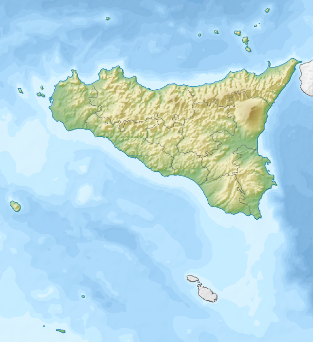
| DescriptionRelief map of Italy Sicily.png |
Русский: Физическая карта Сицилии (Италия).
English: Relief map of Sicily, Italy.
Equirectangular projection, N/S stretching 125 %. Geographic limits of the map:
|
| Date | |
| Source |
|
| Author | Nzeemin |
| Other versions |
|

Licensing
I, the copyright holder of this work, hereby publish it under the following license:
This file is licensed under the Creative Commons Attribution-Share Alike 3.0 Unported license.
- You are free:
- to share – to copy, distribute and transmit the work
- to remix – to adapt the work
- Under the following conditions:
- attribution – You must give appropriate credit, provide a link to the license, and indicate if changes were made. You may do so in any reasonable manner, but not in any way that suggests the licensor endorses you or your use.
- share alike – If you remix, transform, or build upon the material, you must distribute your contributions under the same or compatible license as the original.
Captions
Relief map of Sicily, Italy
מפת תבליט של סיציליה, איטליה
19 November 2012
File history
Click on a date/time to view the file as it appeared at that time.
| Date/Time | Thumbnail | Dimensions | User | Comment | |
|---|---|---|---|---|---|
| current | 20:41, 22 January 2014 | | 645 × 705 (284 KB) | Fulvio314 | Greyed out Malta & Calabria (not belonging to Sicily) |
| 18:23, 19 November 2012 |  | 645 × 705 (298 KB) | Nzeemin | User created page with UploadWizard |
File usage
The following pages on the English Wikipedia use this file (pages on other projects are not listed):
- 1169 Sicily earthquake
- 1693 Sicily earthquake
- 1968 Belice earthquake
- Assorus (Sicily)
- Battle of Cape Ecnomus
- Battle of Drepana
- Battle of Lilybaeum
- Battle of Panormus
- Battle of the Aegates
- Battle of the Crimissus
- Biviere Lake
- Bosco Littorio
- Dirillo Lake
- Disueri Lake
- Fanaco Lake
- Garcia Lake
- Gibil Gabib
- Grotta del Gelo
- Gulf of Castellammare
- Gurrida Lake
- Ibn Qalaqis
- La Terra Trema
- Lago Arancio
- Lago Olivo
- Lago dell'Ancipa
- Lago di Ganzirri
- Lago di Lentini
- Lago di Magazzolo
- Lago di Nicito
- Lago di Ogliastro
- Lago di Piana degli Albanesi
- Lago di Santa Rosalia
- Lampedusa
- Lampione
- Linosa
- Madonie Regional Natural Park
- Maulazzo Lake
- Mechanized Brigade "Aosta"
- Monte Bubbonia
- Monte Erice
- Monte Kronio
- Mount Etna
- Mount Scalpello
- Necropolis of Pantalica
- Nicoletti Lake
- Palazzo dei Normanni
- Pergusa Lake
- Pozzillo Lake
- Prizzi Lake
- Riserva naturale dello Zingaro
- Rocca di Novara
- SS Chesterfield (1913)
- Sabucina
- San Leone (river)
- Sicilian Open
- Sicilian Senior Open
- Siege of Taormina (1078)
- Siege of Taormina (902)
- Strait of Messina
- Trearie Lake
- Val di Noto
- Valle dei Templi
- Vassallaggi
- Zisa, Palermo
- User:Michael!/Project:Location map templates/Italy
- User:Noclador/sandbox/Piazza Marittima di Messina
- User:Ty654/List of earthquakes from 1900-1949 exceeding magnitude 7+
- Draft:Sacred area of the Kothon, Motya
- Module:Location map/data/Italy Sicily
- Module:Location map/data/Italy Sicily/doc
- Module:Location map/data/Sicily
Global file usage
The following other wikis use this file:
- Usage on als.wikipedia.org
- Usage on ar.wikipedia.org
- Usage on ast.wikipedia.org
- Usage on az.wikipedia.org
- Usage on be.wikipedia.org
- Usage on bh.wikipedia.org
- Usage on bs.wikipedia.org
- Usage on ca.wikipedia.org
- Usage on ceb.wikipedia.org
- Usage on ce.wikipedia.org
- Usage on de.wikivoyage.org
View more global usage of this file.
Metadata
This file contains additional information, probably added from the digital camera or scanner used to create or digitize it.
If the file has been modified from its original state, some details may not fully reflect the modified file.
| Horizontal resolution | 17.73 dpc |
|---|---|
| Vertical resolution | 17.73 dpc |
| File change date and time | 20:37, 22 January 2014 |
Retrieved from "https://en.wikipedia.org/wiki/File:Relief_map_of_Italy_Sicily.png"