File:Río_de_la_Paz_map.png
From Wikipedia, the free encyclopedia
Size of this preview: 600 × 600 pixels. Other resolutions: 240 × 240 pixels | 480 × 480 pixels | 768 × 768 pixels | 1,024 × 1,024 pixels | 1,500 × 1,500 pixels.
Original file (1,500 × 1,500 pixels, file size: 836 KB, MIME type: image/png)
| This is a file from the Wikimedia Commons. Information from its description page there is shown below. Commons is a freely licensed media file repository. You can help. |
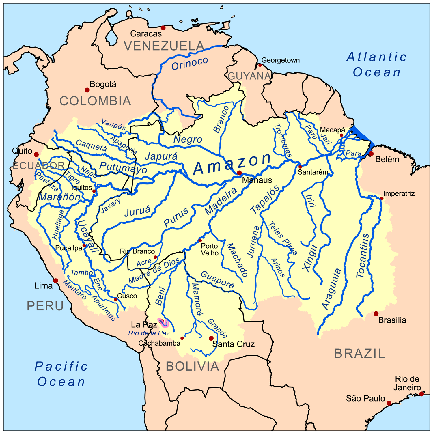
| DescriptionRío de la Paz map.png |
|
||||||||
| Date | (UTC) | ||||||||
| Source | |||||||||
| Author |
|
| This is a retouched picture, which means that it has been digitally altered from its original version. Modifications: Río de la Paz eingefügt. The original can be viewed here: Amazonriverbasin basemap.png:
|
I, the copyright holder of this work, hereby publish it under the following license:
This file is licensed under the Creative Commons Attribution-Share Alike 3.0 Unported license.
- You are free:
- to share – to copy, distribute and transmit the work
- to remix – to adapt the work
- Under the following conditions:
- attribution – You must give appropriate credit, provide a link to the license, and indicate if changes were made. You may do so in any reasonable manner, but not in any way that suggests the licensor endorses you or your use.
- share alike – If you remix, transform, or build upon the material, you must distribute your contributions under the same or compatible license as the original.
Original upload log
This image is a derivative work of the following images:
- File:Amazonriverbasin_basemap.png licensed with Cc-by-sa-3.0
- 2008-09-08T17:13:04Z Kmusser 1500x1500 (921325 Bytes) {{Information |Description=This is a map of the [[:en:Amazon River|Amazon River]] drainage basin. |Source=Own work using [[http://www.maproom.psu.edu/dcw/ Digital Chart of the World]] and [[http://edc.usgs.gov/products/elevat
Uploaded with derivativeFX
Captions
Add a one-line explanation of what this file represents
Items portrayed in this file
depicts
22 April 2010
File history
Click on a date/time to view the file as it appeared at that time.
| Date/Time | Thumbnail | Dimensions | User | Comment | |
|---|---|---|---|---|---|
| current | 07:18, 22 April 2010 | | 1,500 × 1,500 (836 KB) | Meister | {{Information |Description={{Information |Description=Map of the Amazon River drainage basin including Río de la Paz. |Source=*Amazonriverbasin_basemap.png |Date=2010-04-22 07:19 (UTC) |Author=* |
File usage
No pages on the English Wikipedia use this file (pages on other projects are not listed).
Global file usage
The following other wikis use this file:
- Usage on az.wikipedia.org
- Usage on be.wikipedia.org
- Usage on de.wikipedia.org
- Usage on fa.wikipedia.org
- Usage on fr.wikipedia.org
- Usage on hy.wikipedia.org
- Usage on pt.wikipedia.org
- Usage on qu.wikipedia.org
- Usage on ru.wikipedia.org
- Usage on www.wikidata.org
Retrieved from "https://en.wikipedia.org/wiki/File:Río_de_la_Paz_map.png"