File:Peak_District_National_Park_UK_relief_location_map.png
From Wikipedia, the free encyclopedia
Size of this preview: 469 × 600 pixels. Other resolutions: 188 × 240 pixels | 375 × 480 pixels | 601 × 768 pixels | 801 × 1,024 pixels | 2,000 × 2,557 pixels.
Original file (2,000 × 2,557 pixels, file size: 3.32 MB, MIME type: image/png)
| This is a file from the Wikimedia Commons. Information from its description page there is shown below. Commons is a freely licensed media file repository. You can help. |
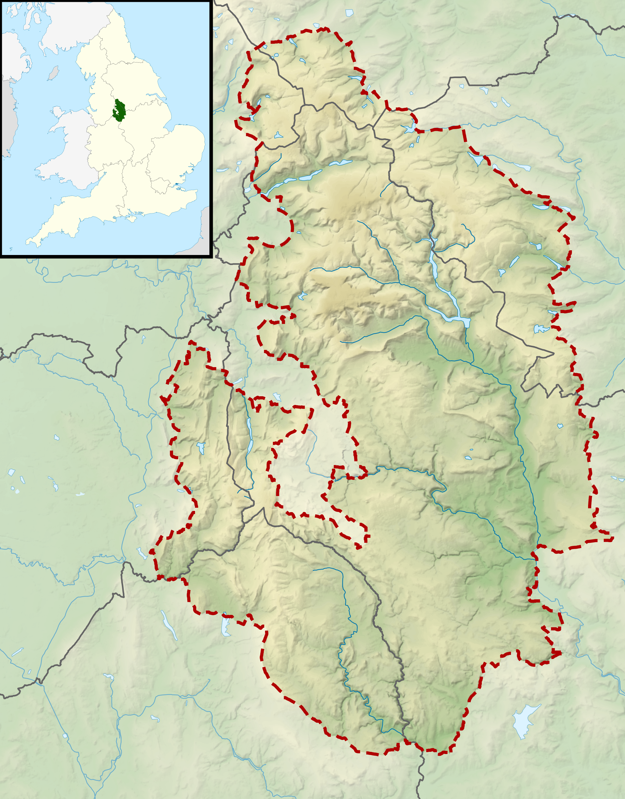
| DescriptionPeak District National Park UK relief location map.png |
Relief map of the Peak District National Park, UK Equirectangular map projection on WGS 84 datum, with N/S stretched 170% Geographic limits:
|
| Date | |
| Source |
Office of National Statistics Geography
|
| Author | Nilfanion, created using Ordnance Survey data |
| Permission (Reusing this file) |
This file is licensed under the Creative Commons Attribution-Share Alike 3.0 Unported license. Attribution: Contains Ordnance Survey data © Crown copyright and database right
|
Captions
Add a one-line explanation of what this file represents
Items portrayed in this file
depicts
17 March 2012
File history
Click on a date/time to view the file as it appeared at that time.
| Date/Time | Thumbnail | Dimensions | User | Comment | |
|---|---|---|---|---|---|
| current | 10:58, 17 March 2012 | | 2,000 × 2,557 (3.32 MB) | Nilfanion | {{Information |Description=Relief map of the Peak District National Park, UK Equirectangular map projection on WGS 84 datum, with N/S stretched 170% Geographic limits: *West: 2.30W *East: 1.50W *North: 53.62N *South: 53.00N |Sourc... |
File usage
The following pages on the English Wikipedia use this file (pages on other projects are not listed):
- Axe Edge Moor
- Black Chew Head
- Black Edge
- Black Hill (Peak District)
- Bleaklow
- Britland Edge Hill
- Brown Knoll
- Cheeks Hill
- Derwent Edge
- Featherbed Moss
- Featherbed Top
- Grin Low
- Higger Tor
- Kinder Scout
- Lost Lad
- Mam Tor
- Margery Hill
- Merryton Low
- Mill Hill (Derbyshire)
- Oliver Hill (Peak District)
- Rushup Edge
- Shining Tor
- Thorpe Cloud
- Module:Location map/data/United Kingdom Peak District
- Module:Location map/data/United Kingdom Peak District/doc
Metadata
This file contains additional information, probably added from the digital camera or scanner used to create or digitize it.
If the file has been modified from its original state, some details may not fully reflect the modified file.
| Horizontal resolution | 187.8 dpc |
|---|---|
| Vertical resolution | 187.8 dpc |
| File change date and time | 02:13, 12 March 2012 |