File:Paddington_Station-4269161-by-Oast-House-Archive.jpg
From Wikipedia, the free encyclopedia
Size of this preview: 800 × 600 pixels. Other resolutions: 320 × 240 pixels | 640 × 480 pixels | 1,024 × 768 pixels.
Original file (1,024 × 768 pixels, file size: 260 KB, MIME type: image/jpeg)
| This is a file from the Wikimedia Commons. Information from its description page there is shown below. Commons is a freely licensed media file repository. You can help. |
Summary
| DescriptionPaddington Station-4269161-by-Oast-House-Archive.jpg |
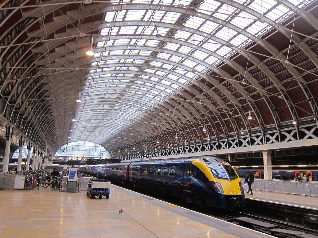
English: Paddington station, also known as London Paddington, is a central London railway terminus and London Underground station complex.
The site is historic, having been the London terminus of the Great Western Railway and its successors since 1838. Much of the current mainline station dates from 1854 and was designed by Isambard Kingdom Brunel. The site was first served by Underground trains in 1863, as the original western terminus of the Metropolitan Railway, the world's first underground railway. The complex has since been modernised and now has an additional role as the London terminus for the dedicated Heathrow Express airport service. Paddington is in fare zone 1. The station is the terminus for services from Reading, Bristol, Cardiff, Swansea, Oxford, Newbury, Taunton, Exeter, Plymouth, Penzance, Cheltenham, Worcester and Hereford, and for inner- and outer-suburban services. |
| Date | |
| Source | Geograph - https://www.geograph.org.uk/photo/4269161 |
| Author | Oast House Archive |
| Attribution (required by the license) InfoField | Oast House Archive / Platform 8, Paddington Station / |
InfoField | Oast House Archive / Platform 8, Paddington Station |
| Camera location | 51° 31′ 01.79″ N, 0° 10′ 36.55″ W | View this and other nearby images on: OpenStreetMap |
|---|
Licensing

|
This image was taken from the Geograph project collection. See this photograph's page on the Geograph website for the photographer's contact details. The copyright on this image is owned by Oast House Archive and is licensed for reuse under the Creative Commons Attribution-ShareAlike 2.0 license.
|
This file is licensed under the Creative Commons Attribution-Share Alike 2.0 Generic license.
Attribution: Oast House Archive
- You are free:
- to share – to copy, distribute and transmit the work
- to remix – to adapt the work
- Under the following conditions:
- attribution – You must give appropriate credit, provide a link to the license, and indicate if changes were made. You may do so in any reasonable manner, but not in any way that suggests the licensor endorses you or your use.
- share alike – If you remix, transform, or build upon the material, you must distribute your contributions under the same or compatible license as the original.
Captions
Add a one-line explanation of what this file represents
Items portrayed in this file
depicts
51°31'1.790"N, 0°10'36.548"W
5 December 2014
File history
Click on a date/time to view the file as it appeared at that time.
| Date/Time | Thumbnail | Dimensions | User | Comment | |
|---|---|---|---|---|---|
| current | 01:13, 11 February 2017 | | 1,024 × 768 (260 KB) | Bellminsterboy | User created page with UploadWizard |
File usage
The following pages on the English Wikipedia use this file (pages on other projects are not listed):
Global file usage
The following other wikis use this file:
- Usage on bn.wikipedia.org
- Usage on de.wikipedia.org
- Usage on fa.wikipedia.org
- Usage on hu.wikipedia.org
- Usage on it.wikipedia.org
- Usage on ja.wikipedia.org
- Usage on tr.wikipedia.org
- Usage on uk.wikipedia.org
- Usage on yi.wikipedia.org
- Usage on zh.wikipedia.org