File:PUTNAM_MEMORIAL_STATE_PARK.jpg
From Wikipedia, the free encyclopedia
Original file (3,464 × 5,240 pixels, file size: 2.15 MB, MIME type: image/jpeg)
| This is a file from the Wikimedia Commons. Information from its description page there is shown below. Commons is a freely licensed media file repository. You can help. |
Summary
| DescriptionPUTNAM MEMORIAL STATE PARK.jpg |
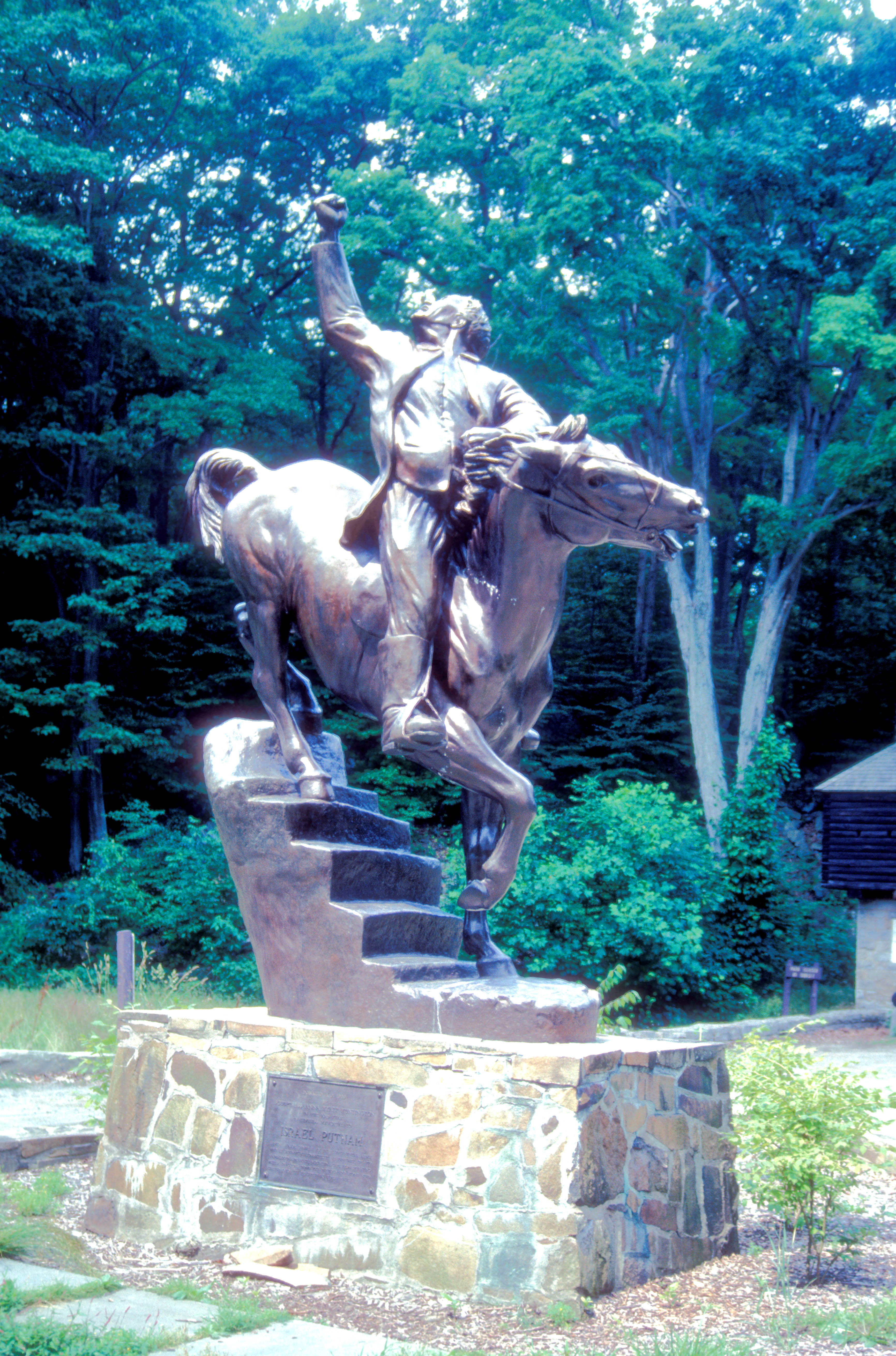
English: THIS STATUE DEPICTS PUTNAM ESCAPING BRITISH CAPTURE BY RIDING HIS HORSE DOWN A FLIGHT OF STAIRS DURING THE REVOLUTIONARY WAR
|
||
| Date | |||
| Source | Own work | ||
| Author | ROY KLOTZ M.D. |
| Camera location | 41° 20′ 18.36″ N, 73° 22′ 52.62″ W | View this and other nearby images on: OpenStreetMap |
|---|
Licensing
| Public domainPublic domainfalsefalse |
This work is in the public domain in the United States because it was published in the United States between 1929 and 1977, inclusive, without a copyright notice. For further explanation, see Commons:Hirtle chart as well as a detailed definition of "publication" for public art. Note that it may still be copyrighted in jurisdictions that do not apply the rule of the shorter term for US works (depending on the date of the author's death), such as Canada (50 p.m.a.), Mainland China (50 p.m.a., not Hong Kong or Macao), Germany (70 p.m.a.), Mexico (100 p.m.a.), Switzerland (70 p.m.a.), and other countries with individual treaties.
العربية ∙ беларуская (тарашкевіца) ∙ čeština ∙ Deutsch ∙ Ελληνικά ∙ English ∙ español ∙ français ∙ Bahasa Indonesia ∙ italiano ∙ 日本語 ∙ 한국어 ∙ македонски ∙ Nederlands ∙ português ∙ русский ∙ sicilianu ∙ slovenščina ∙ ไทย ∙ Tiếng Việt ∙ 中文(简体) ∙ 中文(繁體) ∙ +/− |
 |
- You are free:
- to share – to copy, distribute and transmit the work
- to remix – to adapt the work
- Under the following conditions:
- attribution – You must give appropriate credit, provide a link to the license, and indicate if changes were made. You may do so in any reasonable manner, but not in any way that suggests the licensor endorses you or your use.
- share alike – If you remix, transform, or build upon the material, you must distribute your contributions under the same or compatible license as the original.
Captions
Items portrayed in this file
depicts
some value
17 October 1970
41°20'18.359"N, 73°22'52.619"W
File history
Click on a date/time to view the file as it appeared at that time.
| Date/Time | Thumbnail | Dimensions | User | Comment | |
|---|---|---|---|---|---|
| current | 17:14, 17 November 2012 | | 3,464 × 5,240 (2.15 MB) | Ras67 | losslessly cropped with Jpegcrop, GPS data added |
| 00:24, 11 October 2012 |  | 3,946 × 5,782 (2.5 MB) | KLOTZ | User created page with UploadWizard |
File usage
Global file usage
The following other wikis use this file:
- Usage on ceb.wikipedia.org
- Usage on de.wikipedia.org
- Usage on es.wikipedia.org
- Usage on www.wikidata.org
Metadata
This file contains additional information, probably added from the digital camera or scanner used to create or digitize it.
If the file has been modified from its original state, some details may not fully reflect the modified file.
| Camera manufacturer | NIKON |
|---|---|
| Camera model | Nikon SUPER COOLSCAN 4000 ED |
| Latitude | 41° 20′ 18.36″ N |
| Longitude | 73° 22′ 52.62″ W |
| Altitude | 190 meters above sea level |
| Orientation | Normal |
| Horizontal resolution | 4,000 dpi |
| Vertical resolution | 4,000 dpi |
| Software used | Adobe Photoshop Elements 2.0 |
| File change date and time | 18:49, 17 October 1970 |
| Y and C positioning | Centered |
| Exif version | 2.2 |
| Meaning of each component |
|
| Supported Flashpix version | 1 |
| Color space | Uncalibrated |
| GPS tag version | 2.2.0.0 |