File:Otsego_County_outline_map_Middlefield_red.png
From Wikipedia, the free encyclopedia
No higher resolution available.
Otsego_County_outline_map_Middlefield_red.png (180 × 191 pixels, file size: 18 KB, MIME type: image/png)
| This is a file from the Wikimedia Commons. Information from its description page there is shown below. Commons is a freely licensed media file repository. You can help. |

|
This file was moved to Wikimedia Commons from en.wikipedia using a bot script. All source information is still present. It requires review. Additionally, there may be errors in any or all of the information fields; information on this file should not be considered reliable and the file should not be used until it has been reviewed and any needed corrections have been made. Once the review has been completed, this template should be removed. For details about this file, see below. Check now! |
Summary
| DescriptionOtsego County outline map Middlefield red.png | |
| Date | 4 April 2006 (original upload date) |
| Source | Transferred from en.wikipedia to Commons. |
| Author | The original uploader was Cbarown at English Wikipedia. |
| Permission (Reusing this file) |
Released into the public domain (by the author). |

|
This map image could be re-created using vector graphics as an SVG file. This has several advantages; see Commons:Media for cleanup for more information. If an SVG form of this image is available, please upload it and afterwards replace this template with
{{vector version available|new image name}}.
It is recommended to name the SVG file “Otsego County outline map Middlefield red.svg”—then the template Vector version available (or Vva) does not need the new image name parameter. |
Licensing
=
| Public domainPublic domainfalsefalse |
| |
This work has been released into the public domain by its author, Cbarown, at the English Wikipedia project. This applies worldwide. In case this is not legally possible: |
Original upload log
The original description page was here. All following user names refer to en.wikipedia.
| Date/Time | Dimensions | User | Comment |
|---|---|---|---|
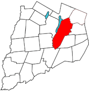
| 2006-04-04 20:35 | 180×191× (18898 bytes) | Cbarown | Map of [[Otsego County, New York]] with the Town of [[Middlefield, New York]] in red |
Captions
Add a one-line explanation of what this file represents
Items portrayed in this file
depicts
4 April 2006
File history
Click on a date/time to view the file as it appeared at that time.
| Date/Time | Thumbnail | Dimensions | User | Comment | |
|---|---|---|---|---|---|
| current | 16:09, 23 March 2021 | | 180 × 191 (18 KB) | Ixfd64 | Transferred from en.wikipedia via #commonshelper |
File usage
The following pages on the English Wikipedia use this file (pages on other projects are not listed):
Global file usage
The following other wikis use this file:
- Usage on ur.wikipedia.org
Metadata
This file contains additional information, probably added from the digital camera or scanner used to create or digitize it.
If the file has been modified from its original state, some details may not fully reflect the modified file.
| Horizontal resolution | 9.45 dpc |
|---|---|
| Vertical resolution | 9.45 dpc |