File:Mississippi_Missouri_confluence_point.jpg
From Wikipedia, the free encyclopedia
Size of this preview: 799 × 219 pixels. Other resolutions: 320 × 88 pixels | 640 × 176 pixels | 1,024 × 281 pixels | 1,280 × 351 pixels | 2,560 × 702 pixels | 7,728 × 2,120 pixels.
Original file (7,728 × 2,120 pixels, file size: 2.56 MB, MIME type: image/jpeg)
| This is a file from the Wikimedia Commons. Information from its description page there is shown below. Commons is a freely licensed media file repository. You can help. |
Summary
| DescriptionMississippi Missouri confluence point.jpg |
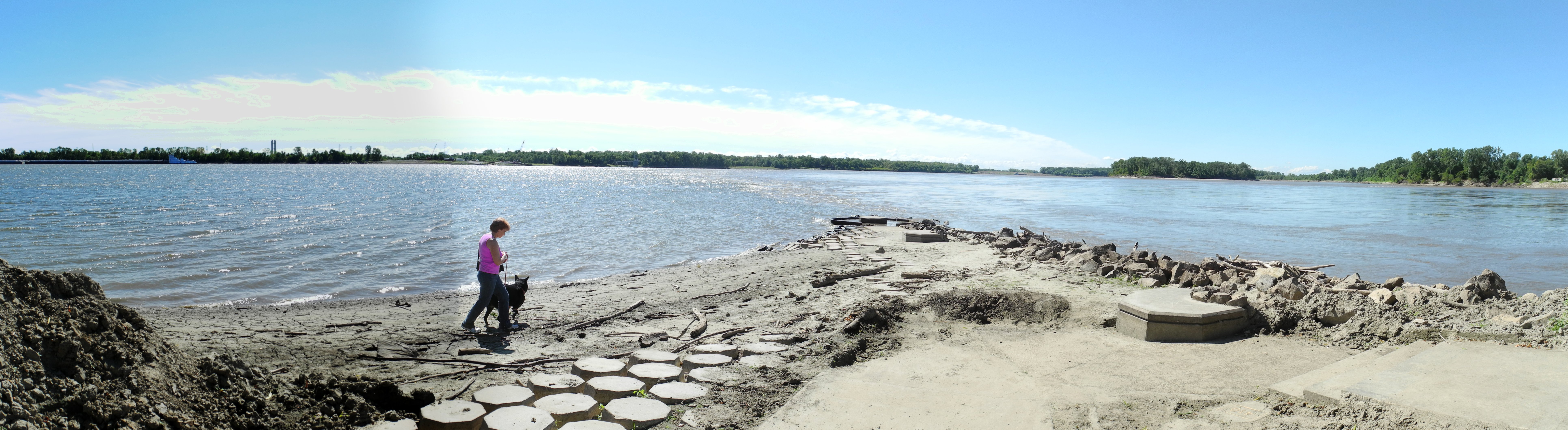
English: Looking south at the confluence of the Mississippi River (left) and the Missouri River (right) at Jones-Confluence Point State Park in the state of Missouri. The debris and disturbed aspect of the facility are due to the floods that are prone to occur at this spot. Lewis and Clark wintered on the far (east) bank of the Mississippi near the center of this image at Camp Dubois in 1803-1804 prior to their expedition up the Missouri River.
This image was created with Hugin. |
| Date | |
| Source | Own work |
| Author | Kbh3rd |
| Camera location | 38° 48′ 58.18″ N, 90° 07′ 10.34″ W | View this and other nearby images on: OpenStreetMap |
|---|
Licensing
I, the copyright holder of this work, hereby publish it under the following license:
This file is licensed under the Creative Commons Attribution-Share Alike 3.0 Unported license.
- You are free:
- to share – to copy, distribute and transmit the work
- to remix – to adapt the work
- Under the following conditions:
- attribution – You must give appropriate credit, provide a link to the license, and indicate if changes were made. You may do so in any reasonable manner, but not in any way that suggests the licensor endorses you or your use.
- share alike – If you remix, transform, or build upon the material, you must distribute your contributions under the same or compatible license as the original.
| Annotations InfoField | This image is annotated: View the annotations at Commons |
3594
774
328
116
7728
2120
Lewis and Clark State Historic Site -- Lewis and Clark wintered on the east bank here from December 1803 to May 1804 before heading up the Missouri River with the Corps of Discovery.
Captions
Add a one-line explanation of what this file represents
Items portrayed in this file
depicts
5 September 2011
38°48'58.18"N, 90°7'10.34"W
File history
Click on a date/time to view the file as it appeared at that time.
| Date/Time | Thumbnail | Dimensions | User | Comment | |
|---|---|---|---|---|---|
| current | 05:05, 7 September 2011 | 7,728 × 2,120 (2.56 MB) | Kbh3rd |
File usage
The following pages on the English Wikipedia use this file (pages on other projects are not listed):
Global file usage
The following other wikis use this file:
- Usage on he.wikivoyage.org
- Usage on www.wikidata.org
Metadata
This file contains additional information, probably added from the digital camera or scanner used to create or digitize it.
If the file has been modified from its original state, some details may not fully reflect the modified file.
| Date and time of data generation | 12:59, 5 September 2011 |
|---|---|
| File change date and time | 12:59, 5 September 2011 |