File:Mashonaland_East_districts.png
From Wikipedia, the free encyclopedia
Size of this preview: 776 × 600 pixels. Other resolutions: 311 × 240 pixels | 621 × 480 pixels | 994 × 768 pixels | 1,056 × 816 pixels.
Original file (1,056 × 816 pixels, file size: 39 KB, MIME type: image/png)
| This is a file from the Wikimedia Commons. Information from its description page there is shown below. Commons is a freely licensed media file repository. You can help. |
Summary
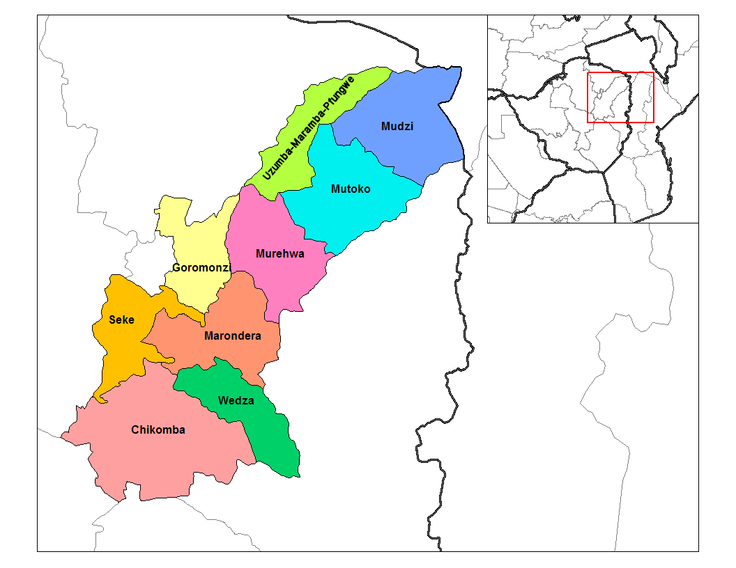
| DescriptionMashonaland East districts.png |
English: Map of the districts of Mashonaland East province of Zimbabwe. |
| Date | |
| Source |
Own work (Rarelibra) using MapInfo Professional v8.5 and various mapping resources. Transferred from en.wikipedia |
| Author | Rarelibra at en.wikipedia |
Licensing
| Public domainPublic domainfalsefalse |
| This work has been released into the public domain by its author, Rarelibra at English Wikipedia. This applies worldwide. In some countries this may not be legally possible; if so: Rarelibra grants anyone the right to use this work for any purpose, without any conditions, unless such conditions are required by law.Public domainPublic domainfalsefalse |
Original upload log
The original description page was here. All following user names refer to en.wikipedia.
- 2006-09-28 18:29 Rarelibra 1056×816× (34182 bytes) Map of the districts of Mashonaland East province of Angola. Created by ~~~~ for public domain use, using MapInfo Professional v8.5 and various mapping resources.
Captions
Add a one-line explanation of what this file represents
In dieser Datei abgebildete Objekte
depicts
28 September 2006
File history
Click on a date/time to view the file as it appeared at that time.
| Date/Time | Thumbnail | Dimensions | User | Comment | |
|---|---|---|---|---|---|
| current | 20:15, 22 April 2014 | | 1,056 × 816 (39 KB) | Maproom | Relabelled the northern of the two "Murehwa" districts as "Uzumba-Maramba-Pfungwe", as requested at https://en.wikipedia.org/wiki/Wikipedia:Graphics_Lab/Map_workshop on April 22nd, 2014. |
| 13:36, 10 January 2011 |  | 1,056 × 816 (33 KB) | Klik9 | {{Information |Description=Map of the districts of Mashonaland East province of Zimbabwe |Source=Originally from [http://en.wikipedia.org en.wikipedia]; description page is (was) here |Date=2006 |Author=[[Rareli |
File usage
The following pages on the English Wikipedia use this file (pages on other projects are not listed):
Global file usage
The following other wikis use this file:
- Usage on ca.wikipedia.org
- Usage on de.wikipedia.org
- Usage on es.wikipedia.org
- Usage on frr.wikipedia.org
- Usage on it.wikipedia.org
- Usage on ja.wikipedia.org
- Usage on ka.wikipedia.org
- Usage on lt.wikipedia.org
- Usage on mrj.wikipedia.org
- Usage on nl.wikipedia.org
- Usage on pl.wikipedia.org
- Usage on pt.wikipedia.org
- Usage on ro.wikipedia.org
- Usage on ru.wikipedia.org
- Usage on si.wikipedia.org
- Usage on sn.wikipedia.org
- Usage on tr.wikipedia.org
- Usage on uk.wikipedia.org
- Usage on zu.wikipedia.org
Metadata
This file contains additional information, probably added from the digital camera or scanner used to create or digitize it.
If the file has been modified from its original state, some details may not fully reflect the modified file.
| File change date and time | 20:14, 22 April 2014 |
|---|---|
| Horizontal resolution | 37.79 dpc |
| Vertical resolution | 37.79 dpc |
Retrieved from "https://en.wikipedia.org/wiki/File:Mashonaland_East_districts.png"