File:Mapa_Geografico_de_America_Meridional_(1790).jpg
From Wikipedia, the free encyclopedia
Size of this preview: 424 × 599 pixels. Other resolutions: 170 × 240 pixels | 339 × 480 pixels | 543 × 768 pixels | 1,059 × 1,497 pixels.
Original file (1,059 × 1,497 pixels, file size: 558 KB, MIME type: image/jpeg)
| This is a file from the Wikimedia Commons. Information from its description page there is shown below. Commons is a freely licensed media file repository. You can help. |
Summary
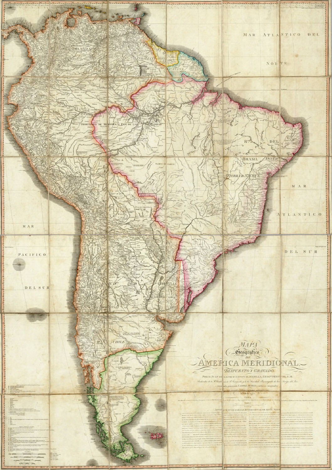
| DescriptionMapa Geografico de America Meridional (1790).jpg |
English: Geographical Map of South America, Drawn and Engraved by Mr. Juan de la Cruz Cano y Olmedilla, Geographer to His Majesty...
Español: Mapa Geografico de America Meridional, dispuesto y gravado por D. Juan de la Cruz Cano y Olmedilla, Geogfo. Pensdo. de S. M. Individuo de la R. Academia de Sn. Fernando, y da la Sociedad Bascongada de los Amigos del Pais, teniendo presentes Varios Mapas y noticias originales con arreglo a Observaciones astronómicas (Año 1775.) Londres, Publicado por William Faden, Geografo del Rey, y del Principe de Gales, Enero 1 de 1799. |
||||||||||||||||||||||
| Date | 1775, reprinted 1799 | ||||||||||||||||||||||
| Source | Unknown sourceUnknown source | ||||||||||||||||||||||
| Author |
creator QS:P170,Q8008902 |
||||||||||||||||||||||
| Other versions |
|
||||||||||||||||||||||
.jpg)
Licensing
|
This is a faithful photographic reproduction of a two-dimensional, public domain work of art. The work of art itself is in the public domain for the following reason:
The official position taken by the Wikimedia Foundation is that "faithful reproductions of two-dimensional public domain works of art are public domain".
This photographic reproduction is therefore also considered to be in the public domain in the United States. In other jurisdictions, re-use of this content may be restricted; see Reuse of PD-Art photographs for details. | |||||
Captions
Add a one-line explanation of what this file represents
Items portrayed in this file
depicts
1790
File history
Click on a date/time to view the file as it appeared at that time.
| Date/Time | Thumbnail | Dimensions | User | Comment | |
|---|---|---|---|---|---|
| current | 02:37, 14 May 2006 | | 1,059 × 1,497 (558 KB) | Fbaltra | |
| 02:32, 14 May 2006 |  | 1,097 × 1,536 (360 KB) | Fbaltra | == Summary == Mapa Geografico de America Meridional de Juan de la Cruz Cano y Olmedilla, 1790. Publicado en 1799 por William Faden, Londres. == Licensing == {{PD-Art}} Category:Historical maps of South America Category:Historical maps of Chile |
File usage
The following pages on the English Wikipedia use this file (pages on other projects are not listed):
Global file usage
The following other wikis use this file:
- Usage on de.wikipedia.org
- Usage on es.wikipedia.org
- Usage on it.wikipedia.org
- Usage on roa-tara.wikipedia.org
Metadata
This file contains additional information, probably added from the digital camera or scanner used to create or digitize it.
If the file has been modified from its original state, some details may not fully reflect the modified file.
| _error | 0 |
|---|
.jpg)