File:Map_of_airports_in_Sicily.jpg
From Wikipedia, the free encyclopedia
No higher resolution available.
Map_of_airports_in_Sicily.jpg (549 × 599 pixels, file size: 32 KB, MIME type: image/jpeg)
| This is a file from the Wikimedia Commons. Information from its description page there is shown below. Commons is a freely licensed media file repository. You can help. |
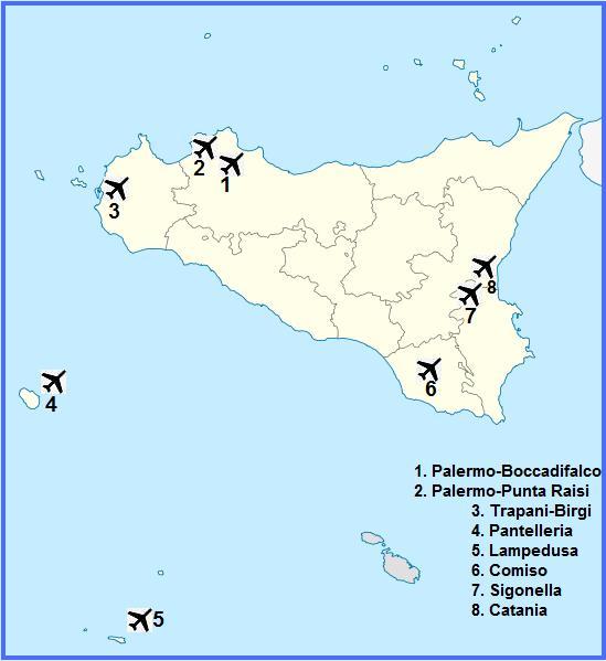
| DescriptionMap of airports in Sicily.jpg | Quadratische Plattkarte, N-S-Streckung 125 %. Geographische Begrenzung der Karte: * N: 38.9° N * S: 35.4° N * W: 11.8° O * O: 15.8° O Equirectangular projection, N/S stretching 125 %. Geographic limits of the map: * N: 38.9° N * S: 35.4° N * W: 11.8° E * E: 15.8° E |
| Date | (UTC) |
| Source | |
| Author |
|
| This is a retouched picture, which means that it has been digitally altered from its original version. Modifications: added Sicilians airport location. The original can be viewed here: Italy Sicily location map.svg:
|
I, the copyright holder of this work, hereby publish it under the following licenses:
This file is licensed under the Creative Commons Attribution-Share Alike 3.0 Unported license.
- You are free:
- to share – to copy, distribute and transmit the work
- to remix – to adapt the work
- Under the following conditions:
- attribution – You must give appropriate credit, provide a link to the license, and indicate if changes were made. You may do so in any reasonable manner, but not in any way that suggests the licensor endorses you or your use.
- share alike – If you remix, transform, or build upon the material, you must distribute your contributions under the same or compatible license as the original.

|
Permission is granted to copy, distribute and/or modify this document under the terms of the GNU Free Documentation License, Version 1.2 or any later version published by the Free Software Foundation; with no Invariant Sections, no Front-Cover Texts, and no Back-Cover Texts. A copy of the license is included in the section entitled GNU Free Documentation License.http://www.gnu.org/copyleft/fdl.htmlGFDLGNU Free Documentation Licensetruetrue |
You may select the license of your choice.
Original upload log
This image is a derivative work of the following images:
- File:Italy_Sicily_location_map.svg licensed with Cc-by-sa-3.0, GFDL
- 2009-06-11T09:47:31Z NordNordWest 1289x1409 (103309 Bytes) {{Information |Description= {{de|Positionskarte von [[:de:Sizilien|Sizilien]], [[:de:Italien|Italien]]}} Quadratische Plattkarte, N-S-Streckung 125 %. Geographische Begrenzung der Karte: * N: 38.9° N * S: 35.4° N * W: 11.8�
Uploaded with derivativeFX
Captions
Add a one-line explanation of what this file represents
Items portrayed in this file
depicts
13 March 2011
File history
Click on a date/time to view the file as it appeared at that time.
| Date/Time | Thumbnail | Dimensions | User | Comment | |
|---|---|---|---|---|---|
| current | 16:48, 13 March 2011 | | 549 × 599 (32 KB) | Sal73x | {{Information |Description={{de|Positionskarte von Sizilien, Italien}} Quadratische Plattkarte, N-S-Streckung 125 %. Geographische Begrenzung der Karte: * N: 38.9° N * S: 35.4° N * W: 11.8° O * O: 15.8° O {{en|Location |
File usage
The following pages on the English Wikipedia use this file (pages on other projects are not listed):
Global file usage
The following other wikis use this file:
- Usage on el.wikipedia.org
- Usage on it.wikivoyage.org
- Usage on ja.wikipedia.org
Metadata
This file contains additional information, probably added from the digital camera or scanner used to create or digitize it.
If the file has been modified from its original state, some details may not fully reflect the modified file.
| File change date and time | 09:47, 11 June 2009 |
|---|
Retrieved from "https://en.wikipedia.org/wiki/File:Map_of_airports_in_Sicily.jpg"