File:Map_Location_Monterrey_MX.png
From Wikipedia, the free encyclopedia
No higher resolution available.
Map_Location_Monterrey_MX.png (238 × 136 pixels, file size: 18 KB, MIME type: image/png)
| This is a file from the Wikimedia Commons. Information from its description page there is shown below. Commons is a freely licensed media file repository. You can help. |
Summary
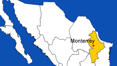
| DescriptionMap Location Monterrey MX.png | Map showing location of the city of Monterrey, Mexico. In yellow, the Mexican State of Nuevo Leon. |
| Date | 25 September 2006 (original upload date) |
| Source | No machine-readable source provided. Own work assumed (based on copyright claims). |
| Author | No machine-readable author provided. AlexCovarrubias assumed (based on copyright claims). |
Licensing
| Public domainPublic domainfalsefalse |
| I, the copyright holder of this work, release this work into the public domain. This applies worldwide. In some countries this may not be legally possible; if so: I grant anyone the right to use this work for any purpose, without any conditions, unless such conditions are required by law. |
Captions
Add a one-line explanation of what this file represents
Items portrayed in this file
depicts
25 September 2006
File history
Click on a date/time to view the file as it appeared at that time.
| Date/Time | Thumbnail | Dimensions | User | Comment | |
|---|---|---|---|---|---|
| current | 12:31, 25 September 2006 | | 238 × 136 (18 KB) | AlexCovarrubias | |
| 12:26, 25 September 2006 |  | 238 × 136 (19 KB) | AlexCovarrubias | Map showing location of the city of Monterrey, Mexico. In yellow, the Mexican State of Nuevo Leon. |
File usage
The following pages on the English Wikipedia use this file (pages on other projects are not listed):
Global file usage
The following other wikis use this file:
- Usage on eml.wikipedia.org
- Usage on it.wikipedia.org
Retrieved from "https://en.wikipedia.org/wiki/File:Map_Location_Monterrey_MX.png"