File:Magnolia_virginiana_range_map_3.png
From Wikipedia, the free encyclopedia
Size of this preview: 600 × 600 pixels. Other resolutions: 240 × 240 pixels | 480 × 480 pixels | 768 × 768 pixels | 1,024 × 1,024 pixels | 2,048 × 2,048 pixels | 2,977 × 2,977 pixels.
Original file (2,977 × 2,977 pixels, file size: 164 KB, MIME type: image/png)
| This is a file from the Wikimedia Commons. Information from its description page there is shown below. Commons is a freely licensed media file repository. You can help. |
Summary
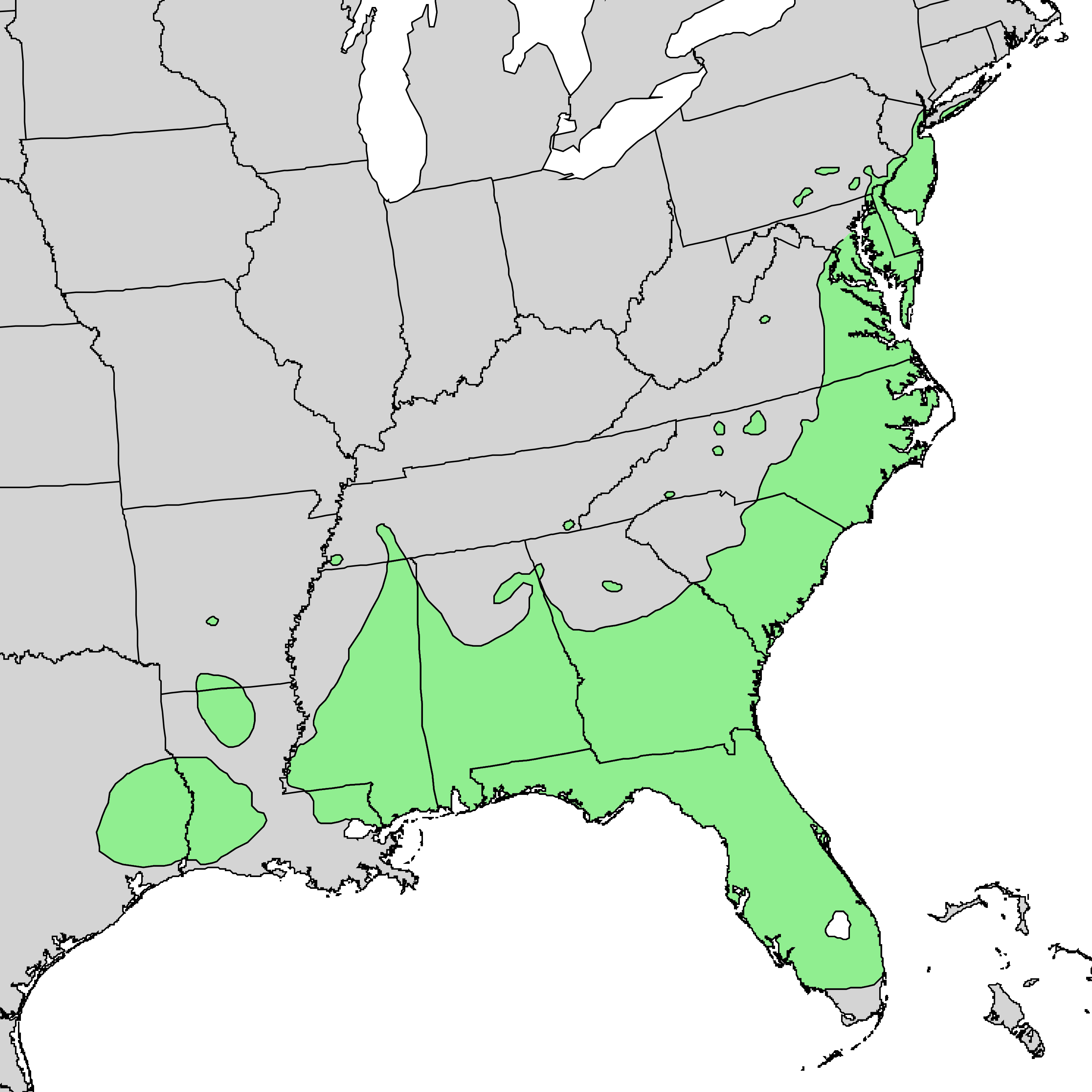
| DescriptionMagnolia virginiana range map 3.png |
English: Range map of Magnolia virginica |
| Date | |
| Source | Digital representation of "Atlas of United States Trees" by Elbert L. Little, Jr. [1] |
| Author | U.S. Geological Survey |
Licensing
| Public domainPublic domainfalsefalse |
This image is in the public domain in the United States because it only contains materials that originally came from the United States Geological Survey, an agency of the United States Department of the Interior. For more information, see the official USGS copyright policy.
Bahasa Indonesia ∙ català ∙ čeština ∙ Deutsch ∙ eesti ∙ English ∙ español ∙ français ∙ galego ∙ italiano ∙ Nederlands ∙ português ∙ polski ∙ sicilianu ∙ suomi ∙ Tiếng Việt ∙ Türkçe ∙ български ∙ македонски ∙ русский ∙ മലയാളം ∙ 한국어 ∙ 日本語 ∙ 中文 ∙ 中文(简体) ∙ 中文(繁體) ∙ العربية ∙ فارسی ∙ +/− |
Original upload log
The original description page was here. All following user names refer to en.wikipedia.
- 2010-05-02 22:51 Masebrock 733×671× (124799 bytes) {{Information |Description=Range map of Magnolia virginica |Source=Digital representation of "Atlas of United States Trees" by Elbert L. Little, Jr. [http://esp.cr.usgs.gov/data/atlas/little/] |Date=1999 |Author=U.S. Geological Survey |Permission={{PD-USG
Captions
Add a one-line explanation of what this file represents
Items portrayed in this file
depicts
1999
File history
Click on a date/time to view the file as it appeared at that time.
| Date/Time | Thumbnail | Dimensions | User | Comment | |
|---|---|---|---|---|---|
| current | 15:54, 3 January 2014 | | 2,977 × 2,977 (164 KB) | Nonenmac | higher resolution |
| 03:16, 10 September 2011 |  | 1,200 × 1,200 (64 KB) | Nonenmac | Removed striping and changed to indexed color mode. | |
| 20:10, 7 August 2010 |  | 733 × 671 (122 KB) | GreenZmiy | {{Information |Description={{en|Range map of Magnolia virginica}} |Source=Transferred from [http://en.wikipedia.org en.wikipedia]<br/> (Original text : ''Digital representation of "Atlas of United States Trees" by Elbert L. Little, Jr. [http://esp.cr.usgs |
File usage
The following pages on the English Wikipedia use this file (pages on other projects are not listed):
Global file usage
The following other wikis use this file:
- Usage on ab.wikipedia.org
- Usage on ar.wikipedia.org
- Usage on arz.wikipedia.org
- Usage on azb.wikipedia.org
- Usage on ca.wikipedia.org
- Usage on ceb.wikipedia.org
- Usage on cs.wikipedia.org
- Usage on es.wikipedia.org
- Usage on fa.wikipedia.org
- Usage on koi.wikipedia.org
- Usage on la.wikipedia.org
- Usage on nl.wikipedia.org
- Usage on no.wikipedia.org
- Usage on pl.wikipedia.org
- Usage on pt.wikipedia.org
- Usage on ru.wikipedia.org
- Usage on sv.wikipedia.org
- Usage on th.wikipedia.org
- Usage on udm.wikipedia.org
- Usage on uk.wikipedia.org
- Usage on uz.wikipedia.org
- Usage on www.wikidata.org
Metadata
This file contains additional information, probably added from the digital camera or scanner used to create or digitize it.
If the file has been modified from its original state, some details may not fully reflect the modified file.
| Horizontal resolution | 472.44 dpc |
|---|---|
| Vertical resolution | 472.44 dpc |