File:Magadan_1978.jpg
From Wikipedia, the free encyclopedia
Original file (652 × 780 pixels, file size: 160 KB, MIME type: image/jpeg)
| This is a file from the Wikimedia Commons. Information from its description page there is shown below. Commons is a freely licensed media file repository. You can help. |
Summary
| DescriptionMagadan 1978.jpg |
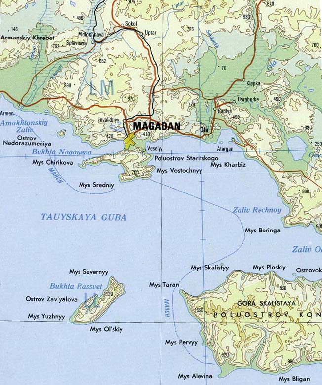
English: Magadan area of far east Russia |
|||
| Date | ||||
| Source | Portion of Magadan sheet. Topographic Map NO 56, Series 1301. Original Scale 1:1,000,000. Printed by U.S. Defense Mapping Agency Topographic Center, 1978. From the PCL map collection, courtesy of the University of Texas Libraries, The University of Texas at Austin.[1] Transferred from en.wikipedia to Commons by Maksim. | |||
| Author | U.S. Defense Mapping Agency Topographic Center | |||
| Other versions |
|
.jpg)
| Public domainPublic domainfalsefalse |
This image is a work of a U.S. military or Department of Defense employee, taken or made as part of that person's official duties. As a work of the U.S. federal government, the image is in the public domain in the United States.
العربية ∙ català ∙ čeština ∙ Deutsch ∙ Ελληνικά ∙ English ∙ español ∙ eesti ∙ فارسی ∙ suomi ∙ français ∙ galego ∙ हिन्दी ∙ hrvatski ∙ magyar ∙ italiano ∙ 日本語 ∙ 한국어 ∙ македонски ∙ മലയാളം ∙ Malti ∙ Nederlands ∙ polski ∙ português ∙ português do Brasil ∙ română ∙ русский ∙ sicilianu ∙ slovenčina ∙ slovenščina ∙ српски / srpski ∙ ไทย ∙ Türkçe ∙ українська ∙ Tiếng Việt ∙ 中文 ∙ 中文(简体) ∙ 中文(繁體) ∙ +/− |
 |
Captions
Items portrayed in this file
depicts
1978
File history
Click on a date/time to view the file as it appeared at that time.
| Date/Time | Thumbnail | Dimensions | User | Comment | |
|---|---|---|---|---|---|
| current | 05:59, 28 September 2015 | | 652 × 780 (160 KB) | Kaliforniyka | rotate and crop |
| 19:16, 4 March 2006 |  | 746 × 871 (184 KB) | Maksim | La bildo estas kopiita de wikipedia:en. La originala priskribo estas: '''Subject''': Magadan area of far east Russia '''Source''': Portion of Magadan sheet. Topographic Map NO 56, Series 1301. Original Scale 1:1,000,000. Printed by U.S. Defense Mapping |
File usage
Global file usage
The following other wikis use this file:
- Usage on az.wikipedia.org
- Usage on be.wikipedia.org
- Usage on bg.wikipedia.org
- Usage on ca.wikipedia.org
- Usage on ceb.wikipedia.org
- Usage on es.wikipedia.org
- Usage on fr.wikipedia.org
- Usage on he.wikipedia.org
- Usage on hr.wikipedia.org
- Usage on hy.wikipedia.org
- Usage on it.wikipedia.org
- Usage on ja.wikipedia.org
- Usage on nl.wikipedia.org
- Usage on nn.wikipedia.org
- Usage on oc.wikipedia.org
- Usage on pl.wiktionary.org
- Usage on pms.wikipedia.org
- Usage on pt.wikipedia.org
- Usage on ru.wikipedia.org
View more global usage of this file.
Metadata
This file contains additional information, probably added from the digital camera or scanner used to create or digitize it.
If the file has been modified from its original state, some details may not fully reflect the modified file.
| Width | 746 px |
|---|---|
| Height | 871 px |
| Bits per component |
|
| Pixel composition | RGB |
| Orientation | Normal |
| Number of components | 3 |
| Horizontal resolution | 150 dpi |
| Vertical resolution | 150 dpi |
| Software used | Adobe Photoshop CS5.1 Macintosh |
| File change date and time | 00:58, 28 September 2015 |
| Exif version | 2.21 |
| Color space | sRGB |
| Date and time of digitizing | 19:55, 27 September 2015 |
| Date metadata was last modified | 19:58, 27 September 2015 |
| Copyright status | Copyright status not set |
| Unique ID of original document | xmp.did:308A165ABB286811B3BEADA81A583D18 |