File:Lower_slopes_of_Charlton_Kings_Common._-_geograph.org.uk_-_36772.jpg
From Wikipedia, the free encyclopedia
No higher resolution available.
Lower_slopes_of_Charlton_Kings_Common._-_geograph.org.uk_-_36772.jpg (640 × 480 pixels, file size: 110 KB, MIME type: image/jpeg)
| This is a file from the Wikimedia Commons. Information from its description page there is shown below. Commons is a freely licensed media file repository. You can help. |
Summary
| DescriptionLower slopes of Charlton Kings Common. - geograph.org.uk - 36772.jpg |
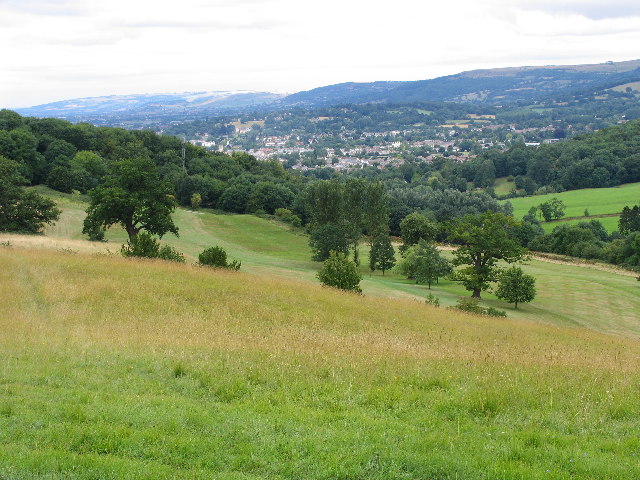
English: Lower slopes of Charlton Kings Common. Eastern Cheltenham with Cleeve Hill behind are in the distance. The A435 Cheltenham to Cirencester road runs in the trees on the middle right hand of the picture. |
| Date | |
| Source | From geograph.org.uk |
| Author | Terry Jacombs |
| Attribution (required by the license) InfoField | Terry Jacombs / Lower slopes of Charlton Kings Common. / |
InfoField | Terry Jacombs / Lower slopes of Charlton Kings Common. |
| Camera location | 51° 51′ 49″ N, 2° 03′ 14″ W | View this and other nearby images on: OpenStreetMap |
|---|
| Object location | 51° 51′ 57″ N, 2° 03′ 16″ W | View this and other nearby images on: OpenStreetMap |
|---|
Licensing

|
This image was taken from the Geograph project collection. See this photograph's page on the Geograph website for the photographer's contact details. The copyright on this image is owned by Terry Jacombs and is licensed for reuse under the Creative Commons Attribution-ShareAlike 2.0 license.
|
This file is licensed under the Creative Commons Attribution-Share Alike 2.0 Generic license.
Attribution: Terry Jacombs
- You are free:
- to share – to copy, distribute and transmit the work
- to remix – to adapt the work
- Under the following conditions:
- attribution – You must give appropriate credit, provide a link to the license, and indicate if changes were made. You may do so in any reasonable manner, but not in any way that suggests the licensor endorses you or your use.
- share alike – If you remix, transform, or build upon the material, you must distribute your contributions under the same or compatible license as the original.
Captions
Add a one-line explanation of what this file represents
Items portrayed in this file
depicts
some value
12 August 2005
51°51'49.21"N, 2°3'14.40"W
51°51'56.66"N, 2°3'16.20"W
0.01 second
5.6
15.4375 millimetre
image/jpeg
File history
Click on a date/time to view the file as it appeared at that time.
| Date/Time | Thumbnail | Dimensions | User | Comment | |
|---|---|---|---|---|---|
| current | 15:14, 30 January 2010 | | 640 × 480 (110 KB) | GeographBot | == {{int:filedesc}} == {{Information |description={{en|1=Lower slopes of Charlton Kings Common. Eastern Cheltenham with Cleeve Hill behind are in the distance. The A435 Cheltenham to Cirencester road runs in the trees on the middle right hand of the pictu |
File usage
The following pages on the English Wikipedia use this file (pages on other projects are not listed):
Global file usage
The following other wikis use this file:
- Usage on de.wikipedia.org
- Usage on nl.wikipedia.org
Metadata
This file contains additional information, probably added from the digital camera or scanner used to create or digitize it.
If the file has been modified from its original state, some details may not fully reflect the modified file.
| Camera manufacturer | Canon |
|---|---|
| Camera model | Canon PowerShot Pro1 |
| Exposure time | 1/100 sec (0.01) |
| F-number | f/5.6 |
| Date and time of data generation | 11:31, 12 August 2005 |
| Lens focal length | 15.4375 mm |
| Orientation | Normal |
| Horizontal resolution | 180 dpi |
| Vertical resolution | 180 dpi |
| File change date and time | 11:31, 12 August 2005 |
| Y and C positioning | Centered |
| Custom image processing | Normal process |
| Exposure mode | Auto exposure |
| White balance | Auto white balance |
| Digital zoom ratio | 1 |
| Scene capture type | Landscape |
| Exif version | 2.21 |
| Date and time of digitizing | 11:31, 12 August 2005 |
| Image compression mode | 3 |
| Shutter speed | 6.65625 |
| APEX aperture | 4.96875 |
| Exposure bias | 0 |
| Maximum land aperture | 3.34375 APEX (f/3.19) |
| Metering mode | Pattern |
| Flash | Flash did not fire, compulsory flash suppression |
| Color space | sRGB |
| Focal plane X resolution | 9,406.3400576369 |
| Focal plane Y resolution | 9,415.3846153846 |
| Focal plane resolution unit | inches |
| Sensing method | One-chip color area sensor |