File:Knebworth_railway_station,_Hertfordshire_(geograph_3242098).jpg
From Wikipedia, the free encyclopedia
Size of this preview: 800 × 600 pixels. Other resolutions: 320 × 240 pixels | 640 × 480 pixels | 1,024 × 768 pixels.
Original file (1,024 × 768 pixels, file size: 174 KB, MIME type: image/jpeg)
| This is a file from the Wikimedia Commons. Information from its description page there is shown below. Commons is a freely licensed media file repository. You can help. |
Summary
| DescriptionKnebworth railway station, Hertfordshire (geograph 3242098).jpg |
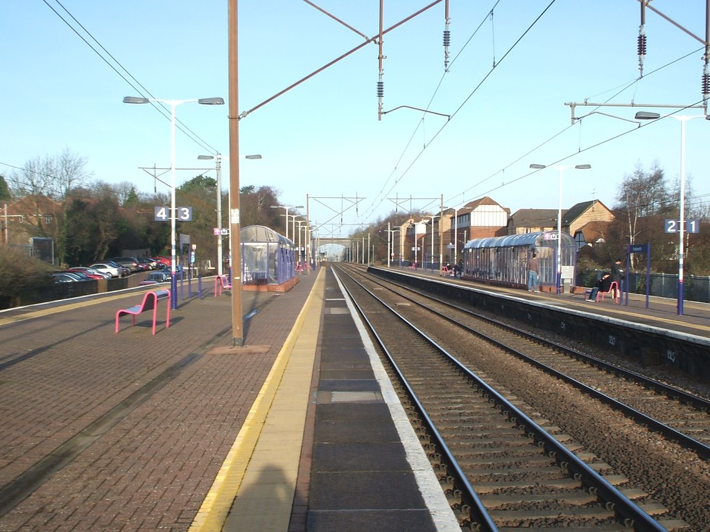
English: Knebworth railway station, Hertfordshire Opened in 1884 by the great Northern Railway on its line from London to Stevenage. View north towards Stevenage and Peterborough. 11 years later, the platform shelters were replaced and the inevitable railings installed. See TL2420 : Knebworth railway station, Hertfordshire for a 2021 view from a similar camera position. |
| Date | Taken on 19 December 2008 |
| Source | From geograph.org.uk |
| Author | Nigel Thompson |
| Permission (Reusing this file) |
Creative Commons Attribution Share-alike license 2.0 |
| Attribution (required by the license) InfoField | Nigel Thompson / Knebworth railway station, Hertfordshire / |
InfoField | Nigel Thompson / Knebworth railway station, Hertfordshire |
.jpg)
| Camera location | 51° 51′ 59.36″ N, 0° 11′ 13.14″ W | View this and other nearby images on: OpenStreetMap |
|---|
| Object location | 51° 52′ 01.2″ N, 0° 11′ 14″ W | View this and other nearby images on: OpenStreetMap |
|---|
Licensing

|
This image was taken from the Geograph project collection. See this photograph's page on the Geograph website for the photographer's contact details. The copyright on this image is owned by Nigel Thompson and is licensed for reuse under the Creative Commons Attribution-ShareAlike 2.0 license.
|
This file is licensed under the Creative Commons Attribution-Share Alike 2.0 Generic license.
Attribution: Nigel Thompson
- You are free:
- to share – to copy, distribute and transmit the work
- to remix – to adapt the work
- Under the following conditions:
- attribution – You must give appropriate credit, provide a link to the license, and indicate if changes were made. You may do so in any reasonable manner, but not in any way that suggests the licensor endorses you or your use.
- share alike – If you remix, transform, or build upon the material, you must distribute your contributions under the same or compatible license as the original.
Captions
Add a one-line explanation of what this file represents
Items portrayed in this file
depicts
some value
19 December 2008
51°51'59.360"N, 0°11'13.142"W
51°52'1.16"N, 0°11'13.92"W
image/jpeg
File history
Click on a date/time to view the file as it appeared at that time.
| Date/Time | Thumbnail | Dimensions | User | Comment | |
|---|---|---|---|---|---|
| current | 12:42, 7 July 2017 | | 1,024 × 768 (174 KB) | Chris j wood | Transferred from geograph.co.uk using [https://tools.wmflabs.org/geograph2commons/ geograph2commons] |
File usage
The following pages on the English Wikipedia use this file (pages on other projects are not listed):
.jpg)