File:KhitanAD1000.png
From Wikipedia, the free encyclopedia
Size of this preview: 800 × 467 pixels. Other resolutions: 320 × 187 pixels | 640 × 373 pixels | 1,024 × 597 pixels | 1,644 × 959 pixels.
Original file (1,644 × 959 pixels, file size: 52 KB, MIME type: image/png)
| This is a file from the Wikimedia Commons. Information from its description page there is shown below. Commons is a freely licensed media file repository. You can help. |
Summary
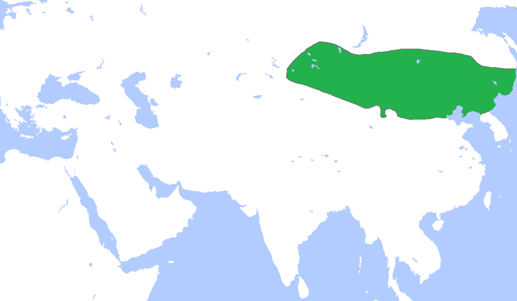
| DescriptionKhitanAD1000.png |
English: Locator map of the Khitan Empire, c. 1000.
(Partially based on Atlas of World History (2007) - The World 750-1000, map) |
| Date | |
| Source | Own work |
| Author | Gabagool |
Licensing
I, the copyright holder of this work, hereby publish it under the following license:
This file is licensed under the Creative Commons Attribution 3.0 Unported license.
- You are free:
- to share – to copy, distribute and transmit the work
- to remix – to adapt the work
- Under the following conditions:
- attribution – You must give appropriate credit, provide a link to the license, and indicate if changes were made. You may do so in any reasonable manner, but not in any way that suggests the licensor endorses you or your use.
Captions
Add a one-line explanation of what this file represents
Items portrayed in this file
depicts
23 April 2009
File history
Click on a date/time to view the file as it appeared at that time.
| Date/Time | Thumbnail | Dimensions | User | Comment | |
|---|---|---|---|---|---|
| current | 02:28, 19 December 2010 | | 1,644 × 959 (52 KB) | Tm | Reverted to version as of 16:02, 18 December 2010 |
| 00:12, 19 December 2010 |  | 1,644 × 959 (52 KB) | Historiographer~commonswiki | See en:Goryeo–Khitan Wars. | |
| 16:02, 18 December 2010 |  | 1,644 × 959 (52 KB) | Tm | Reverted to version as of 01:59, 18 December 2010 (please see the warning in Category:Maps_of_Korea) | |
| 09:09, 18 December 2010 |  | 1,644 × 959 (52 KB) | Garam | Stop it. Goryeo of territory is Aprok river. Please, you can ref to wikipedia. | |
| 01:59, 18 December 2010 |  | 1,644 × 959 (52 KB) | Tm | Reverted to version as of 00:35, 18 December 2010 | |
| 00:36, 18 December 2010 |  | 1,644 × 959 (52 KB) | Historiographer~commonswiki | Reverted to version as of 00:34, 18 December 2010 | |
| 00:35, 18 December 2010 |  | 1,644 × 959 (52 KB) | Evawen | Reverted to version as of 18:29, 17 December 2010 | |
| 00:34, 18 December 2010 |  | 1,644 × 959 (52 KB) | Historiographer~commonswiki | These territory was called as a Six garrison (강동6주). You really think I'm that nationalistic? It is fact. | |
| 18:29, 17 December 2010 |  | 1,644 × 959 (52 KB) | Tm | Reverted to version as of 19:25, 16 December 2010 (please stop this nationalistic POV pushing) | |
| 02:11, 17 December 2010 |  | 1,644 × 959 (52 KB) | Historiographer~commonswiki | Reverted to version as of 06:10, 16 December 2010 |
File usage
The following pages on the English Wikipedia use this file (pages on other projects are not listed):
Global file usage
The following other wikis use this file:
- Usage on af.wikipedia.org
- Usage on an.wikipedia.org
- Usage on ar.wikipedia.org
- Usage on ast.wikipedia.org
- Usage on be.wikipedia.org
- Usage on bg.wikipedia.org
- Usage on cdo.wikipedia.org
- Usage on ce.wikipedia.org
- Usage on ckb.wikipedia.org
- Usage on cs.wikipedia.org
- Usage on es.wikipedia.org
- Usage on eu.wikipedia.org
- Usage on fa.wikipedia.org
- Usage on fr.wikipedia.org
- Usage on fr.wiktionary.org
- Usage on id.wikipedia.org
- Usage on ja.wikipedia.org
- Usage on ka.wikipedia.org
- Usage on kk.wikipedia.org
- Usage on km.wikipedia.org
- Usage on min.wikipedia.org
- Usage on mk.wikipedia.org
- Usage on mn.wikipedia.org
- Usage on ms.wikipedia.org
- Usage on mt.wikipedia.org
- Usage on nl.wikipedia.org
- Usage on no.wikipedia.org
- Usage on oc.wikipedia.org
- Usage on pl.wikipedia.org
- Usage on pnb.wikipedia.org
- Usage on pt.wikipedia.org
View more global usage of this file.
Retrieved from "https://en.wikipedia.org/wiki/File:KhitanAD1000.png"