File:KCMH_Airport_Map.png
From Wikipedia, the free encyclopedia
Size of this preview: 800 × 521 pixels. Other resolutions: 320 × 208 pixels | 640 × 417 pixels | 1,024 × 667 pixels | 1,280 × 834 pixels | 1,980 × 1,290 pixels.
Original file (1,980 × 1,290 pixels, file size: 215 KB, MIME type: image/png)
| This is a file from the Wikimedia Commons. Information from its description page there is shown below. Commons is a freely licensed media file repository. You can help. |
Summary


Licensing
| Public domainPublic domainfalsefalse |
This image or file is a work of a Federal Aviation Administration employee, taken or made as part of that person's official duties. As a work of the U.S. federal government, the image is in the public domain in the United States.
English | italiano | македонски | മലയാളം | Nederlands | русский | sicilianu | українська | 中文 | +/− |
 |
Original upload log
Transferred from en.wikipedia to Commons by Nobunaga24.
The original description page was here. All following user names refer to en.wikipedia.
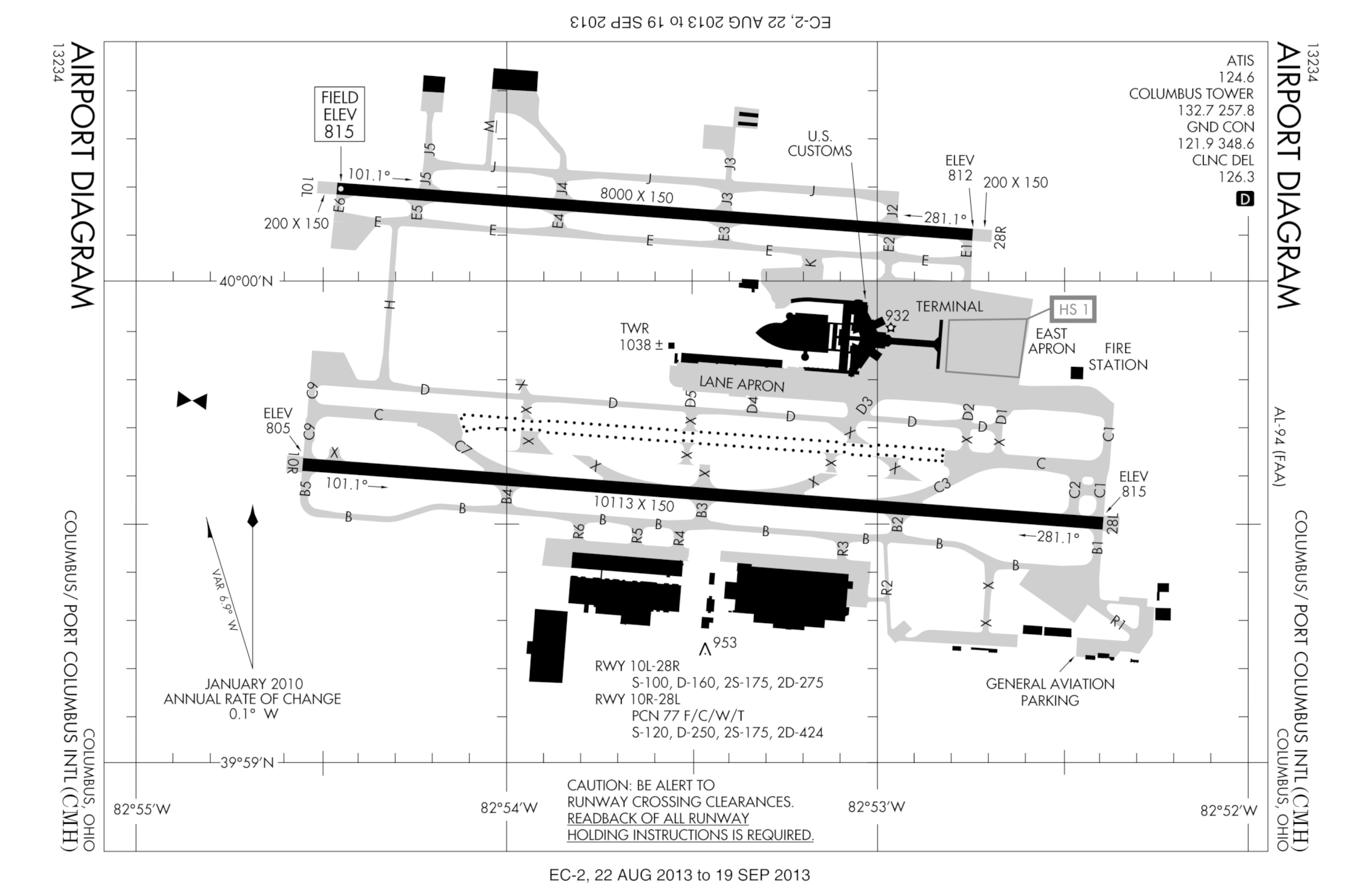
- 2007-08-17 02:27 Polypmaster 537×768×8 (74297 bytes) {{Information | Description = FAA diagram for [[Port Columbus International Airport]] (CMH) in Columbus, Ohio, United States. | Source = http://naco.faa.gov/d-tpp/0709/00094AD.PDF<br/>Note: this URL changes monthly, for current diagram see:
File history
Click on a date/time to view the file as it appeared at that time.
| Date/Time | Thumbnail | Dimensions | User | Comment | |
|---|---|---|---|---|---|
| current | 23:46, 22 August 2013 | | 1,980 × 1,290 (215 KB) | VidTheKid~commonswiki | New version effective 22 August 2013 – 19 September 2013. Notable changes: new runway 10R/28L open; taxiway redesignations. |
| 05:29, 9 March 2013 |  | 3,360 × 2,304 (277 KB) | VidTheKid~commonswiki | Updated to new edition valid 7 March to 4 April 2013. Notable changes: outline of new runway under construction, relocated Taxiway B | |
| 10:09, 25 April 2011 |  | 2,475 × 1,613 (237 KB) | VidTheKid~commonswiki | This version effective 5 May to 2 June 2011. Notable changes: 1) Landscape orientation to reflect orientation of most labels, as well as to point north up; 2) New taxiway H (built 2009); 3) Most of taxiway B and adjacent taxiways closed as construction o | |
| 05:42, 1 May 2008 |  | 537 × 768 (73 KB) | File Upload Bot (Magnus Manske) | {{BotMoveToCommons|en.wikipedia}} {{Information |Description={{en|FAA diagram for en:Port Columbus International Airport (CMH) in Columbus, Ohio, United States.<br/> en:commons:category:Port Columbus International Airport [[:en:commons:categor |
File usage
The following pages on the English Wikipedia use this file (pages on other projects are not listed):
Global file usage
The following other wikis use this file:
- Usage on es.wikipedia.org
Metadata
This file contains additional information, probably added from the digital camera or scanner used to create or digitize it.
If the file has been modified from its original state, some details may not fully reflect the modified file.
| File change date and time | 23:41, 22 August 2013 |
|---|---|
| Horizontal resolution | 94.48 dpc |
| Vertical resolution | 94.48 dpc |
Retrieved from "https://en.wikipedia.org/wiki/File:KCMH_Airport_Map.png"