File:Ivory_Coast_Topography.png
From Wikipedia, the free encyclopedia
Size of this preview: 565 × 600 pixels. Other resolutions: 226 × 240 pixels | 452 × 480 pixels | 1,009 × 1,071 pixels.
Original file (1,009 × 1,071 pixels, file size: 1.55 MB, MIME type: image/png)
| This is a file from the Wikimedia Commons. Information from its description page there is shown below. Commons is a freely licensed media file repository. You can help. |
Summary
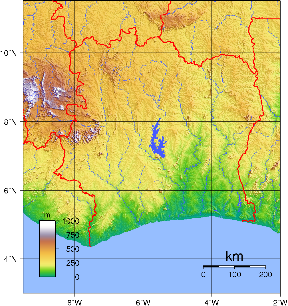
| DescriptionIvory Coast Topography.png | Topographic map of Ivory Coast. Created with GMT fro SRTM data. |
| Date | |
| Source | Own work |
| Author | Sadalmelik |
Licensing
| Public domainPublic domainfalsefalse |
| This work has been released into the public domain by its author, I, Sadalmelik. This applies worldwide. In some countries this may not be legally possible; if so: I, Sadalmelik grants anyone the right to use this work for any purpose, without any conditions, unless such conditions are required by law. |
Captions
Add a one-line explanation of what this file represents
Items portrayed in this file
depicts
2 June 2007
File history
Click on a date/time to view the file as it appeared at that time.
| Date/Time | Thumbnail | Dimensions | User | Comment | |
|---|---|---|---|---|---|
| current | 20:11, 29 June 2007 | | 1,009 × 1,071 (1.55 MB) | Sadalmelik | {{Information |Description=Topographic map of Ivory Coast. Created with GMT fro SRTM data. |Source=self-made |Date=June 2, 2007 |Author= Sadalmelik }} Category:Maps of Côte d'Ivoire Category:Topographic maps of Africa |
File usage
The following pages on the English Wikipedia use this file (pages on other projects are not listed):
Global file usage
The following other wikis use this file:
- Usage on ar.wikipedia.org
- Usage on be.wikipedia.org
- Usage on bn.wikipedia.org
- Usage on fa.wikipedia.org
- Usage on fr.wikipedia.org
- Usage on hu.wikipedia.org
- Usage on it.wikipedia.org
- Usage on ka.wikipedia.org
- Usage on lt.wikipedia.org
- Usage on mdf.wikipedia.org
- Usage on ms.wikipedia.org
- Usage on pl.wikipedia.org
- Usage on ru.wikipedia.org
- Usage on sr.wikipedia.org
- Usage on uk.wikipedia.org
- Usage on vec.wikipedia.org
- Usage on vep.wikipedia.org
- Usage on vi.wikipedia.org
- Usage on zh.wikipedia.org
Retrieved from "https://en.wikipedia.org/wiki/File:Ivory_Coast_Topography.png"