File:Illinois_Locator_Map.PNG
From Wikipedia, the free encyclopedia
No higher resolution available.
Illinois_Locator_Map.PNG (288 × 405 pixels, file size: 12 KB, MIME type: image/png)
| This is a file from the Wikimedia Commons. Information from its description page there is shown below. Commons is a freely licensed media file repository. You can help. |

|
This locator map image could be re-created using vector graphics as an SVG file. This has several advantages; see Commons:Media for cleanup for more information. If an SVG form of this image is available, please upload it and afterwards replace this template with
{{vector version available|new image name}}.
It is recommended to name the SVG file “Illinois Locator Map.svg”—then the template Vector version available (or Vva) does not need the new image name parameter. |
Summary
Licensing
I, Ruhrfisch, the copyright holder of this work, hereby publishes it under the following licenses:

|
Permission is granted to copy, distribute and/or modify this document under the terms of the GNU Free Documentation License, Version 1.2 or any later version published by the Free Software Foundation; with no Invariant Sections, no Front-Cover Texts, and no Back-Cover Texts. A copy of the license is included in the section entitled GNU Free Documentation License.http://www.gnu.org/copyleft/fdl.htmlGFDLGNU Free Documentation Licensetruetrue |
| This file is licensed under the Creative Commons Attribution-Share Alike 3.0 Unported license. | ||
| Attribution: I, Ruhrfisch | ||
| ||
| This licensing tag was added to this file as part of the GFDL licensing update.http://creativecommons.org/licenses/by-sa/3.0/CC BY-SA 3.0Creative Commons Attribution-Share Alike 3.0truetrue |
This file is licensed under the Creative Commons Attribution-Share Alike 2.5 Generic license.
Attribution: I, Ruhrfisch
- You are free:
- to share – to copy, distribute and transmit the work
- to remix – to adapt the work
- Under the following conditions:
- attribution – You must give appropriate credit, provide a link to the license, and indicate if changes were made. You may do so in any reasonable manner, but not in any way that suggests the licensor endorses you or your use.
- share alike – If you remix, transform, or build upon the material, you must distribute your contributions under the same or compatible license as the original.
You may select the license of your choice.
| Public domainPublic domainfalsefalse |
This image or file is a work of a United States Census Bureau employee, taken or made as part of that person's official duties. As a work of the U.S. federal government, the image is in the public domain.
English ∙ español ∙ 日本語 ∙ македонски ∙ മലയാളം ∙ português do Brasil ∙ русский ∙ українська ∙ +/− |
 |
Captions
Add a one-line explanation of what this file represents
Items portrayed in this file
depicts
March 2007
image/png
File history
Click on a date/time to view the file as it appeared at that time.
| Date/Time | Thumbnail | Dimensions | User | Comment | |
|---|---|---|---|---|---|
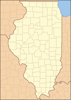
| current | 04:02, 25 April 2007 | | 288 × 405 (12 KB) | Ruhrfisch | {{Information| |Description= Locator Map of Illinois, United States |Source= taken from US Census website [http://factfinder.census.gov/] and modified by User:Ruhrfisch |Date= March 2007 |Author= US Census, Ruhrfisch |Permission= US Census / US Gover |
| 03:45, 28 March 2007 |  | 288 × 405 (13 KB) | Ruhrfisch | {{Information| |Description= Locator Map of Illinois, United States |Source= taken from US Census website [http://factfinder.census.gov/] and modified by User:Ruhrfisch |Date= March 2007 |Author= US Census, Ruhrfisch |Permission= US Census / US Gover | |
| 03:12, 28 March 2007 |  | 242 × 412 (11 KB) | Ruhrfisch | {{Information| |Description= Locator Map of Illinois, United States |Source= taken from US Census website [http://factfinder.census.gov/] and modified by User:Ruhrfisch |Date= March 2007 |Author= US Census, Ruhrfisch |Permission= US Census / US Gover |
File usage
The following pages on the English Wikipedia use this file (pages on other projects are not listed):
- List of counties in Illinois
- List of protected areas of Illinois
- User:Blåmerke
- User:Ruhrfisch
- User talk:Kranar drogin/Archive 2
- User talk:Kranar drogin/Archive 3
- Wikipedia talk:WikiProject Illinois/Archive 3
- Template:Illinois County Labelled Map
- Template:State parks of Illinois map
- Module:Location map/data/USA Illinois inset
- Module:Location map/data/USA Illinois inset/doc
Global file usage
The following other wikis use this file:
- Usage on ar.wikipedia.org
- Usage on bar.wikipedia.org
- Usage on ceb.wikipedia.org
- Usage on de.wikipedia.org
- Usage on fa.wikipedia.org
- فهرست شهرستانهای ایلینوی
- الگو:Geobox locator Illinois
- بیردزتاون، ایلینوی
- بلویل، ایلینوی
- بلویدر، ایلینوی
- بلومینگتون، ایلینوی
- بربنک، ایلینوی
- کانتون، ایلینوی
- کاربوندیل، ایلینوی
- کارتج، ایلینوی
- شمپین، ایلینوی
- چنوآ، ایلینوی
- کلینزویل، ایلینوی
- کیوبا، ایلینوی
- فریپورت، ایلینوی
- جلینا، ایلینوی
- گرانیتسیتی، ایلینوی
- گرینویل، ایلینوی
- هاروی، ایلینوی
- لانرک، ایلینوی
- لارنسویل، ایلینوی
- لاوز پارک، ایلینوی
- مارنگو، ایلینوی
- مونتکارول، ایلینوی
- مونتاسترلینگ، ایلینوی
- اورگان، ایلینوی
- پینکنویل، ایلینوی
- پولو، ایلینوی
- روشل، ایلینوی
- ساوانا، ایلینوی
- سوثبلویت، ایلینوی
- اسپرنگ ولی، ایلینوی
- ویرجینیا، ایلینوی
- الگو:نقشه کلیکخور شهرستان ایلینوی
- رزدیل (ایلینوی)
- گیجز لیک، ایلینوی
- لانگ لیک (ایلینوی)
- فارست لیک، ایلینوی
- فاکس لیک هیلز، ایلینوی
View more global usage of this file.
Retrieved from "https://en.wikipedia.org/wiki/File:Illinois_Locator_Map.PNG"