File:Hartford_KY_tornado_damage.jpg
From Wikipedia, the free encyclopedia
Size of this preview: 800 × 450 pixels. Other resolutions: 320 × 180 pixels | 640 × 360 pixels | 1,024 × 576 pixels | 1,280 × 720 pixels | 2,560 × 1,440 pixels | 4,032 × 2,268 pixels.
Original file (4,032 × 2,268 pixels, file size: 1.09 MB, MIME type: image/jpeg)
| This is a file from the Wikimedia Commons. Information from its description page there is shown below. Commons is a freely licensed media file repository. You can help. |
Summary
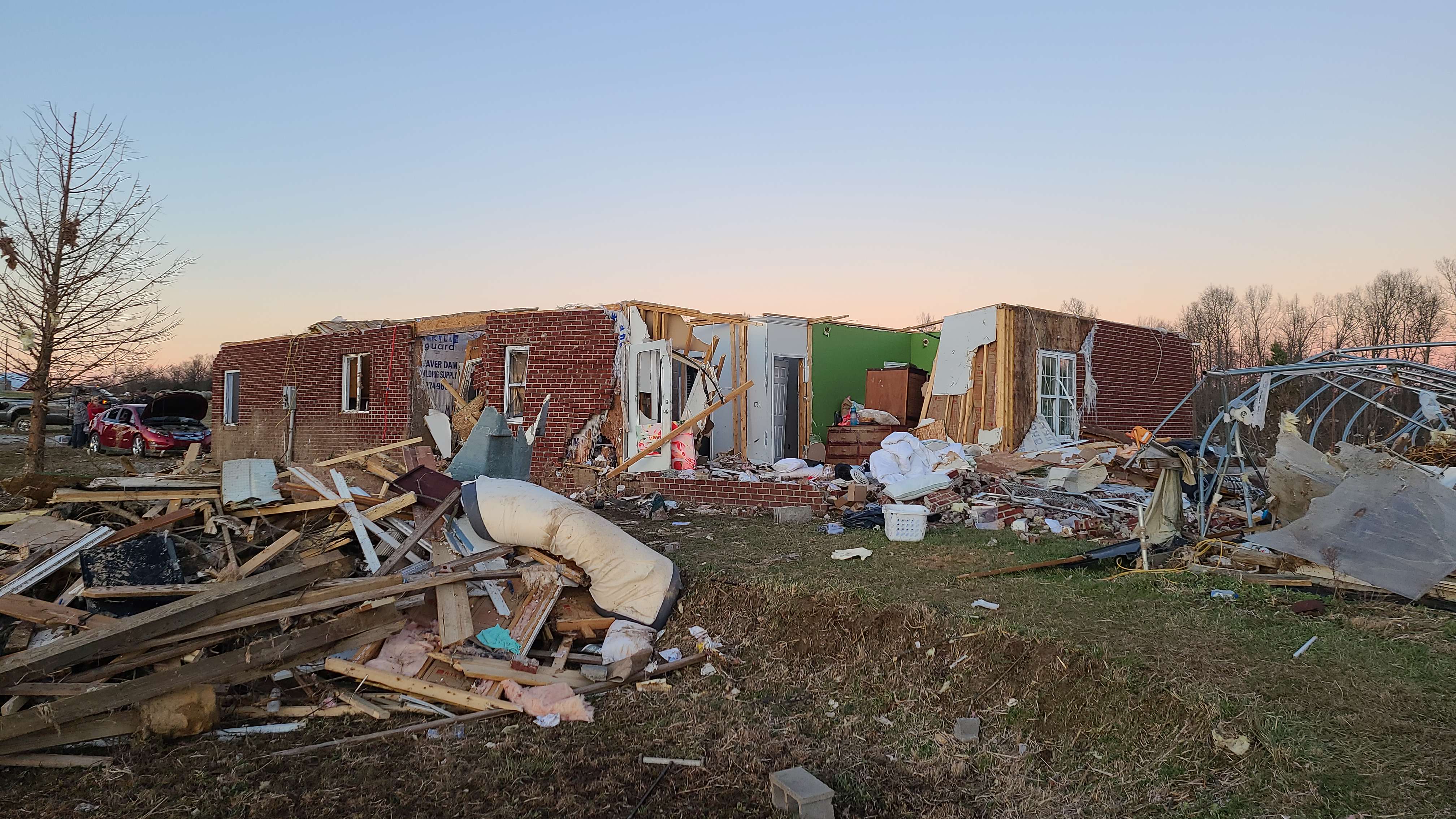
| DescriptionHartford KY tornado damage.jpg | Major structural damage to a house near Hartford, Kentucky. |
| Date | |
| Source | https://apps.dat.noaa.gov/stormdamage/damageviewer/ |
| Author | NWS Louisville |
| Permission (Reusing this file) |
National Weather Service |
| Camera location | 37° 29′ 13.7″ N, 86° 51′ 54.52″ W | View this and other nearby images on: OpenStreetMap |
|---|
Licensing
| Public domainPublic domainfalsefalse |
This image is in the public domain because it was stored on the web servers of the U.S. National Weather Service. NWS-created images are automatically public domain in the U.S. since the NWS is a part of the U.S. government. However, the NWS sites also host non-NWS images which have been submitted by individuals: these are generally shown as "Courtesy of ...". Such images have explicitly been released to the public domain by the copyright owner as part of the upload process.
As stated at https://www.weather.gov/fsd/disclaimer: "By submitting images, you understand that your image is being released into the public domain. This means that your photo or video may be downloaded, copied, and used by others." Thus, all* images on NWS servers are public domain (including "Courtesy of ..." and “Photo by ...” images) unless specifically stated otherwise through a copyright (©) watermark.
*A deletion discussion in November 2023 ruled that Getty Images on the web servers of NWS, are to be considered copyrighted, even without a copyright (©) watermark and are the sole exception to this rule.English | suomi | македонски | português | +/− |
Captions
Add a one-line explanation of what this file represents
Items portrayed in this file
depicts
0.00833333333333333333 second
1.8
5.4 millimetre
image/jpeg
e97b58fd3e9e01ecf8d7242aaa36a82e7802618d
1,142,147 byte
2,268 pixel
4,032 pixel
37°29'13.700"N, 86°51'54.518"W
12 December 2021
File history
Click on a date/time to view the file as it appeared at that time.
| Date/Time | Thumbnail | Dimensions | User | Comment | |
|---|---|---|---|---|---|
| current | 05:07, 6 January 2022 | | 4,032 × 2,268 (1.09 MB) | TornadoInformation12 | {{Information |Description=Major structural damage to a house near Hartford, Kentucky. |Source=https://apps.dat.noaa.gov/stormdamage/damageviewer/ |Date=December 12, 2021 |Author=NWS Louisville |Permission=National Weather Service |other_versions= }} |
File usage
The following pages on the English Wikipedia use this file (pages on other projects are not listed):
Global file usage
The following other wikis use this file:
- Usage on ja.wikipedia.org
Metadata
This file contains additional information, probably added from the digital camera or scanner used to create or digitize it.
If the file has been modified from its original state, some details may not fully reflect the modified file.
| Camera manufacturer | samsung |
|---|---|
| Camera model | SM-G981U |
| Exposure time | 1/120 sec (0.0083333333333333) |
| F-number | f/1.8 |
| ISO speed rating | 51 |
| Date and time of data generation | 16:29, 12 December 2021 |
| Lens focal length | 5.4 mm |
| Latitude | 37° 29′ 13.7″ N |
| Longitude | 86° 51′ 54.52″ W |
| Altitude | 98.171 meters above sea level |
| Width | 4,032 px |
| Height | 2,268 px |
| Orientation | Normal |
| Horizontal resolution | 72 dpi |
| Vertical resolution | 72 dpi |
| Software used | ArcGIS Survey123 |
| File change date and time | 16:29, 12 December 2021 |
| Y and C positioning | Centered |
| Exposure Program | Normal program |
| Exif version | 2.3 |
| Date and time of digitizing | 16:29, 12 December 2021 |
| Meaning of each component |
|
| Shutter speed | 6.906 |
| APEX aperture | 1.69 |
| APEX brightness | 4.77 |
| Exposure bias | 0 |
| Maximum land aperture | 1.69 APEX (f/1.8) |
| Metering mode | Average |
| Flash | Flash did not fire |
| DateTime subseconds | 031725 |
| DateTimeOriginal subseconds | 031725 |
| DateTimeDigitized subseconds | 031725 |
| Supported Flashpix version | 0.1 |
| Color space | sRGB |
| Sensing method | 0 |
| Scene type | A directly photographed image |
| Exposure mode | Auto exposure |
| White balance | Auto white balance |
| Focal length in 35 mm film | 0 mm |
| Scene capture type | Standard |
| GPS time (atomic clock) | 00:00 |
| Speed unit | Kilometers per hour |
| Speed of GPS receiver | 0.001304436 |
| Reference for direction of movement | True direction |
| Direction of movement | 269.9445 |
| Reference for direction of image | Magnetic direction |
| Direction of image | 292.21 |
| Geodetic survey data used | WGS-84 |
| GPS date | 2021-12-12 |
| GPS tag version | 2.3.0.0 |
Retrieved from "https://en.wikipedia.org/wiki/File:Hartford_KY_tornado_damage.jpg"