File:General_Government_for_the_occupied_Polish_territories_(1941).png
From Wikipedia, the free encyclopedia
Size of this preview: 605 × 600 pixels. Other resolutions: 242 × 240 pixels | 484 × 480 pixels | 774 × 768 pixels | 1,033 × 1,024 pixels | 2,299 × 2,280 pixels.
Original file (2,299 × 2,280 pixels, file size: 543 KB, MIME type: image/png)
| This is a file from the Wikimedia Commons. Information from its description page there is shown below. Commons is a freely licensed media file repository. You can help. |
Summary
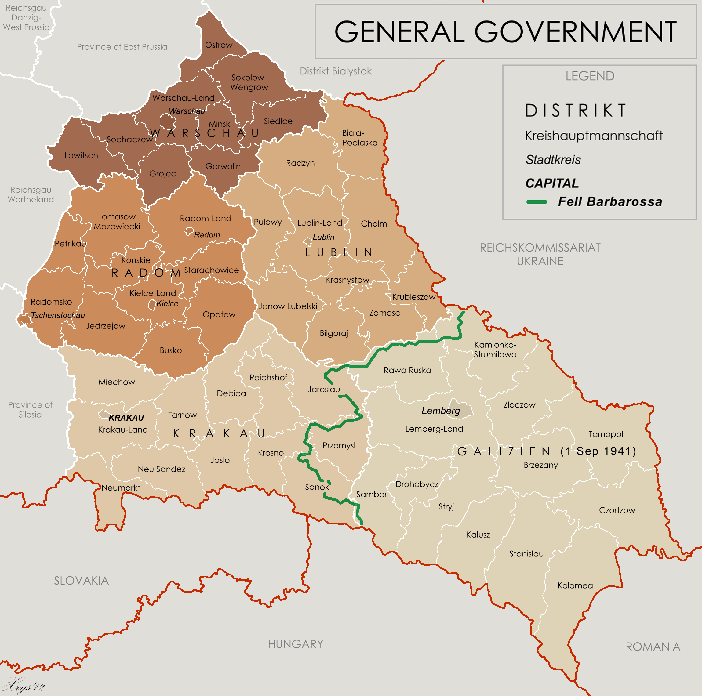
| DescriptionGeneral Government for the occupied Polish territories (1941).png |
English: Map of the administrative areas of the General Government |
| Date | |
| Source |
Own work by XrysD, edited by Poeticbent with superimposed German-Soviet border before Operation Barbarossa. Sources at: File:Generalne gubernatorstwo 1945.png and File:Western portions of the Ukrainian SSR 1940.jpg A published source with the same information is Musial, Bogdan (2000) (in German) Deutsche Zivilverwaltung und Judenverfolgung im Generalgouvernement: eine Fallstudie zum Distrikt Lublin 1939-1944, Otto Harrassowitz Verlag, p. 424 ISBN: 978-3-447-05063-0. |
| Author | XrysD and User:Poeticbent (the 1941 demarkation line and legend) |
| Other versions |
File:Generalgouvernement fur die besetzten polnischen gebiete.png |
Licensing
This file is licensed under the Creative Commons Attribution-Share Alike 3.0 Unported license.
- You are free:
- to share – to copy, distribute and transmit the work
- to remix – to adapt the work
- Under the following conditions:
- attribution – You must give appropriate credit, provide a link to the license, and indicate if changes were made. You may do so in any reasonable manner, but not in any way that suggests the licensor endorses you or your use.
- share alike – If you remix, transform, or build upon the material, you must distribute your contributions under the same or compatible license as the original.
Captions
Add a one-line explanation of what this file represents
Items portrayed in this file
depicts
26 May 2012
File history
Click on a date/time to view the file as it appeared at that time.
| Date/Time | Thumbnail | Dimensions | User | Comment | |
|---|---|---|---|---|---|
| current | 15:33, 8 May 2014 | | 2,299 × 2,280 (543 KB) | Poeticbent | legend |
| 16:48, 18 March 2014 |  | 2,299 × 2,280 (453 KB) | Poeticbent | =={{int:filedesc}}== {{Information |description={{en|1=Map of the administrative areas of the General Government}} |date=2012-05-26 |source={{own}} by {{u|XrysD}}, edited by {{u|Poeticbent}} with superimposed German-Soviet border before Operation Barba... |
File usage
The following pages on the English Wikipedia use this file (pages on other projects are not listed):
Global file usage
The following other wikis use this file:
- Usage on ar.wikipedia.org
- Usage on azb.wikipedia.org
- Usage on es.wikipedia.org
- Usage on fr.wikipedia.org
- Usage on it.wikipedia.org
- Usage on no.wikipedia.org
- Usage on pl.wikipedia.org
- Usage on pt.wikipedia.org
- Usage on ru.wikipedia.org
- Usage on www.wikidata.org
- Usage on zh.wikipedia.org
Metadata
This file contains additional information, probably added from the digital camera or scanner used to create or digitize it.
If the file has been modified from its original state, some details may not fully reflect the modified file.
| Horizontal resolution | 28.35 dpc |
|---|---|
| Vertical resolution | 28.35 dpc |
.png)