File:Cornish_windsor_bridge.jpg
From Wikipedia, the free encyclopedia
Original file (4,567 × 3,198 pixels, file size: 1.49 MB, MIME type: image/jpeg)
| This is a file from the Wikimedia Commons. Information from its description page there is shown below. Commons is a freely licensed media file repository. You can help. |
|
This is an image of a place or building that is listed on the National Register of Historic Places in the United States of America. Its reference number is 76000135. |
| Camera location | 43° 28′ 26″ N, 72° 23′ 01″ W | View this and other nearby images on: OpenStreetMap |
|---|
| DescriptionCornish windsor bridge.jpg |
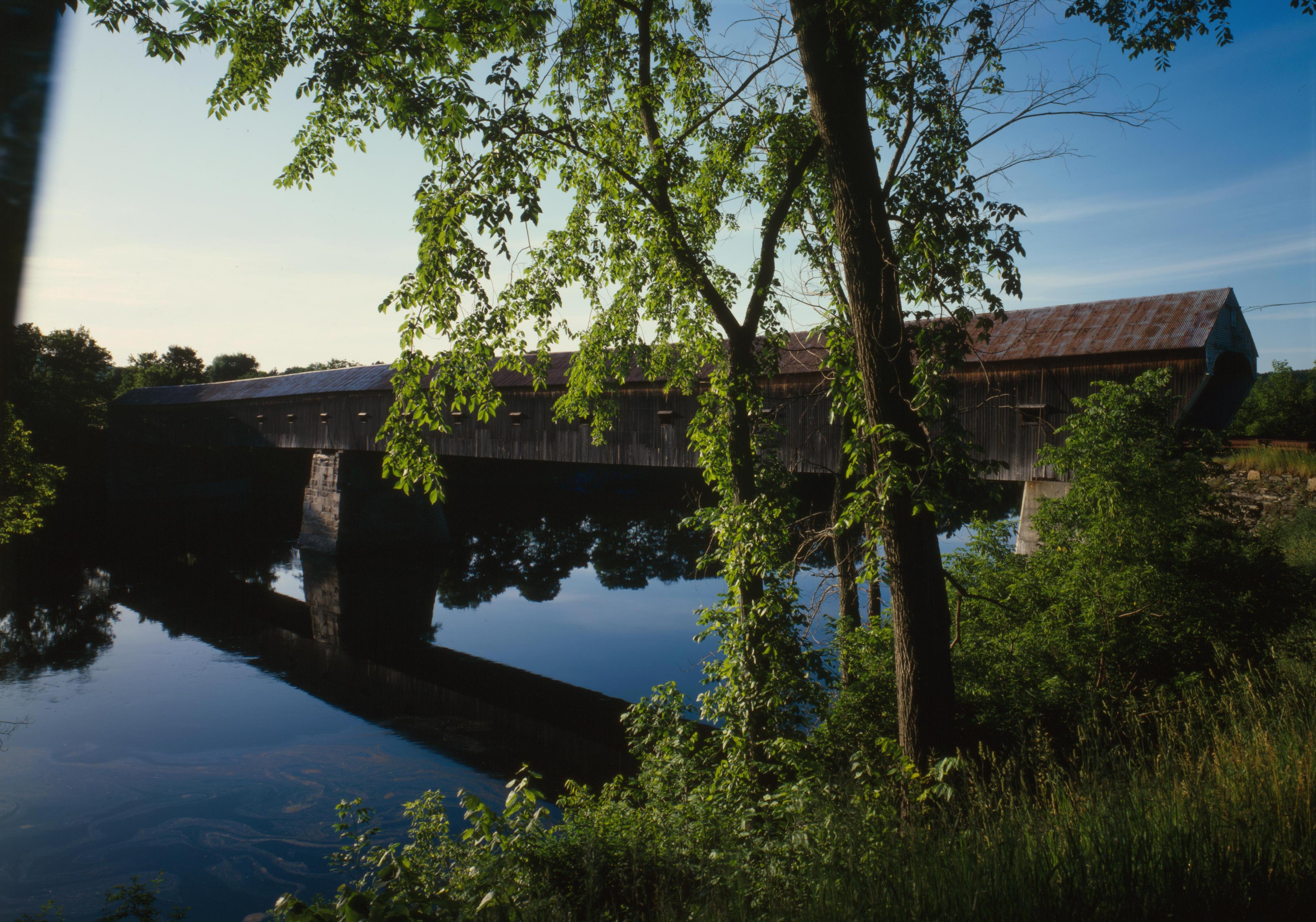
English: Southern (downstream) side of the Cornish-Windsor Covered Bridge, which spans the end of the Zoarville Bridge, which spans the Connecticut River between Cornish, New Hampshire and Windsor, Vermont, in the United States. Built in 1866, it is listed on the National Register of Historic Places. |
|||||||||||||||||||||||
| Date | ||||||||||||||||||||||||
| Source | Library of Congress, Prints and Photograph Division HAER: NH,10-CORN,2-11 | |||||||||||||||||||||||
| Author |
creator QS:P170,Q6188857 |
|||||||||||||||||||||||
| Permission (Reusing this file) |
|
|||||||||||||||||||||||
.jpg)

|
This image is available from the United States Library of Congress's Prints and Photographs division
under the digital ID hhh.nh0177. This tag does not indicate the copyright status of the attached work. A normal copyright tag is still required. See Commons:Licensing. العربية ∙ беларуская (тарашкевіца) ∙ বাংলা ∙ čeština ∙ Deutsch ∙ English ∙ español ∙ فارسی ∙ suomi ∙ français ∙ galego ∙ עברית ∙ magyar ∙ Bahasa Indonesia ∙ italiano ∙ 日本語 ∙ lietuvių ∙ македонски ∙ മലയാളം ∙ Nederlands ∙ polski ∙ português ∙ português do Brasil ∙ română ∙ русский ∙ sicilianu ∙ slovenčina ∙ slovenščina ∙ Türkçe ∙ українська ∙ 简体中文 ∙ 繁體中文 ∙ +/− |
Captions
Khoản mục được tả trong tập tin này
depicts
1984
43°28'26.000"N, 72°23'1.000"W
image/jpeg
29069a1957ab8a1733830f4e70b41ca8e332fab7
1,557,280 byte
3,198 pixel
4,567 pixel
File history
Click on a date/time to view the file as it appeared at that time.
| Date/Time | Thumbnail | Dimensions | User | Comment | |
|---|---|---|---|---|---|
| current | 17:32, 6 September 2009 | | 4,567 × 3,198 (1.49 MB) | Cropbot | upload cropped version, operated by User:Finavon. Summary: border cropped |
| 05:07, 14 August 2009 |  | 4,911 × 3,556 (1.69 MB) | Nyttend | {{Location|43|28|26|N|72|23|1|W}} {{Information |Description={{en|Southern (downstream) side of the {{w|Cornish-Windsor Covered Bridge}}, which spans the end of the {{w|Zoarville Bridge}}, which spans the {{w|Connecticut River}} between {{w|Cornish, New H |
File usage
- List of Historic Civil Engineering Landmarks
- List of bridges on the National Register of Historic Places in New Hampshire
- List of bridges on the National Register of Historic Places in Vermont
- National Register of Historic Places listings in Windsor County, Vermont
- Windsor, Vermont
- User:Eurodog/sandbox153
- Portal:U.S. roads/Did you know
- Portal:U.S. roads/Did you know/October 2011
Global file usage
The following other wikis use this file:
- Usage on ar.wikipedia.org
- Usage on de.wikipedia.org
- Usage on es.wikipedia.org
- Usage on fr.wikipedia.org
- Usage on vi.wikipedia.org
- Usage on zh.wikipedia.org
Metadata
This file contains additional information, probably added from the digital camera or scanner used to create or digitize it.
If the file has been modified from its original state, some details may not fully reflect the modified file.
| Width | 4,911 px |
|---|---|
| Height | 3,556 px |
| Compression scheme | Uncompressed |
| Pixel composition | RGB |
| Orientation | Normal |
| Number of rows per strip | 4 |
| Horizontal resolution | 4,911 dpc |
| Vertical resolution | 3,556 dpc |
| Data arrangement | chunky format |
| File change date and time | 18:08, 21 May 2001 |